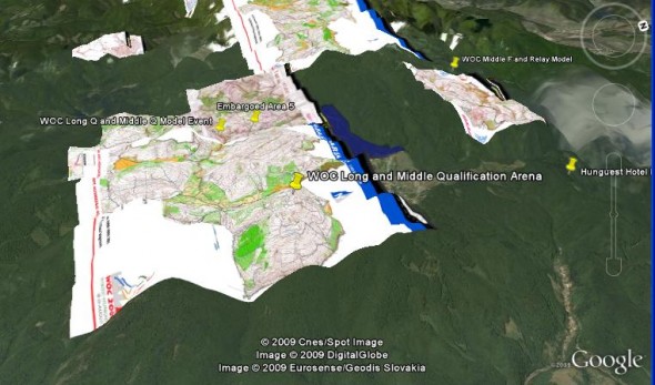
Fly through the areas where the World Orienteering Champs will be decided the coming week – and see what kind of hilly challenges the best orienteers will face! Below a video from Google Earth is embedded which includes old maps of embargoed areas and traning areas – and you can also open the maps in Google Earth yourself and take a look.
The terrain for all competitions except for the long final and the sprint is described as non-typical karst with a small number of negative features and many point objects. The terrain is quite hilly, and the competitions will be physically though. For the sprint, the terrain is describes as semi-urban with many paths and some erosion features. The long distance final is the most special terrain – with many negative features and quite stony.
Here is what Team Canada writes about the terrain:
The terrains are mostly very open and runnable hills that are big and steep. The limestone composition of the mountains means that there are areas of stony ground near the tops of hills and ridges that influence route choice. The mapped rock features (boulders and cliffs) tend to be smallish and so most of the navigation is by the major contours. [From Team Canada Orienteering Blog]
Fly in Google Earth
Use the links below to open the old maps of the competition are in Google Earth as well as other WOC2009-related information (competition area is somewhat larger than the old maps – there is no old map for the long final area):
- Embaroed area middle final / relay jpg (Google Earth kml-file)
- Embargoed area middle qual / long qual (Google Earth kml-file)
- Emarbgoed area spring (Google Earth kml-file)
- Google Earth file with 25 training overlayed at their respective positions in the WOC area
- Google Earth file with embargoed areas and other important places in the WOC 2009 area
- Google Earth file with arenas
#WOC2009 @ Twitter
Follow the action in at the World Orienteering Champs through Twitter. Below the latest Tweets for #WOC2009 are shown in the LiveBlog. Your tweets including the hash-tag #woc2009 will also show up below.
 World of O News


