World of O News
Today’s leg in Route to Christmas takes us to a national youth competition in southwestern Norway – O-Idol. The terrain is quite tricky the first times you run there – and choosing the best route might also prove a bit difficult if you are not familiar with the terrain.
You can look far ahead, but looking is easier than moving.
The chosen leg is the 9th leg in the Men-16 course – featuring all the best 16-year old orienteers in Norway. The race was organized on September 24th 2016 – by chance on the very same day as Route to Christmas Day 1 – a good day for orienteering!
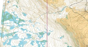
The leg is as usually first provided without routes – you may take a look at it and think about how you would attack this leg (if the image is too small, you may click on it to get it larger). The terrain looks very special – with a feeling of being high up in the mountains although you are not very high above the sea level. You can look far ahead, but looking is easier than moving.
![]()
Location
You find other maps from the area in omaps.worldofo.com here. See also latest additions in 3DRerun from this area in order to learn more about this terrain type.
Webroute
Next you can draw your own route using the ‘Webroute’ below. Think through how you would attack this leg, and draw the route you would have made. Some comments about why you would choose a certain route are always nice for the other readers.
Then you can take a look at how the runners have solved this leg below.
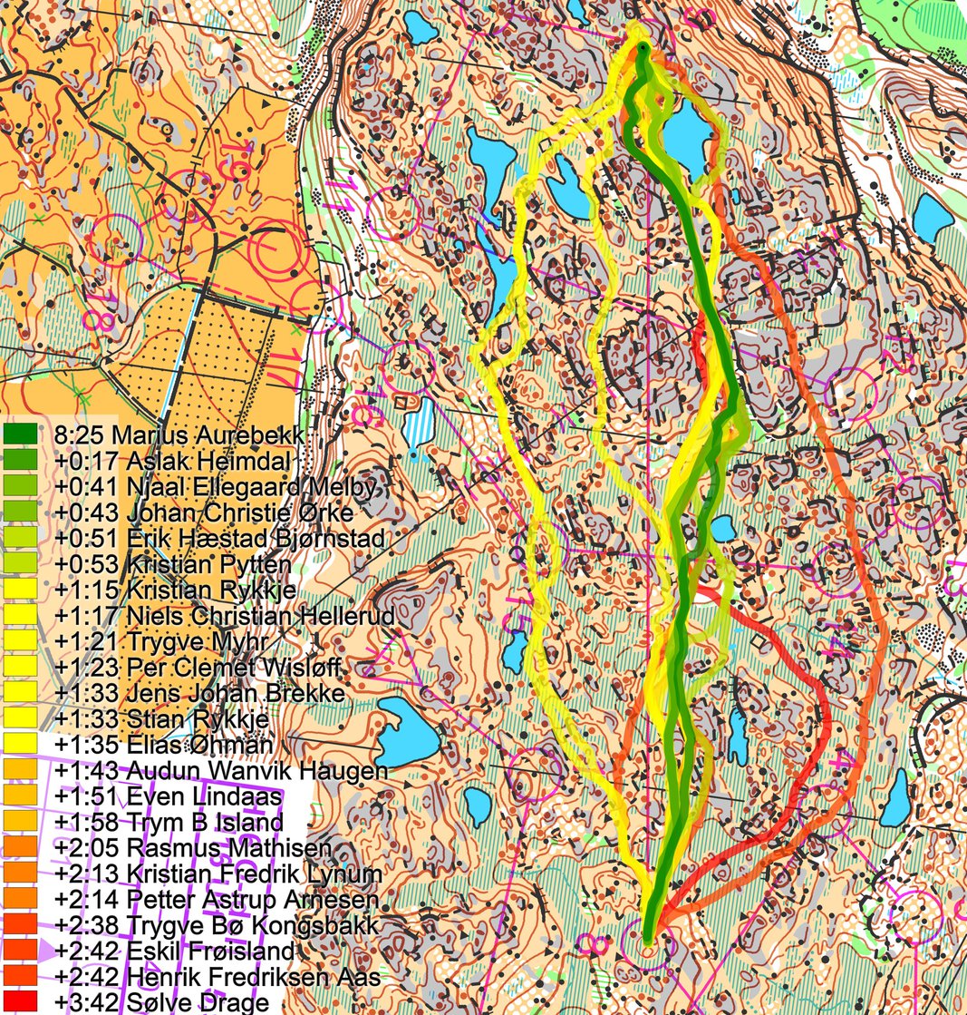
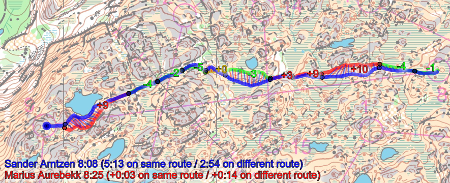
As you can see, many different routes were run by the runners, but going slight right was clearly faster with the second fast alternative being left.
Running slight right was clearly faster with the second fast alternative being left
By studying the routes in somewhat more detail, you can spot the reason for why left is more than half a minute slower; (1) the route is 100 meters longer and (2) the part on the left route along the small lake and just after the small lake is significantly slower than the corresponding part on the rightmost route.
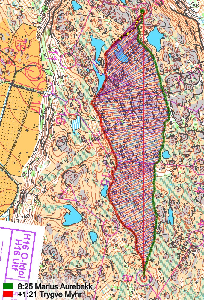
And a comparison with another route to the left – here the second part of the leg is also slower than the rightmost choice – the rightmost being better runnable.
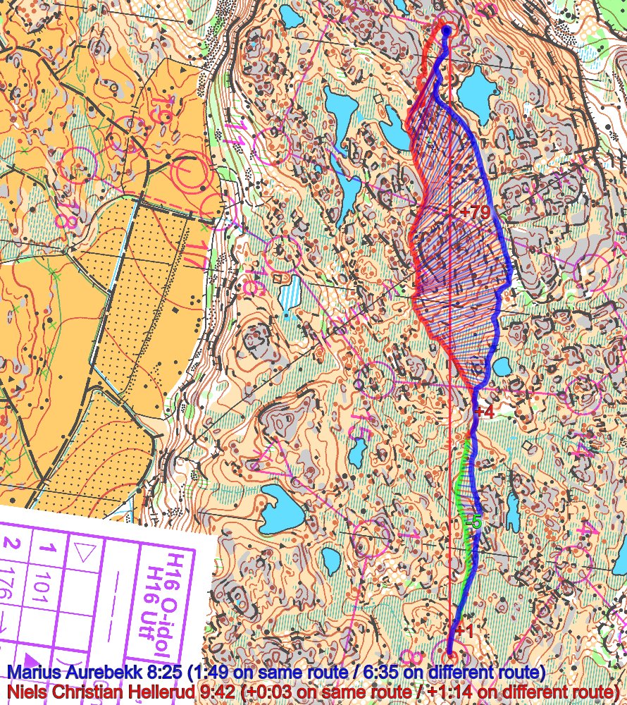
Edit 2/12 12:00: Note that Sander Arntzen (missing in official GPS-tracking) ran this leg even faster, along the same route as Aurebekk but some better micro routechoices.
Density map
See below for a density map of some of the ones who have drawn their routes so far (density map will be available after 10 AM).

Additional information
You find the complete map in omaps.worldofo.com at this location.
Route to Christmas series
The Route to Christmas series at World of O has been very popular the last years – giving the readers the opportunity to do one Route Choice Challenge each day from December 1st until December 24th. If you have got any good legs in RouteGadget, GPSSeuranta or 3DRerun from 2016-competitions – or old forgotten ones which are still interesting – please email me the link at Jan@Kocbach.net, and I’ll include it in Route to Christmas if it looks good. Route to Christmas will not be interesting if YOU don’t contribute.
Not all legs are taken for the interesting routechoice alternatives – some are also taken because the map is interesting – or because it is not straightforward to see what to do on a certain leg. Any comments are welcome – especially if you ran the event chosen for todays leg!