World of O News
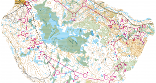
Today’s edition of Route to Christmas is from the Course of the Year according to Thierry Gueorgiou – the Norwegian O-Festival long distance which was also a selection race for WOC for the Swiss team. We are looking at the 14th leg – which is also a tip from Color.
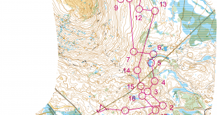
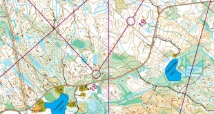
The leg is as usually first provided without routes – you may take a look at it and think about how you would attack this leg (if the image is too small, you may click on it to get it larger):
![]()
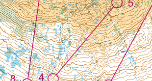
Location
You find other maps from the area in omaps.worldofo.com here. See also latest additions in 3DRerun from this area in order to learn more about this terrain type.
Webroute
Next you can draw your own route using the ‘Webroute’ below. Think through how you would attack this leg, and draw the route you would have made. Some comments about why you would choose a certain route are always nice for the other readers.
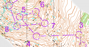
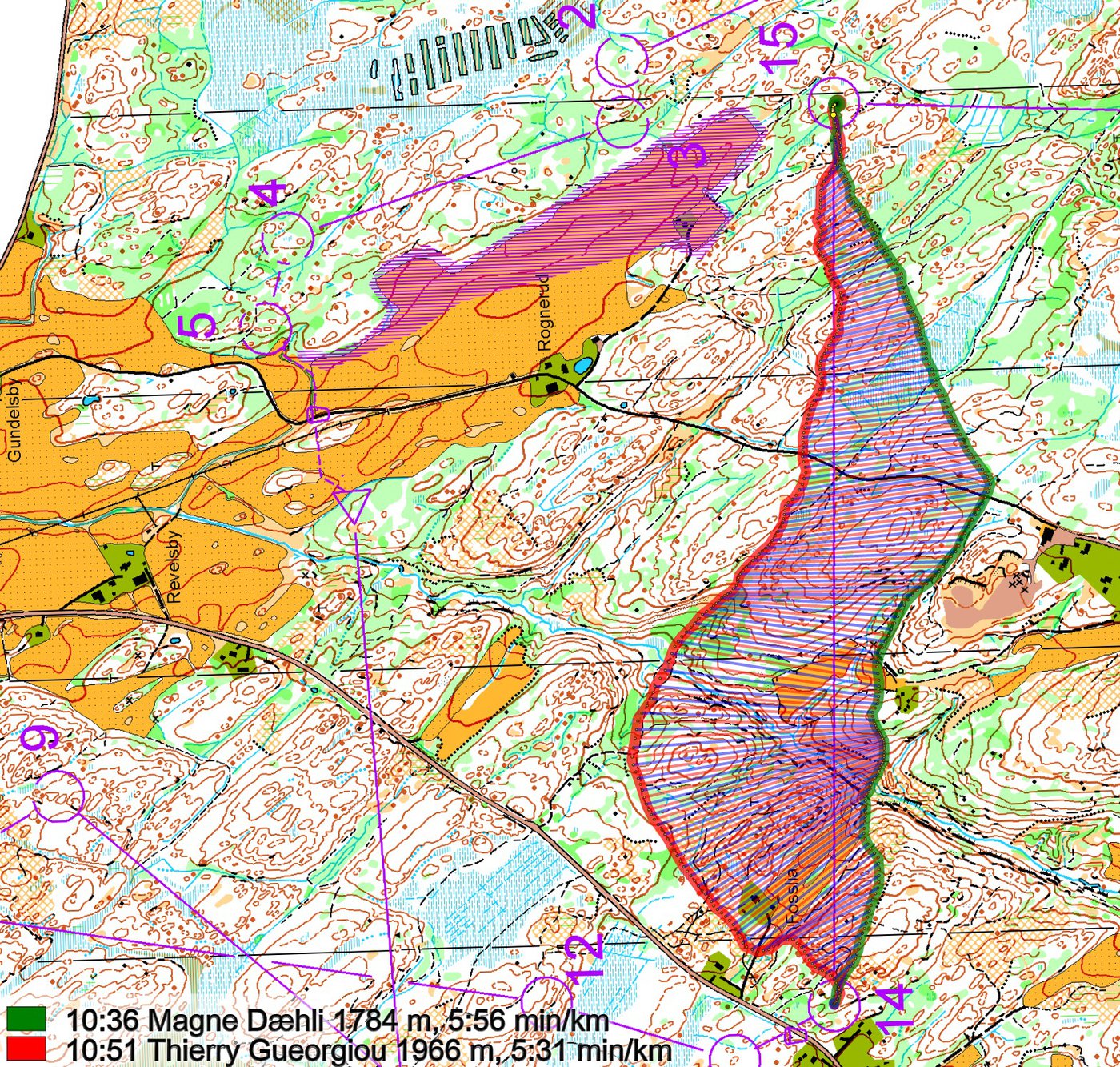
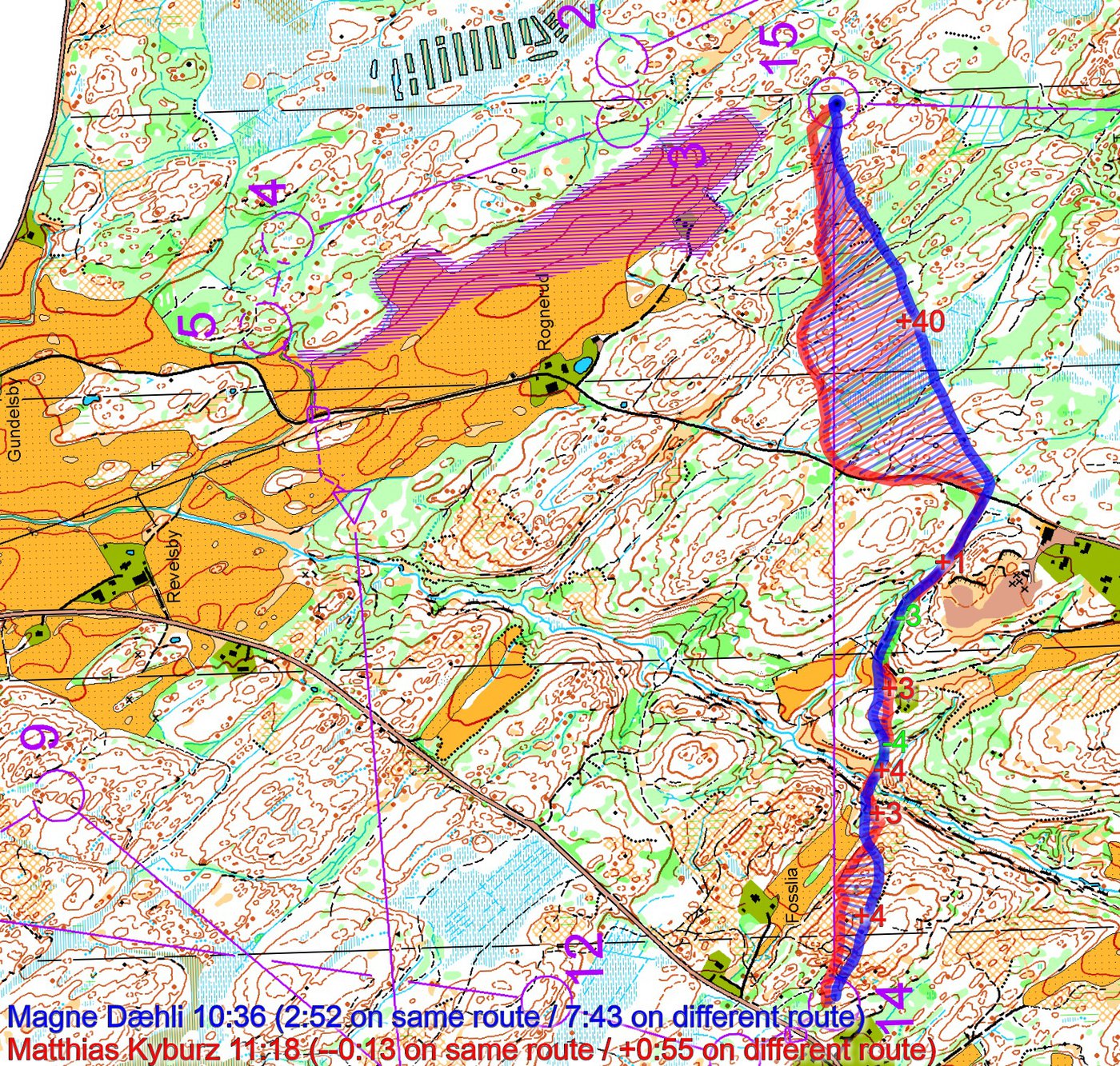
Then you can take a look at how the runners have solved this leg below. As you can see from the map below, going straight is faster than going around to the left – although you can run quite well to the left as well as Gueorgiou proves. In this terrain it was however a lot about micro routechoices – for both options it is very important to run a straight line. You can also note from the figures how Kyburz loses significant time by not going straight at the last part of the leg.
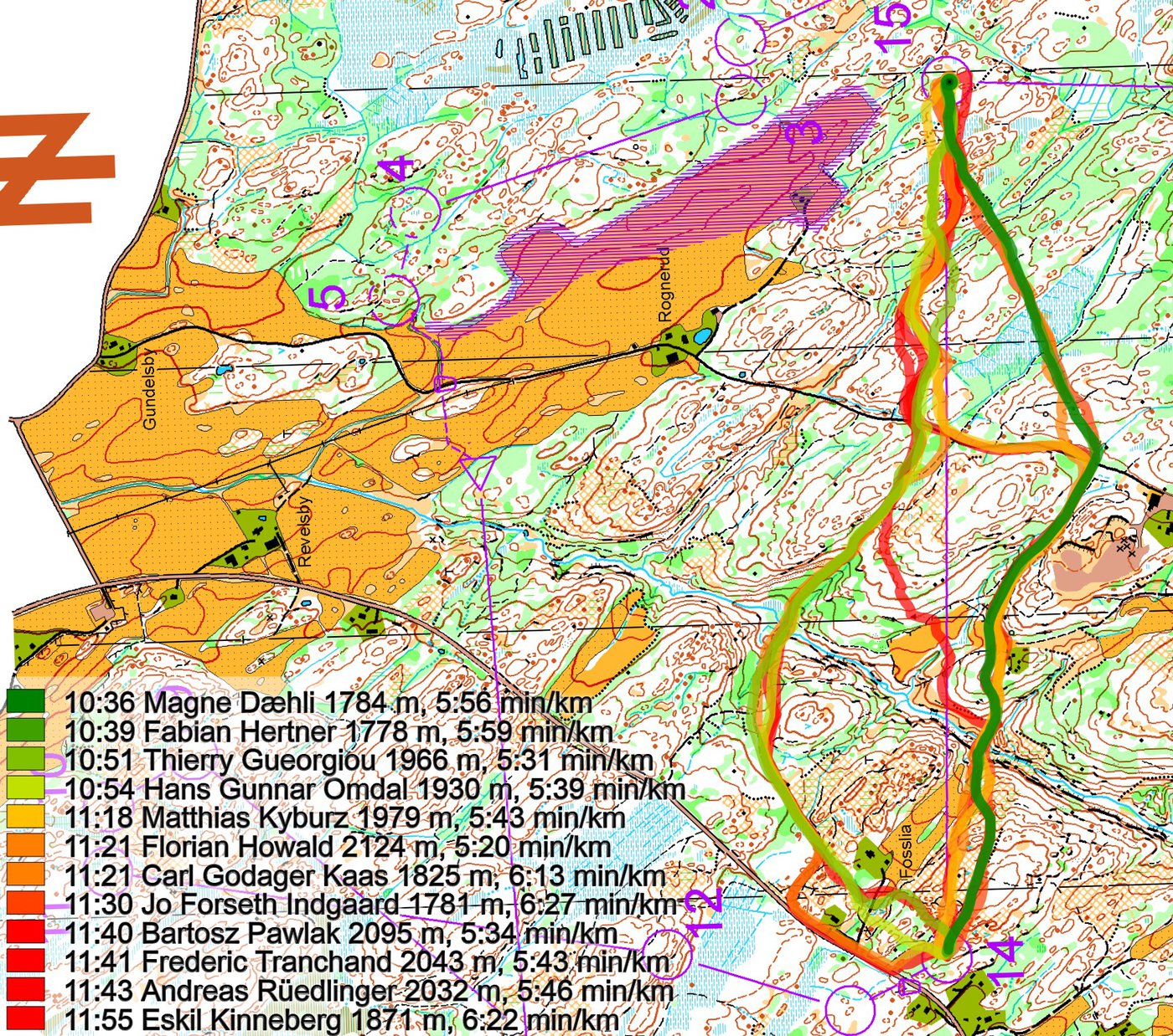
In the end also a short analysis provided på Color by e-mail:
Seems to be crucial to avoid extra climb. On both options you can see that it is really important to be straight. Right hand side is around 200 m shorter, you have to take the first hill after the valley, not run around it. Than fully straight from the junction to the control, probably quite difficult and not very fast parts? On the other hand you can run around left, use the small path until you get out of the valley and use the small yellow bit to cut on the small ride (not run to the junction!) then aim for the hill top (Thierry even uses 2 hills). By doing so you get pretty close to the control, 200 m longer but safer and better runablity. Doing the “S” seems to combine longer distance and bad runability parts. So its clearly slower but maybe used for an easier approach to the control.
Density map
See below for a density map of some of the ones who have drawn their routes so far.

Additional information
You find the complete map in omaps.worldofo.com at this location.
Route to Christmas series
The Route to Christmas series at World of O has been very popular the last years – giving the readers the opportunity to do one Route Choice Challenge each day from December 1st until December 24th. If you have got any good legs in RouteGadget, GPSSeuranta or 3DRerun from 2016-competitions – or old forgotten ones which are still interesting – please email me the link at Jan@Kocbach.net, and I’ll include it in Route to Christmas if it looks good. Route to Christmas will not be interesting if YOU don’t contribute.
Not all legs are taken for the interesting routechoice alternatives – some are also taken because the map is interesting – or because it is not straightforward to see what to do on a certain leg. Any comments are welcome – especially if you ran the event chosen for todays leg!