World of O News
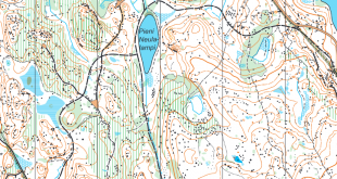
Today we are travelling to the World Championships 2019 area in south-eastern Norway. Today’s leg is a long leg in terrain which according to the WOC 2019 organizers is very relevant for WOC 2019 – and the leg itself has also been suggested by the WOC 2019 organizers to be part of Route to Christmas.
The leg is the 9th leg from the Men 21 Elite course in Småleneløpet. Småleneløpet is one of the season opener races in eastern Norway organized in late April this year. The analysis of this leg is also co-posted over at the WOC 2019 webpage in World of O’s GPS-column – over there some additional context is added to the leg as well.
The terrain can be characterized as quite tough and hilly Nordic terrain. The race winner Anders Nordberg ran at around 7 minutes/kilometer overall – but as you see from the chosen leg, it was not possible to run straight everywhere due to some lakes. In relatively flat, white forest his running speed was around 5 minutes/kilometer.
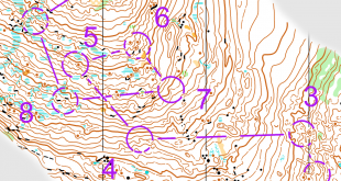
The leg is as usually first provided without routes – you may take a look at it and think about how you would attack this leg (if the image is too small, you may click on it to get it larger):
![]()
Location
You find other maps from the area in omaps.worldofo.com here. See also latest additions in 3DRerun from this area in order to learn more about this terrain type.
Webroute
Next you can draw your own route using the ‘Webroute’ below. Think through how you would attack this leg, and draw the route you would have made. Some comments about why you would choose a certain route are always nice for the other readers.
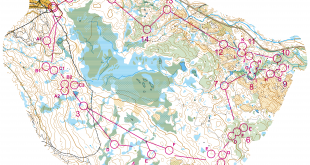
Below you can see how the runners solved the leg. There are four main routechoices here – left (blue below), right (red), direct left (violet) and direct right (green).

An analysis of the main options:
- Blue route: Nordberg wins the leg by a clear margin by taking the blue route – mostly running on a small path with very little climb. A majority of the runners take this route – it is mostly quite easy to execute, and once you have decided on the left route, there are not many further choices to be made until the very end of the leg.
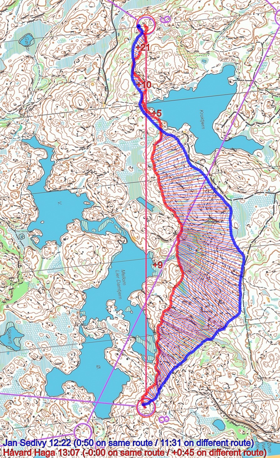
- Red route: Also a lot of path running, but you need to take some extra climb. If you take the path all around (backwards out of the control), this route has approximately the same length as the blue route. If you cut across like Jan Sedivy does, you save around 300 meters running. Compared to the blue route, the red route probably loses you some 30-50 seconds – taking Sedivy’s cut is 10-15 seconds faster than all around. Thomas Natvig Årstad is second on this leg, and in his own analysis he writes that he was very uncertain when choosing the route here and didn’t see the route to the left. Neither did he notice that cutting along Sedivy’s route would be better on the red route.
- Green/violet route: It is quite tough to go straight in this terrain when you have to pass many small hills, especially along the lakes. With the green route you get quite good runnability with little climb the last half of the leg, and don’t lose too much time. It would probably have been possible to push this time down towards the red route or even below with perfect execution by a top runner. Actually, Haga who runs straight looses less than 10 seconds to Sedivy from the control until they are together again. You need to be very skilled in this terrain to execute this route well, though.
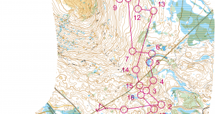
Then you can look at the traditional color-plot – showing leg time by color from green (fast) to slow (red):
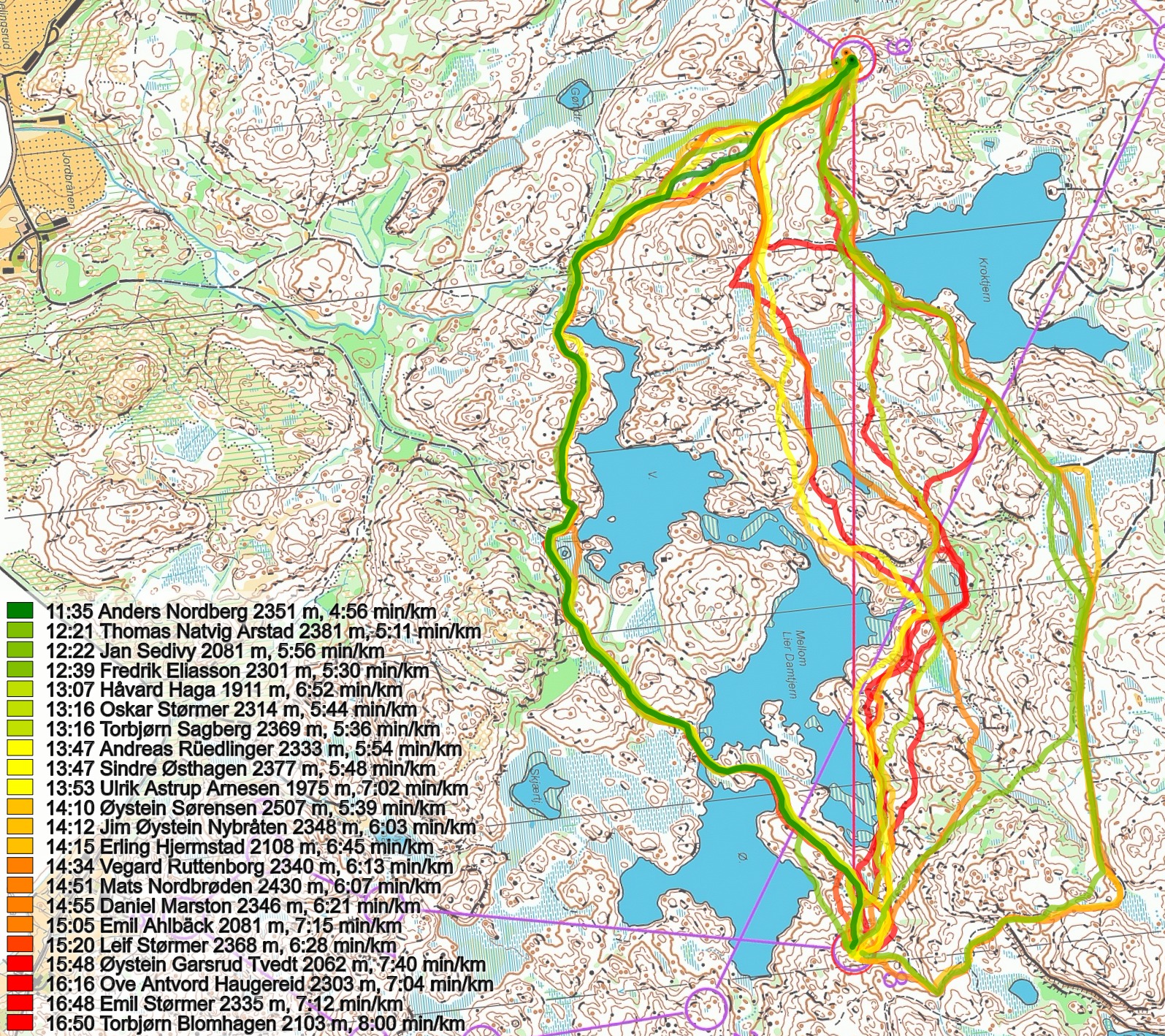
Comparing left (Nordberg) with right (Årstad) shows that what is really slow is to get up to the main path, the rest of the route is quite fast.
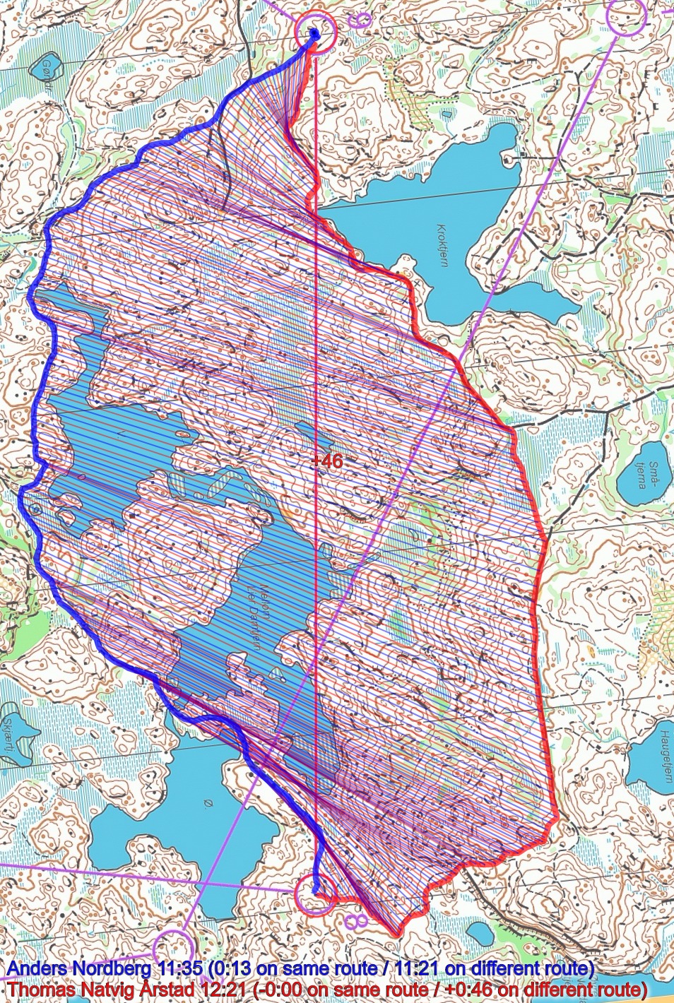
The comparison below of the two fastest on the left route shows how Eliasson loses 20 seconds the first 2-300 meters out of the control by not choosing the path. This shows how important execution is in this terrain.
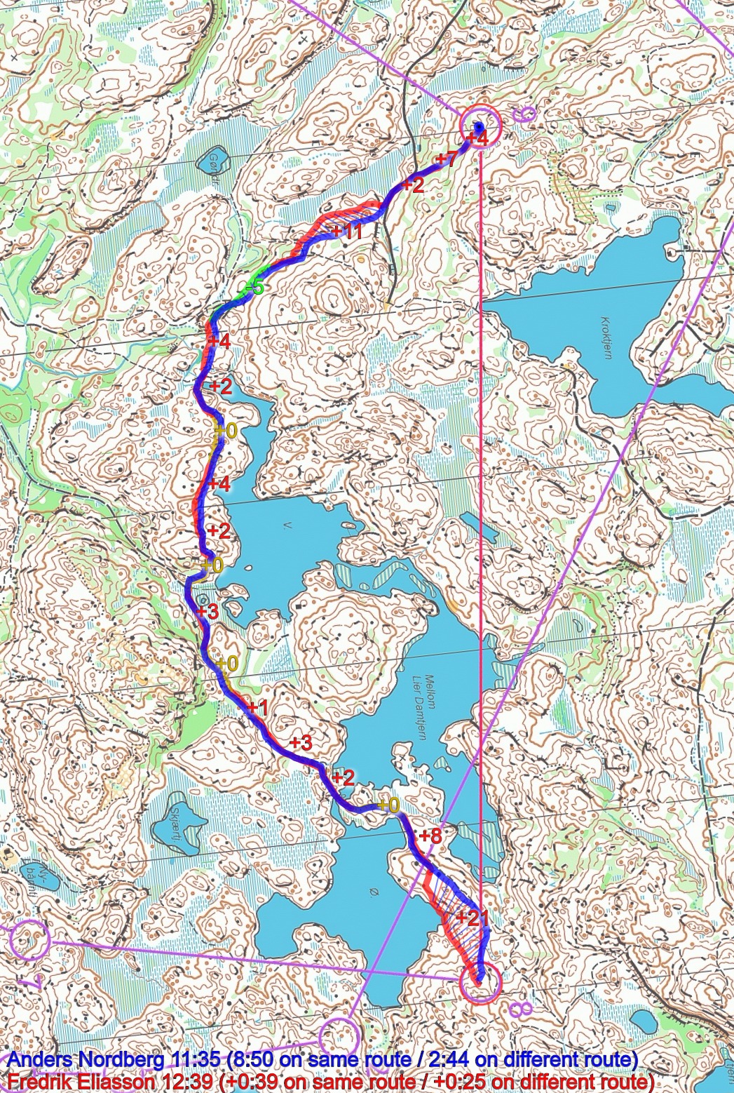
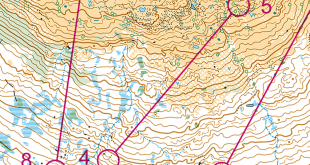
Comparison of Sedivy versus Natvig Årstad (the cut to the right):

And finally a look at Haga’s direct route – not bad that cut direct!
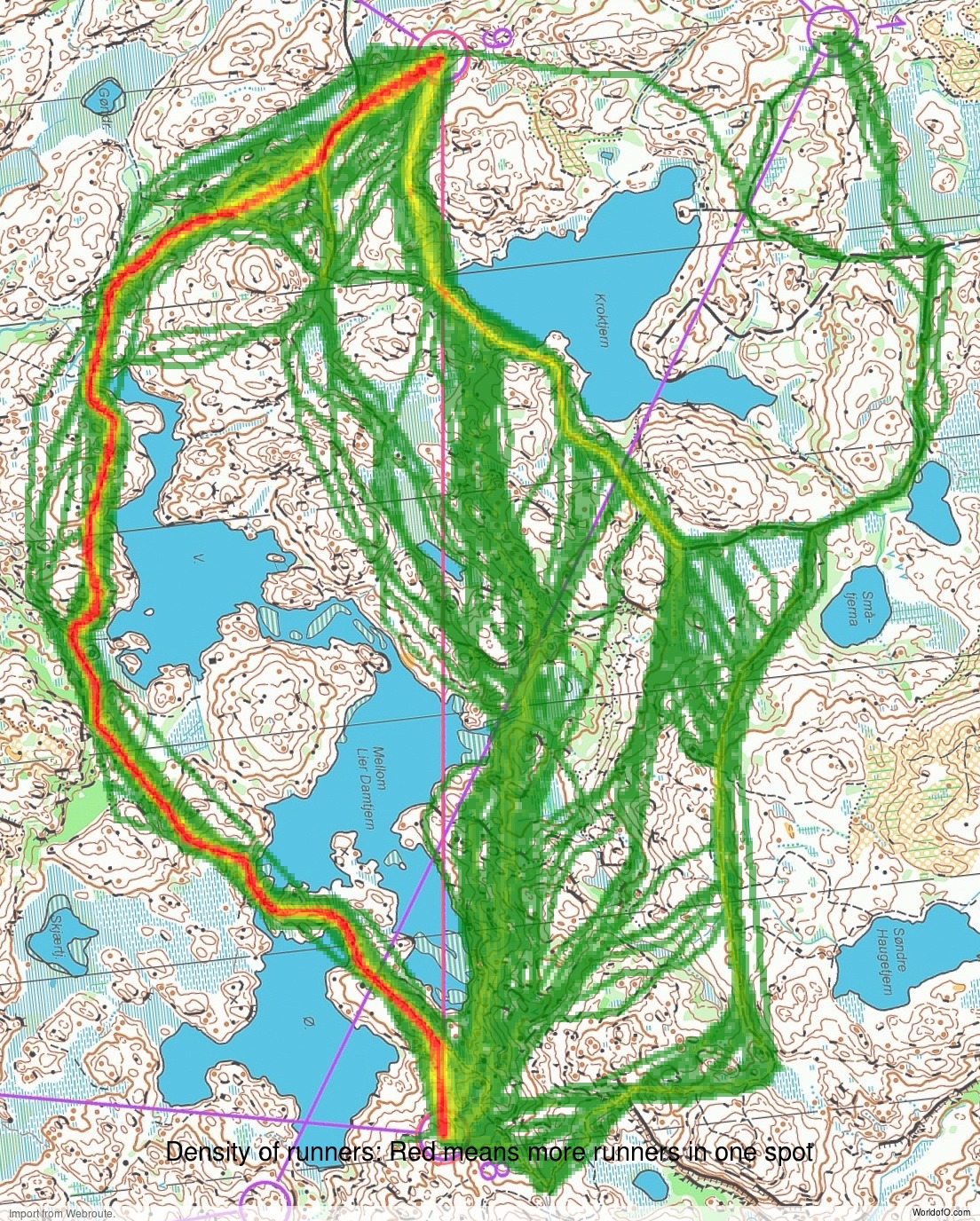
Density map
See below for a density map of some of the ones who have drawn their routes so far.
Additional information
You find the complete map in omaps.worldofo.com at this location.
Route to Christmas series
The Route to Christmas series at World of O is a pre-Christmas tradition at World of O – giving the readers the opportunity to do one Route Choice Challenge each day from December 1st until December 24th. If you have got any good legs in RouteGadget, GPSSeuranta or 3DRerun from 2017-competitions – or old forgotten ones which are still interesting – please email me the link at Jan@Kocbach.net, and I’ll include it in Route to Christmas if it looks good. Route to Christmas will not be interesting if YOU don’t contribute.
Not all legs are taken for the interesting routechoice alternatives – some are also taken because the map is interesting – or because it is not straightforward to see what to do on a certain leg. Any comments are welcome – especially if you ran the event chosen for todays leg!