Today’s leg in Route to O-Season 2020 is from the Norwegian Championships Ultralong 2019. The chosen leg is not one of the longest legs, as those were mostly run in quite open terrain with mostly micro-routechoices to be made quite close to the line. Instead we take a look at one of the last legs where we are down in the forest.
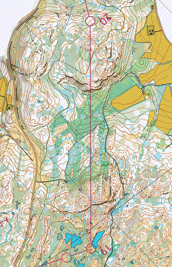
The leg is as usually first provided without routes – you may take a look at it and think about how you would attack this leg (if the image is too small, you may click on it to get it larger):
Location
You find other maps from the area in omaps.worldofo.com here. See also latest additions in 3DRerun from this area in order to learn more about this terrain type.
Webroute
Next you can draw your own route using the ‘Webroute’ below. Think through how you would attack this leg, and draw the route you would have made. Some comments about why you would choose a certain route are always nice for the other readers.
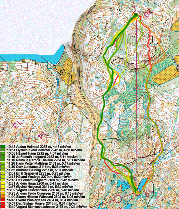
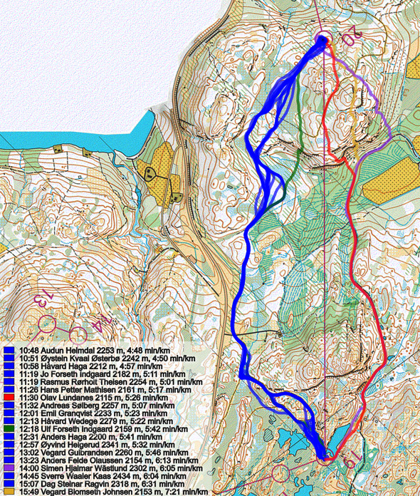
Then you can take a look at how the runners have solved this leg below. This was maybe too easy for you behind your computer, but after some 20 km of running in tough Norwegian terrain this may be a tricky choice. Going to the right takes you much further down in the valley, and in addition there is extra uphill over the last hill before the control, and you have to climb a steep hillside. So in conclusion, the length you save (some 100 meters of running) and the good path to the right is definitely not worth the extra climb! Olav Lundanes was one of the runners running to the right, by the way…
Density map
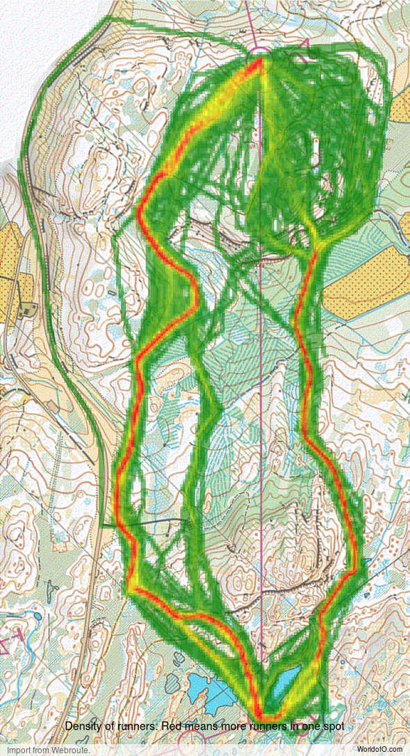
See below for a density map of some of the ones who have drawn their routes so far (available during the day when some readers have drawn their route).
Additional information
You find the complete map in omaps.worldofo.com at this location.
Route to O-Season 2020 series
Route Choice Challenges while waiting for the real action: With the upcoming orienteering season indefinitely on hold in large parts of the the world due to COVID-19, regular orienteering route choice challenges may be one way to make sure those orienteering skills don’t get completely rusty. I’ll try to keep these coming daily, but need help from all of you out there to keep them coming and to keep up a certain quality.
Tips on good route choice challenges – either from races/trainings (even cancelled ones) or theoretical ones with accompanying analysis – are very welcome (please e-mail to jan@kocbach.net).
Not all legs are taken for the interesting routechoice alternatives – some are also taken because the map is interesting – or because it is not straightforward to see what to do on a certain leg. Any comments are welcome – especially if you ran the event chosen for todays leg!
 World of O News


I lived in Trondheim for 7-8 years, this leg seems quite similar to many of the “Hu & Hei” ultra long route choices where you really need to adjust your routes based on how wet the marshes currently are!