Today’s leg in Route to O-Season 2020 is a fresh leg from a contactless middle distance “race” organized by Team Latvia this week. Thanks a lot to Janis Tamuzs for the tip and the analysis!
Here is Janis’ intro to the leg:
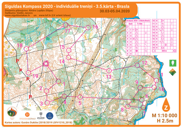
During the quarantine, Team Latvia, similar to orienteers all around the world, are also practicing contact-less shared trainings. One of them was a middle distance a couple of kilometers north of the WOC 2018 long distance terrain. Flags in the terrain, maps at the starting point – run the course at your own convenience and share your route later in Worldofo’s 3DRerun!
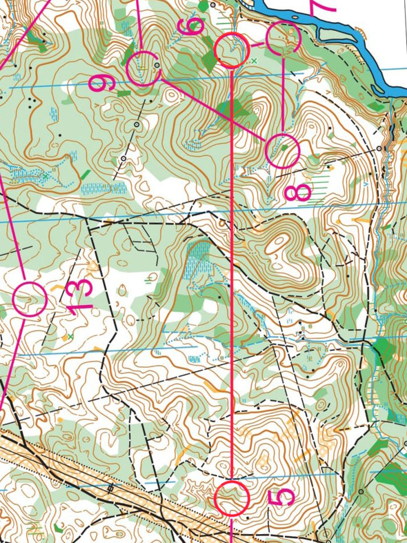
Considering a route-choice, first thing to take into account is that the contour interval is 2,5m, not 5m – so the hills on the map look two times bigger than they are! At this time of the year green is not that green yet, except for dark green – there it’s usually a fallen tree hell. White forest is nice pine forest with mostly solid or slightly soft ground. Marshes are muddy and wet, not really great for running. Paths and roads have very good runnability.
The leg is as usually first provided without routes – you may take a look at it and think about how you would attack this leg (if the image is too small, you may click on it to get it larger):
Location
You find other maps from the area in omaps.worldofo.com here. See also latest additions in 3DRerun from this area in order to learn more about this terrain type.
Webroute
Next you can draw your own route using the ‘Webroute’ below. Think through how you would attack this leg, and draw the route you would have made. Some comments about why you would choose a certain route are always nice for the other readers.
Then you can take a look at how the runners have solved this leg below.
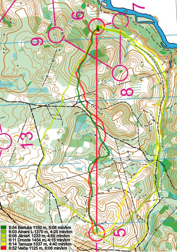
Looking at the GPS times of this leg, we have to keep in mind that this is training run after all, and runners had different levels of effort. Even if the best GPS leg time on this leg is run by Bertuks, going straight, it might not be the best option (Bertuks was clearly the fastest runner on this course by around 10%). As there are no big hills and impassable cliffs, in Baltic terrains usually there has to be a very good reason not to go straight. Also in this case it is not a very bad option, but probably some 20 seconds slower than other options.
The southern option looks good, but no need to go back out from the control (as Drozds) – white forest has good enough runnability to cut across the first slope like AinarsL or Tamuzs. Surprisingly, the northern route choice, taken by a local orienteering legend Janis Krumins, could be the best route choice – mostly flat, using roads and paths, and short – only around 100m longer than the straight option and more than 100m shorter than southern option.
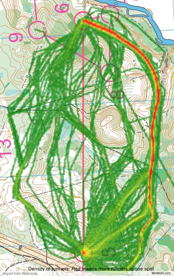
Density map
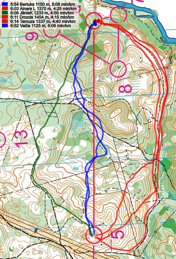
See below for a density map of some of the ones who have drawn their routes so far (available during the day when some readers have drawn their route).
Additional information
You find the complete map in omaps.worldofo.com at this location.
Route to O-Season 2020 series
Route Choice Challenges while waiting for the real action: With the upcoming orienteering season indefinitely on hold in large parts of the the world due to COVID-19, regular orienteering route choice challenges may be one way to make sure those orienteering skills don’t get completely rusty. I’ll try to keep these coming daily, but need help from all of you out there to keep them coming and to keep up a certain quality.
Tips on good route choice challenges – either from races/trainings (even cancelled ones) or theoretical ones with accompanying analysis – are very welcome (please e-mail to jan@kocbach.net).
Not all legs are taken for the interesting routechoice alternatives – some are also taken because the map is interesting – or because it is not straightforward to see what to do on a certain leg. Any comments are welcome – especially if you ran the event chosen for todays leg!
 World of O News
