 World of O News
Another day in Route to O-Season 2020 with focus on 10Mila and “Långa natten”. Today we take a look at the 12th control from “Långa” at 10Mila 2013. Thanks a lot to Viktor Antonsson for the tip!
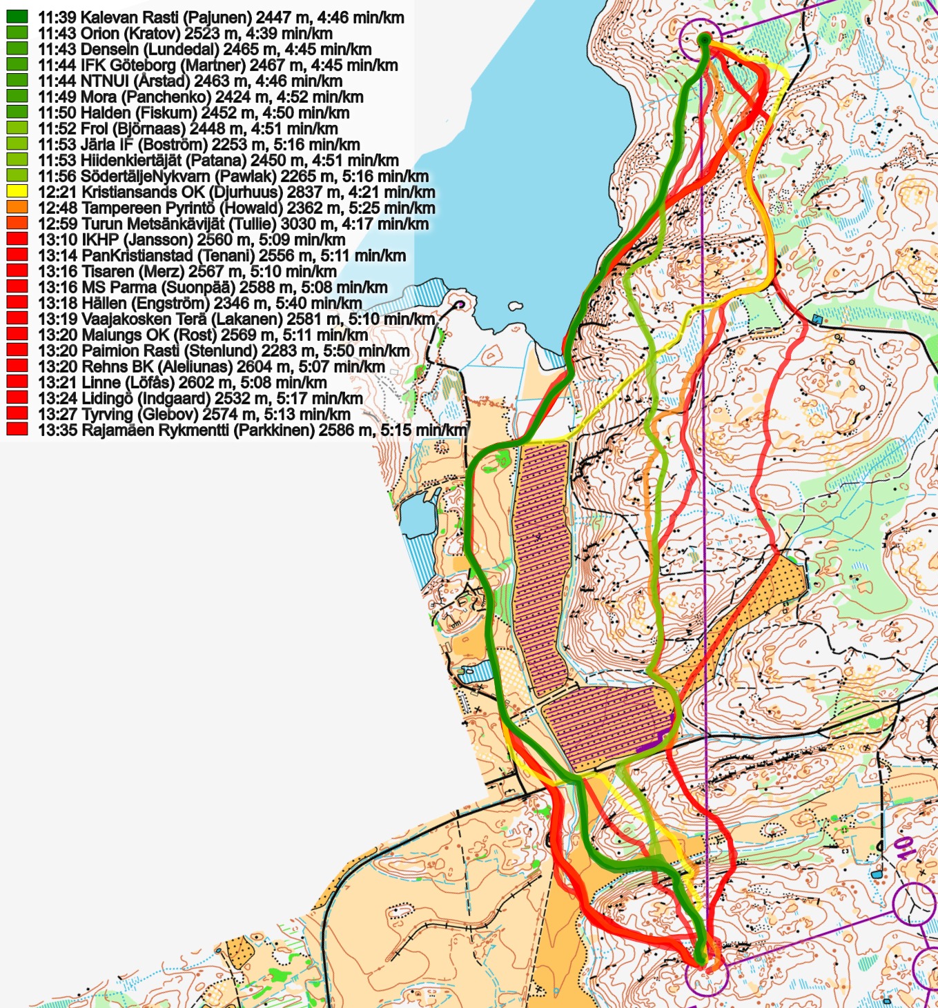
The leg is as usually first provided without routes – you may take a look at it and think about how you would attack this leg (if the image is too small, you may click on it to get it larger):
![]()
Location
You find other maps from the area in omaps.worldofo.com here. See also latest additions in 3DRerun from this area in order to learn more about this terrain type.
Webroute
Next you can draw your own route using the ‘Webroute’ below. Think through how you would attack this leg, and draw the route you would have made. Some comments about why you would choose a certain route are always nice for the other readers.
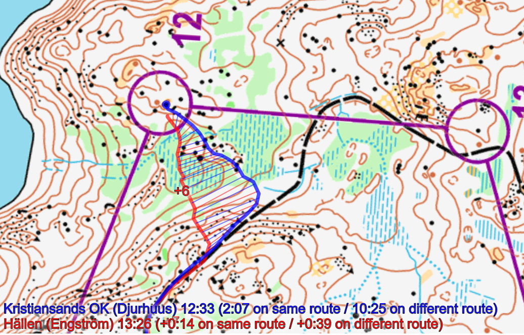
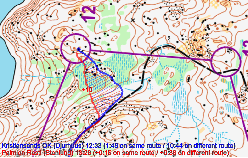
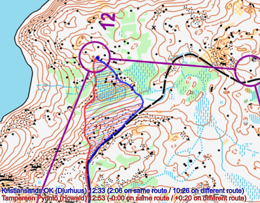
Then you can take a look at how the runners have solved this leg below. As you can see, the (maybe somewhat risky) route along the lake was the fastest here. It is, however, readable from the map that it should be quite runnable down there as there is a thin slice of white between the cliffs and the lake. Would you risk going down to the lake? Taking the straight approach (left side of the line) is not much slower – it looks like you lose 20-30 seconds, but it might also be more exhausting with more up and down.
[PS! Take a look at the article “10Mila 2013: Wow! What a night of mistakes” describing what happened in 10mila 2013]

Density map
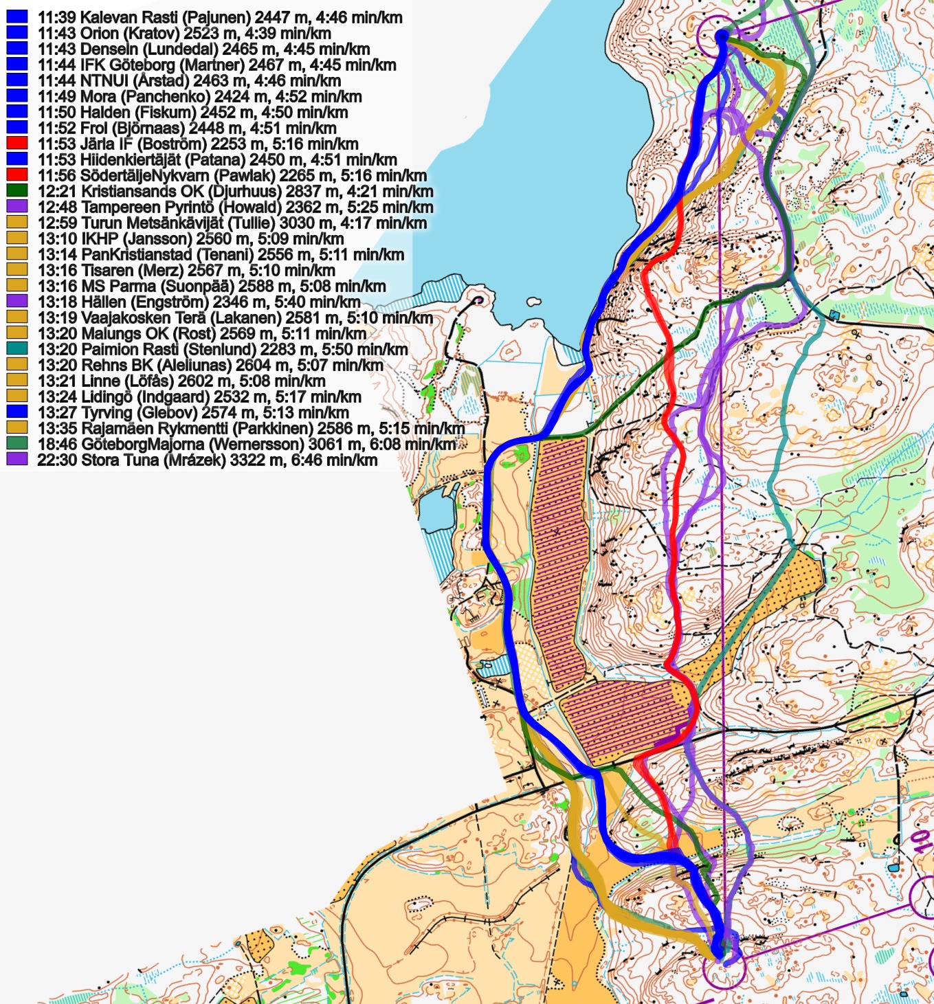
See below for a density map of some of the ones who have drawn their routes so far (available during the day when some readers have drawn their route).
![]()
Additional information
You find the complete map in omaps.worldofo.com at this location.
Route to O-Season 2020 series
Route Choice Challenges while waiting for the real action: With the upcoming orienteering season indefinitely on hold in large parts of the the world due to COVID-19, regular orienteering route choice challenges may be one way to make sure those orienteering skills don’t get completely rusty. I’ll try to keep these coming daily, but need help from all of you out there to keep them coming and to keep up a certain quality.
Tips on good route choice challenges – either from races/trainings (even cancelled ones) or theoretical ones with accompanying analysis – are very welcome (please e-mail to jan@kocbach.net).
Not all legs are taken for the interesting routechoice alternatives – some are also taken because the map is interesting – or because it is not straightforward to see what to do on a certain leg. Any comments are welcome – especially if you ran the event chosen for todays leg!


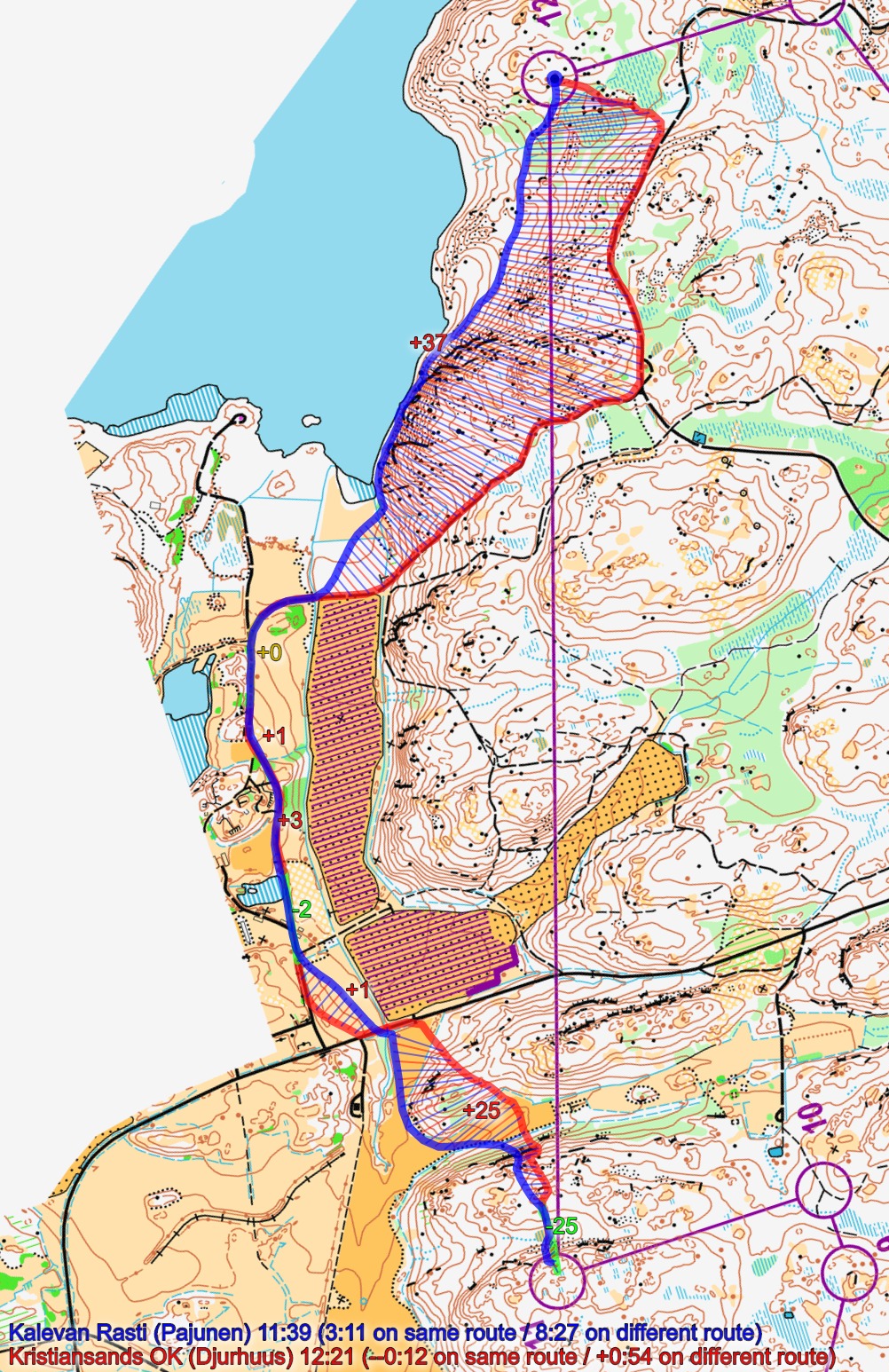
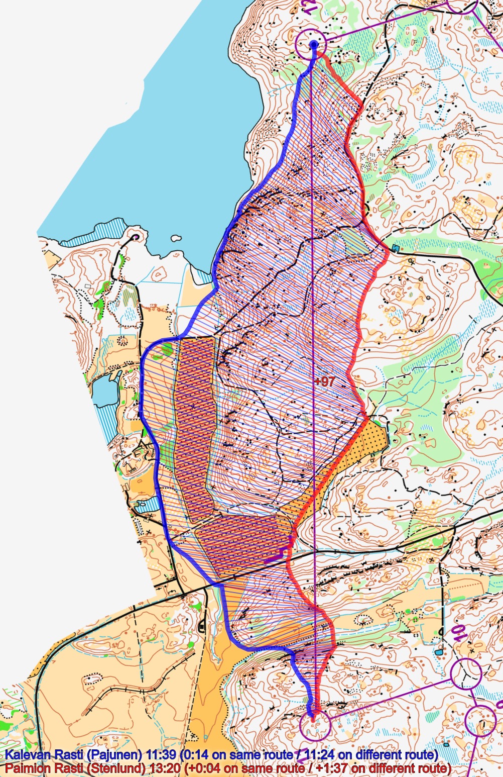
I believe that when you take into account the suboptimal approach to the control by Kristiansands OK and correct the wrong microroutechoice in the beginning, then this S-shaped choice might be quite equal to the leftmost choice. Also it would release from the burden of ‘betting’ on the lakeside strip.
I don’t think I agree. Based on the third figure where Kristiansand is compared to KR, you can clearly see that it is where KR runs along the lake most time is gained/lost.
Looking at the connecting lines, both Kristiansand and KR are almost in equal distance from the control point (a few hundred meters before the CP). But from the road bend Kristiansand would have had practically only downhill to the CP while KR has upphill to the CP. Simply the turn from the road towards CP should have been earlier and more straightforward.
But I guess the final truth will be subjective as always.
@Uku: I added some additional figures of athletes from the road to the control. Of the 4 with GPS-tracking who came from the road, Kristiansand is fastest, and I am actually not sure that the approach to the control is that sub-optimal for Kristiansand (at least not >30 seconds slower as it would have to be for this to be the best choice).
Thanks a lot for the discussion, highly appreciated!
The right option, taking the tracks for most of the leg seems quite good, and perhaps even better, no?
It seems no GPS runner took it, but many WoO reader draw it.
The distance difference isn’t huge, it’s almost all flat and tracks, and the control entrance is «flat» you don’t have this steep slope.
When you have a look at PR vs KR analysis, and if you consider where PR was (compare to KR) when he leaves the tracks, and the distance/climbing/tracks running difference he would need to achieve if sticking on the track; then it might be faster?
(Not sure to be clear, sorry)
Any opinion on this option?