World of O News
Today’s leg in Route to Christmas 2021 is another long and interesting leg! Now we are back to Norwegian forests – the last time was on December 11th. Thanks a lot to Arild Andersen for the tip!
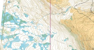
The leg is as usually first provided without routes – you may take a look at it and think about how you would attack this leg (if the image is too small, you may click on it to get it larger):
![]()
Location
You find other maps from the area in omaps.worldofo.com here. See also latest additions in 3DRerun from this area in order to learn more about this terrain type.
Webroute
Next you can draw your own route using the ‘Webroute’ below. Think through how you would attack this leg, and draw the route you would have made. Some comments about why you would choose a certain route are always nice for the other readers.
Then you can take a look at the route choice alternatives that course setter Snorre Veggan sketched up ahead of the competition. Here is his thoughts about the leg (translated to English, taken from this page):
The three longest courses were built around a nearly three kilometer long leg. The aim of the leg was to create as many different route choices as possible. It should not only be right, left or straight on, but different routes and maybe some changes along the way. At the same time, it was an aim that this leg could be used by all three courses and that the various route choices should be reasonably good to run. It had to go diagonally [with respect to the main terrain features] in order to get different route choices. If it had been laid across, it would have been too much up and down, and if it had been laid along it would have been obvious to follow the main path system too much. Such long stretches are rare, so it is also a good exercise in learning how to carry out long legs.

Below is a table with characteristics for the various route choices above. As mentioned, there are also different combinations. Based on other assumptions, the ranking may also be changed.
| Route | Est. time | Length | Climb | |
| 1 | G | 21,44 | 3,94 | 190 |
| 2 | B | 22,21 | 4,20 | 160 |
| 3 | I | 22,69 | 3,51 | 170 |
| 4 | D | 22,73 | 3,95 | 215 |
| 5 | J | 23,30 | 3,77 | 245 |
| 6 | F | 23,51 | 3,40 | 220 |
| 7 | H | 23,91 | 3,37 | 195 |
| 8 | C | 24,12 | 3,36 | 175 |
| 9 | A | 24,74 | 4,61 | 195 |
| 10 | E | 25,12 | 3,70 | 215 |
- Olav Eide 23.27, løpslengde 3676m
- Erik Persson 23.54, løpslengde 3479m
- Helene Scheele 24.32, løpslengde 3487m
- Bent Erik Skaug 25.14, løpslengde 3766m
- Leif Størmer 27.12, løpslengde 3482m
- Sondre Olaussen 27.46, løpslengde 3920m
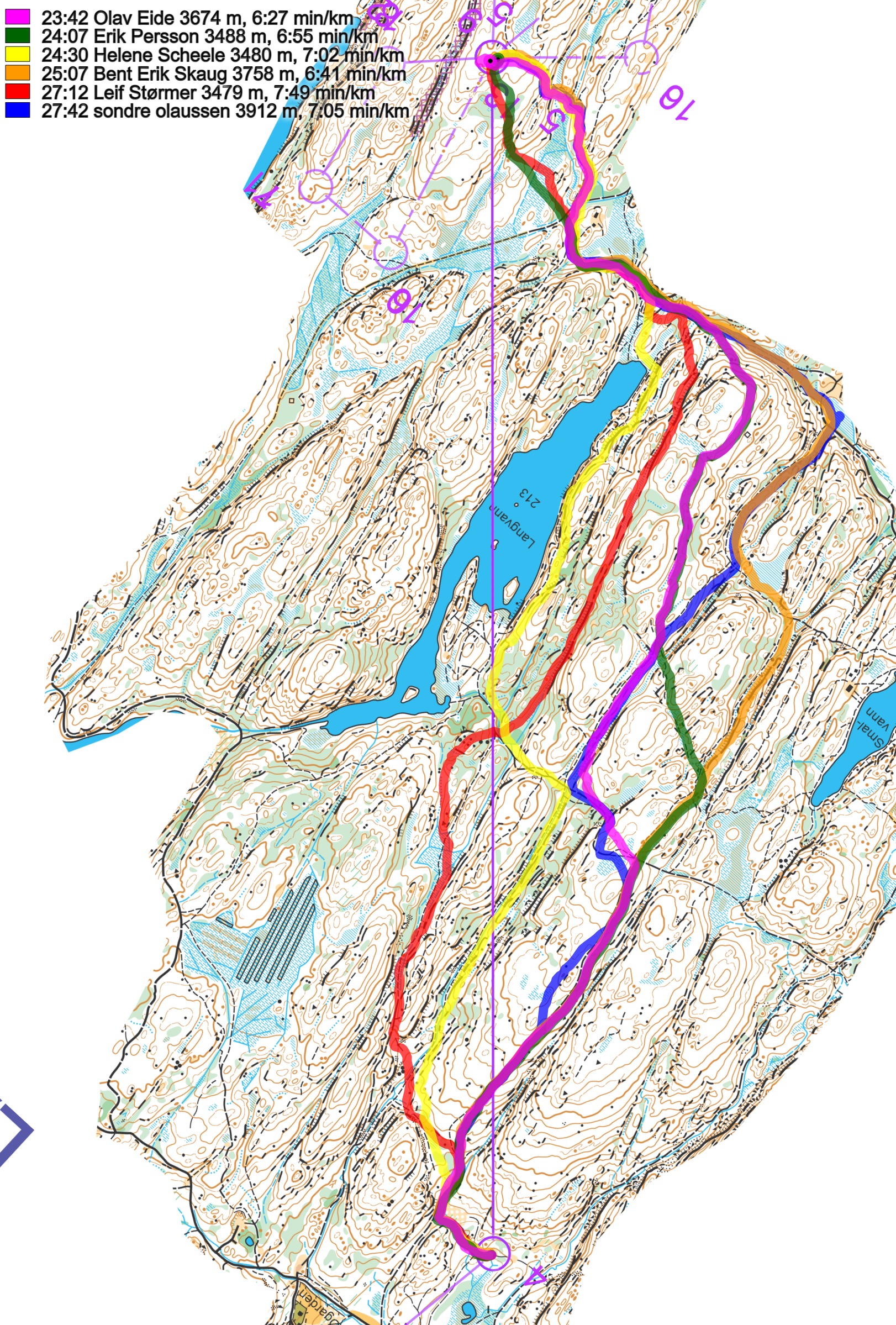
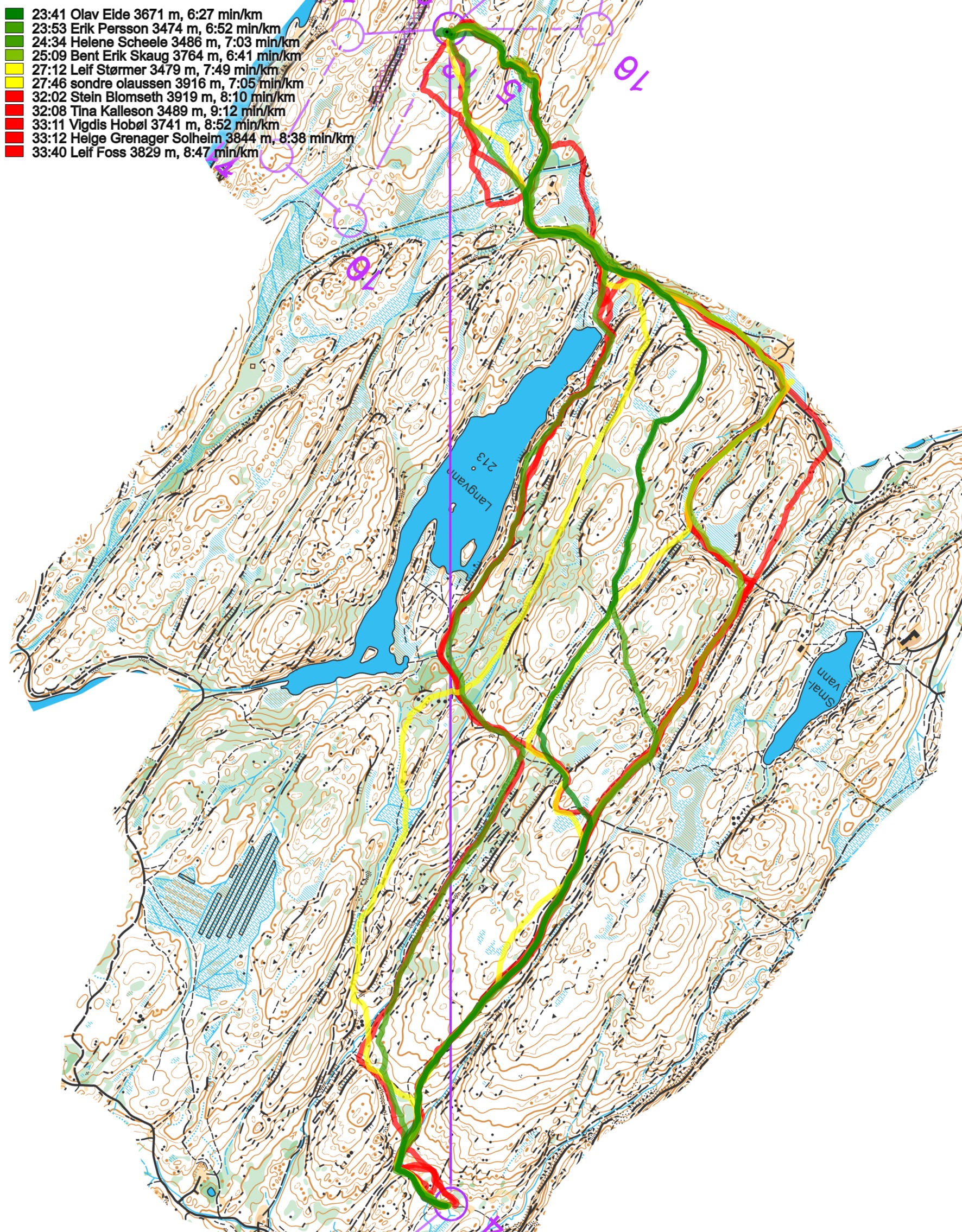
Here are all the routes with colors according to leg time:
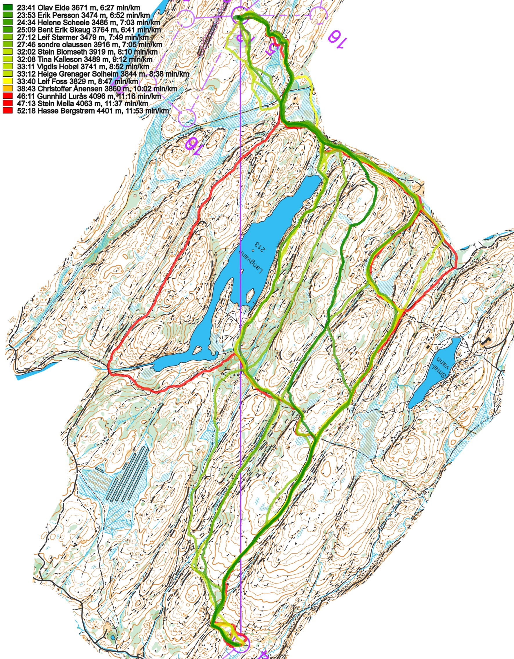
And a selection of these.
Then some more analysis from Snorre Veggan, the course setter:
In addition to the length of the route, the slope and surface play a role, as well as, of course, personal characteristics. An athlete who is a fast road runner will have a great advantage of running a lot on roads, while one who is o-technically strong can choose the alternative that Erik chose, even with the last part in the terrain.
Ahead of the race, I had seen the road choices on the left side of the line as the two fastest. Two of the route choices are the longest, but they have the least incline and the best surface most of the way. Route choice B has approx. 160 meter climb, in contrast to e.g. route choice J, which Bent Erik took, which has a full 245 meters. And the difference in length is just over 400 meters.
When I planned the leg, I took as my starting point a running time of approx. 4 min / km on road, 5 min / km on large path, 6 min / km on small paths and 8 min / km in hilly terrain. In addition, I added some time for the climb. Then I arrived at 21-22 minutes running time on route G and B. Route C I had at approx. 24 minutes (Helene used 24.5), while I had route choice J in 23.5min (Bent Erik used 25). However, I had not taken into account that there is a path along the ridge west of Langvann, where Olav and Erik ran. However, they take so much climb that I do not think it is the fastest anyway. It is also confirmed by Helene’s time. The 13-year-old is only one minute weaker than the fastest seniors.
Density map
See below for a density map of some of the ones who have drawn their routes so far (available during the day when some readers have drawn their route).
![]()
Additional information
You find the complete map in omaps.worldofo.com at this location.
Route to Christmas series
The Route to Christmas series is a pre-Christmas tradition at World of O – giving the readers the opportunity to do one Route Choice Challenge each day from December 1st until December 24th. If you have got any good legs in GPSSeuranta or 3DRerun from 2021-competitions, or old forgotten ones which are still interesting, please email me the link at Jan@Kocbach.net, and I’ll consider including it in Route to Christmas if it looks good. Route to Christmas will not be interesting if YOU don’t contribute.
Not all legs are taken for the interesting routechoice alternatives – some are also taken because the map is interesting – or because it is not straightforward to see what to do on a certain leg. Any comments are welcome – especially if you ran the event chosen for todays leg!