Today’s leg in Route to O-Season 2020 is another one from Sweden: Leg 6 in the M21E course from the second stage in the “MILA Stockholm by Night” series. Thanks a lot for the tip to Simon Hector, course setter.
We will let Hector make the introduction to the leg:
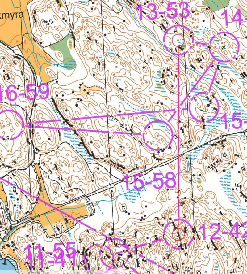
This leg is from a typical old school Stockholm map which was drawn 20-30 years ago and since then updated many times. The terrain is rough with a lot of hills and cliffs that you almost can’t pass even if you would really want to, but also nice with many open hilltops (not shown due to old mapping style). The terrain is in overall nicely runnable. This training competition was a mass-start night race, known as nattcup in Swedish.
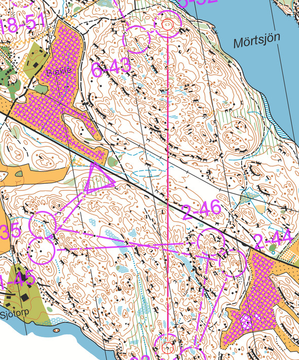
The leg is as usually first provided without routes – you may take a look at it and think about how you would attack this leg (if the image is too small, you may click on it to get it larger):
Location
You find other maps from the area in omaps.worldofo.com here. See also latest additions in 3DRerun from this area in order to learn more about this terrain type.
Webroute
Next you can draw your own route using the ‘Webroute’ below. Think through how you would attack this leg, and draw the route you would have made. Some comments about why you would choose a certain route are always nice for the other readers.
For the analysis, we again let Hector describe his thoughts as a course setter:
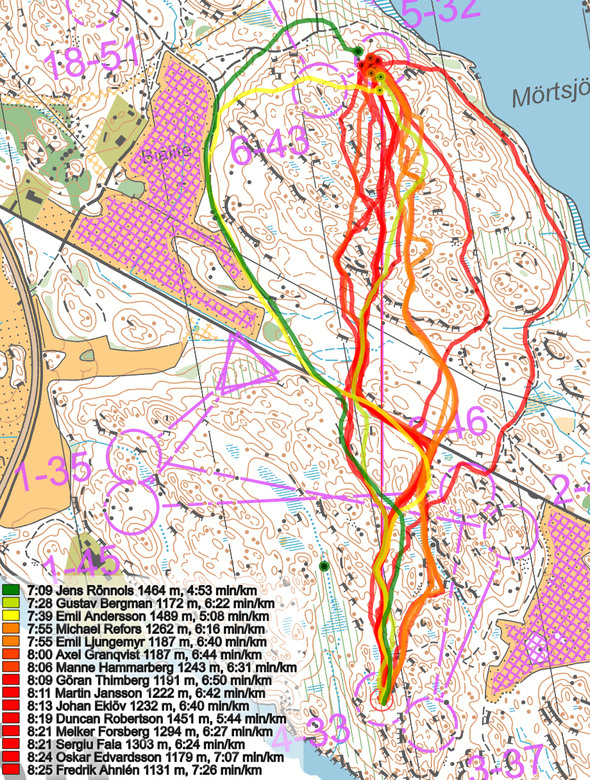
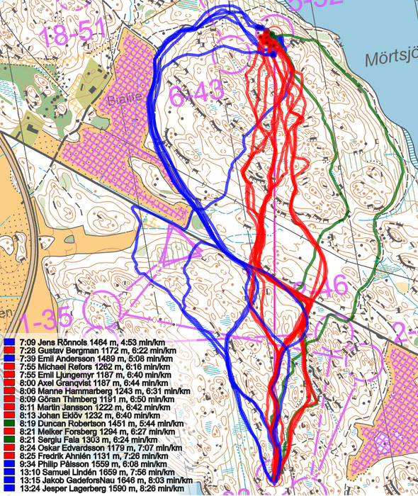
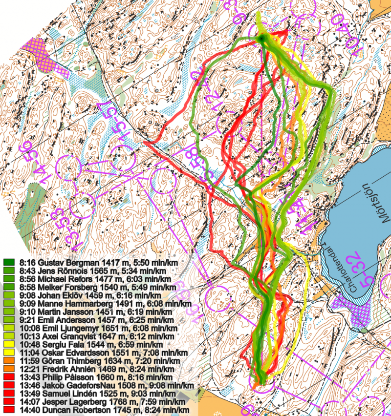
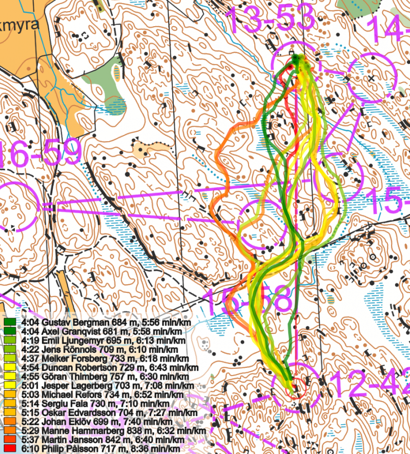
Stockholm terrain is usually one where you would go straight on most legs, but bear in mind this is at night and the terrain is hilly. This leg provided three main route choices but almost even more important here is to nail every passage nicely to not have to take extra contours or end up on a cliff. My guess is that straight could be fastest if you really run smooth and end up on the best passages, but that is not easy here and especially not at night. Jens chose a safer route choice and executed the first part to the road well, I think his route choice might be the best and safest route choice also in daylight.
I am a bit surprised not more runners got tempted by the right route choice, but the part to the road is a bit rough and I would not want to risk getting stuck on those cliffs. That means you end up having to go left or right of the hill where controls 2 are placed, and then get a big climb in the end, so I also understand those who didn’t choose it.
Take a look at how the runners have solved this leg below.
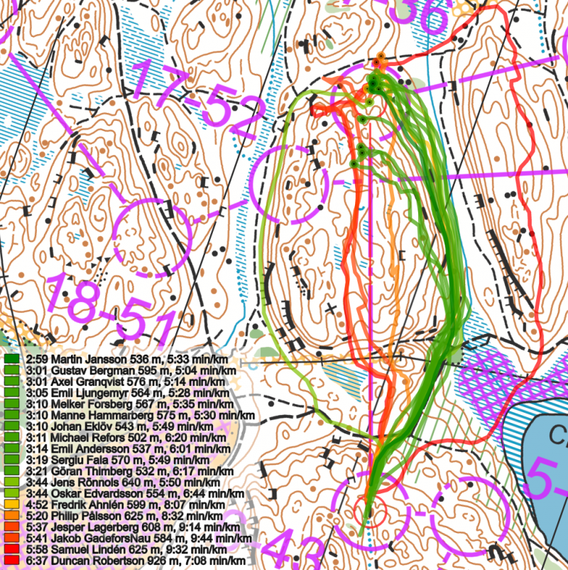
Those who wish can also have a look at some more route choice legs from this race, the runners actually spread quite a bit also on other legs.
Density map
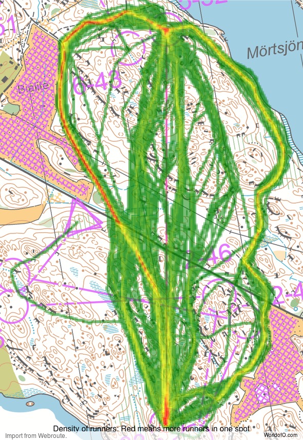
See below for a density map of some of the ones who have drawn their routes so far (available during the day when some readers have drawn their route).
Additional information
You find the complete map in omaps.worldofo.com at this location.
Route to O-Season 2020 series
Route Choice Challenges while waiting for the real action: With the upcoming orienteering season indefinitely on hold in large parts of the the world due to COVID-19, regular orienteering route choice challenges may be one way to make sure those orienteering skills don’t get completely rusty. I’ll try to keep these coming daily, but need help from all of you out there to keep them coming and to keep up a certain quality.
Tips on good route choice challenges – either from races/trainings (even cancelled ones) or theoretical ones with accompanying analysis – are very welcome (please e-mail to jan@kocbach.net).
Not all legs are taken for the interesting routechoice alternatives – some are also taken because the map is interesting – or because it is not straightforward to see what to do on a certain leg. Any comments are welcome – especially if you ran the event chosen for todays leg!
 World of O News
