Today’s leg in Route to O-Season 2020 is from a very recent race – the Melbourne Sprint Weekend 2020 Race 1 – a World Ranking Event organized earlier this month in Australia. The chosen leg is leg 19 in the M21E course. Thanks a lot to Patrick Jaffe for the tip!
According to Jaffe, the map is a new map of Overnewton College that included both a section of small/irregular school buildings (typical of the campuses that are often used for sprints in Aus/NZ) and an area of farmland/sports fields with many impassable fences. There were really strong fields for these races, the M21E podium for this event was Frédéric Tranchand, Tommy Hayes and Aston Key (all former WOC or JWOC sprint medalists) and W21E was won by Lizzie Ingham (former World Cup medalist).
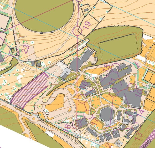
The leg is as usually first provided without routes – you may take a look at it and think about how you would attack this leg (if the image is too small, you may click on it to get it larger). The leg came just after a map flip followed by a series of very technical controls, so runners had little chance to plan ahead. In thinking about the route choices, people should also consider the fact that there were very muddy conditions on the day of the race (although runners weren’t fully aware of just how muddy the fields were at this point in the course). Also note that it is possible to pass the passable fences.
Location
You find other maps from the area in omaps.worldofo.com here. See also latest additions in 3DRerun from this area in order to learn more about this terrain type.
Webroute
Next you can draw your own route using the ‘Webroute’ below. Think through how you would attack this leg, and draw the route you would have made. Some comments about why you would choose a certain route are always nice for the other readers.
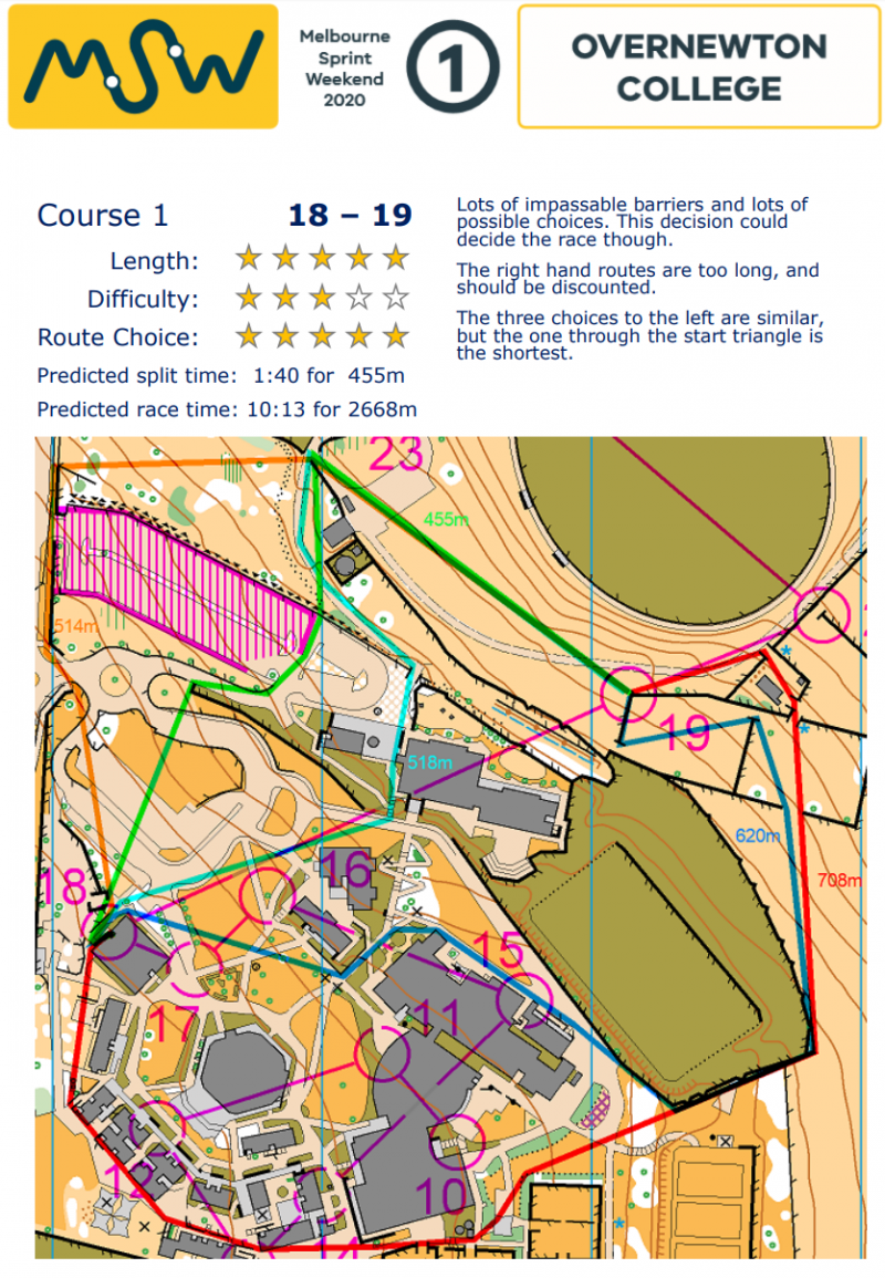
The organizers had put together a really nice analysis of the course, where each leg was discussed and given “stars” for length, difficulty and route choice. The leg from 18 to 19 had the most stars for route choice on the course (5 stars), and the analysis reads:
Lots of impassable barriers and lots of possible choices. This decision could decide the race though.
The right hand routes are too long, and should be discounted.
The three choices to the left are similar, but the one through the start triangle (start triangle is not shown here, this is the green route on the map below) is the shortest.
Here is the analysis for leg 18-19:

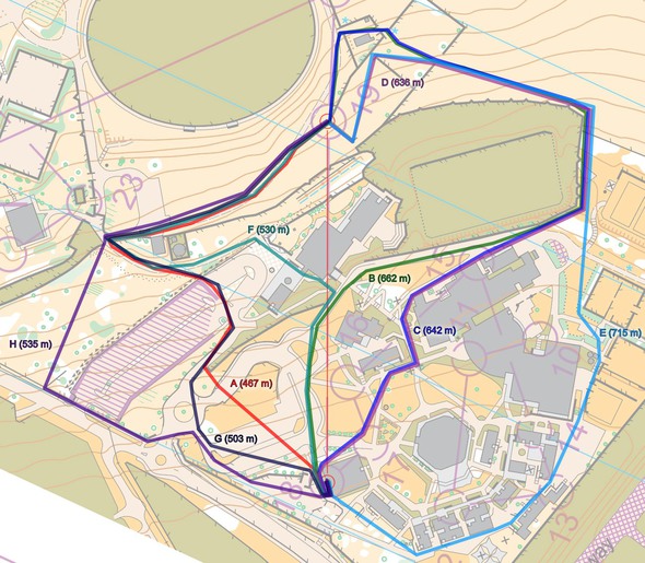
In addition I have redrawn some variants (including drawing a left variant without fence crossings) to see how much longer that is.

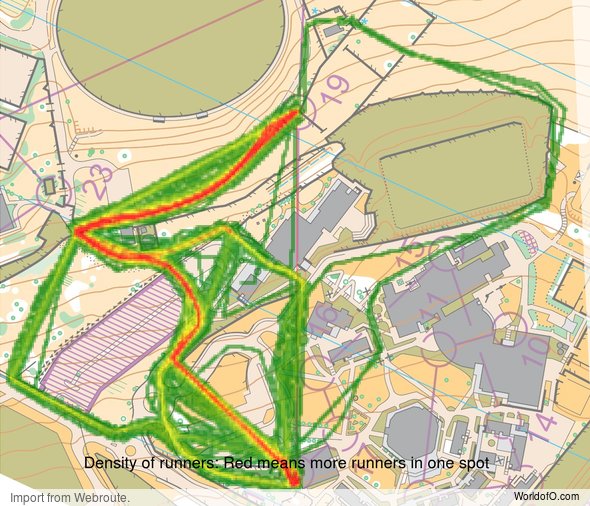
Density map
See below for a density map of some of the ones who have drawn their routes so far (available during the day when some readers have drawn their route).
Additional information
You find the complete map here.
Route to O-Season 2020 series
Route Choice Challenges while waiting for the real action: With the upcoming orienteering season indefinitely on hold in large parts of the the world due to COVID-19, regular orienteering route choice challenges may be one way to make sure those orienteering skills don’t get completely rusty. I’ll try to keep these coming daily, but need help from all of you out there to keep them coming and to keep up a certain quality.
Tips on good route choice challenges – either from races/trainings (even cancelled ones) or theoretical ones with accompanying analysis – are very welcome (please e-mail to jan@kocbach.net).
Not all legs are taken for the interesting routechoice alternatives – some are also taken because the map is interesting – or because it is not straightforward to see what to do on a certain leg. Any comments are welcome – especially if you ran the event chosen for todays leg!
 World of O News


The w21e leg was arguably a tougher decision I think; with the leg going directly from 18-20.
Thanks for the comment, Lizzie. I considered both the men’s and women’s leg and decided for the men’s based on the analysis provided. When looking at the legs in more detail now, I agree that the women’s may be a bit more interesting, yes…