Today’s leg in Route to O-Season 2020 takes us to 10Mila! But instead of this year’s edition which is cancelled/postponed, we look back at the 10Mila 2011 – looking at the 11th control of the 6th leg (night leg).
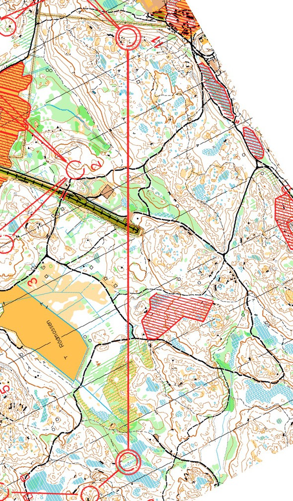
The leg is as usually first provided without routes – you may take a look at it and think about how you would attack this leg (if the image is too small, you may click on it to get it larger):
Location
You find other maps from the area in omaps.worldofo.com here. See also latest additions in 3DRerun from this area in order to learn more about this terrain type.
Webroute
Next you can draw your own route using the ‘Webroute’ below. Think through how you would attack this leg, and draw the route you would have made. Some comments about why you would choose a certain route are always nice for the other readers.
Then you can take a look at how the runners have solved this leg below. Here is the analysis from back in 2011:
There are basically three options for this leg:
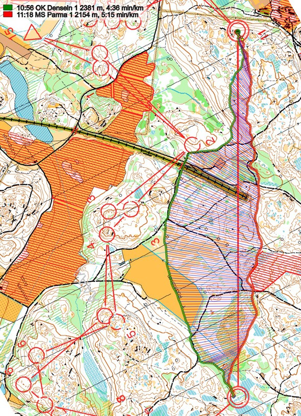
- (1) A direct option passing along the edge of the forbidden area – see MS Parma’s route,
- (2) A left variant with 80% path, open field and road – mostly large paths – see OK Denseln’s route.
- (3) A right variant with more than 90% paths – significant amounts of that being small paths.
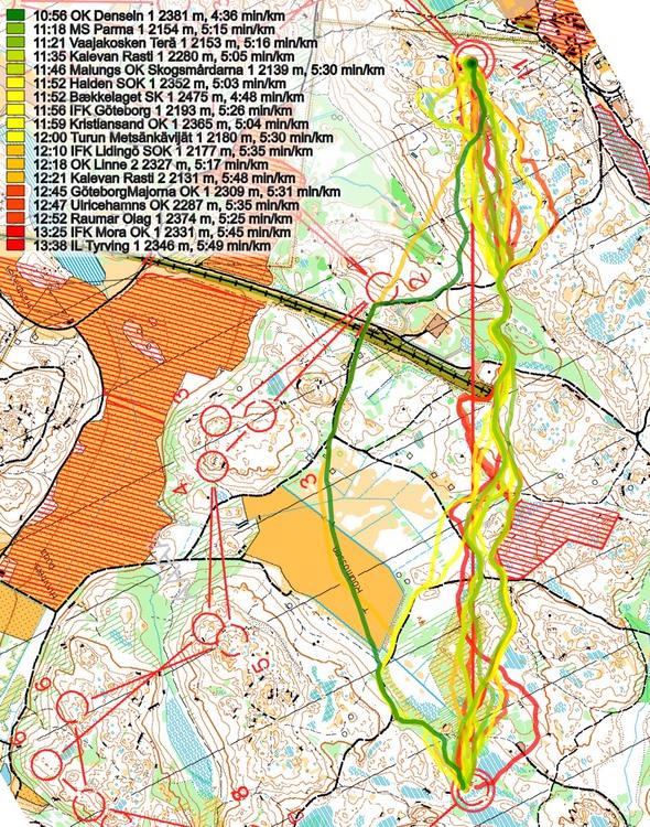
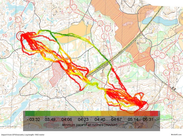
Of the teams with GPS tracking, most teams have taken variants of the direct option with some curves here and there to use paths. Some have taken the left option, but none have taken the rightmost option (
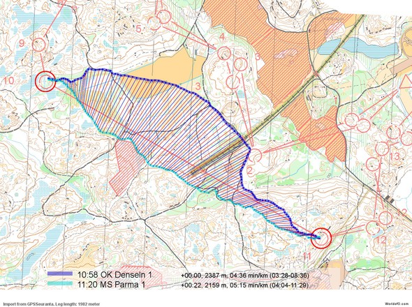
Looking at the illustrations below, you can see that the fastest time is run by OK Denseln running the left variant even if it is more than 10% longer than the direct route. The reason for this is the very high speed you can run in on the road/track/open field, which is very nicely illustrated on the pace map. Also, the direct route is not really direct – you actually do a lot of curves when trying to run it optimally, giving a running distance of around 2160 meters on the 1980 meter long leg (the leftmost is around 2390 meters). Add to that that the leftmost route is much more secure than the direct route (many obviously could not keep their direction), the leftmost option surely looks to be the best option on this leg on nightorienteering. The rightmost option could look tempting due to the amount of running on paths, but as (1) small paths are usually slower and (2) it is longer than the rightmost route, I’d think the leftmost route is the choice to take here.
Density map
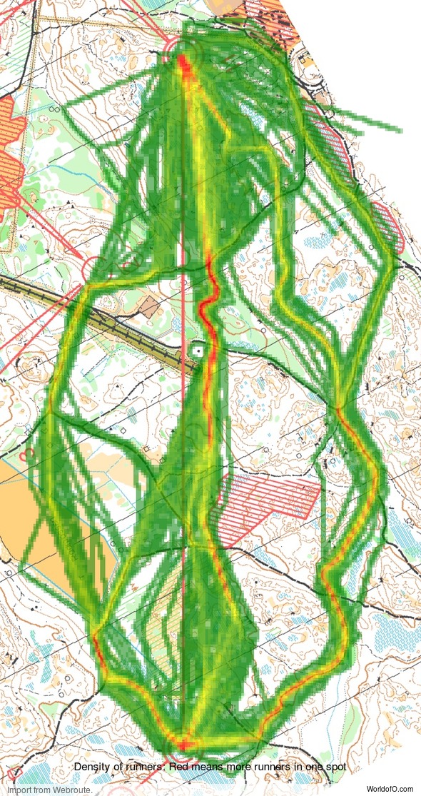
See below for a density map of some of the ones who have drawn their routes so far (available during the day when some readers have drawn their route).
Additional information
You find the complete map in omaps.worldofo.com at this location.
Route to O-Season 2020 series
Route Choice Challenges while waiting for the real action: With the upcoming orienteering season indefinitely on hold in large parts of the the world due to COVID-19, regular orienteering route choice challenges may be one way to make sure those orienteering skills don’t get completely rusty. I’ll try to keep these coming daily, but need help from all of you out there to keep them coming and to keep up a certain quality.
Tips on good route choice challenges – either from races/trainings (even cancelled ones) or theoretical ones with accompanying analysis – are very welcome (please e-mail to jan@kocbach.net).
Not all legs are taken for the interesting routechoice alternatives – some are also taken because the map is interesting – or because it is not straightforward to see what to do on a certain leg. Any comments are welcome – especially if you ran the event chosen for todays leg!
 World of O News
