World of O News
Today’s leg in Route to Christmas 2025 is a leg from a night orienteering competition in pretty tricky terrain – here you really have to focus. The leg is from the Norwegian Championships Night Orienteering.
Thanks a lot to Halvor for suggestion this course as a candidate for Course of the Year 2025 – that’s how I stumbled over this very nice leg.
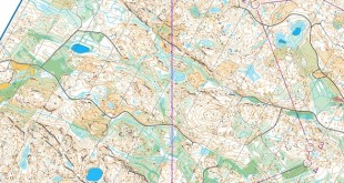
The leg is as usually first provided without routes – you may take a look at it and think about how you would attack this leg (if the image is too small, you may click on it to get it larger). Feel free to treat the leg as a day orienteering leg – it surely is challenging enough at day-time as well. Here is the terrain description from the invitation: The terrain we offer in Høvåg is one of the finest areas for orienteering in Southern Norway, featuring runnable ground and varied, technically demanding orienteering. Light to moderate undulation. The terrain is technically varied and mostly offers good runnability and visibility, but runners will also encounter sections with denser vegetation. Some parts of the terrain have somewhat reduced passability due to cliffs and rock details.
![]()
Location
You find other maps from the area in omaps.worldofo.com here. See also latest additions in 3DRerun from this area in order to learn more about this terrain type.
Webroute
Next you can draw your own route using the ‘Webroute’ below. Think through how you would attack this leg, and draw the route you would have made. Some comments about why you would choose a certain route are always nice for the other readers.
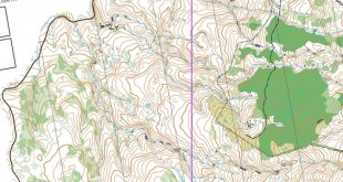
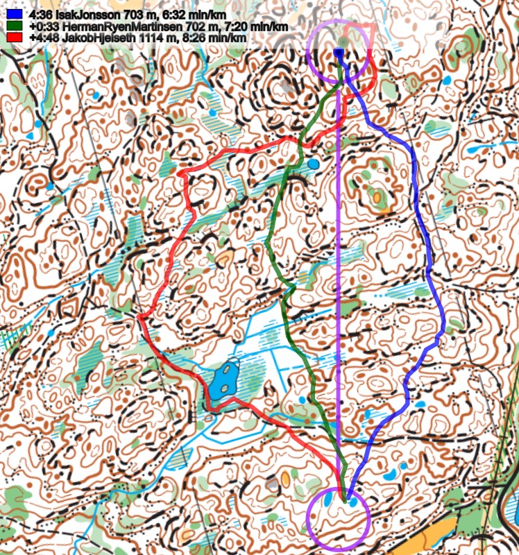
Then you can take a look at how the runners have solved this leg below. The routes are colored according to fastest split time on the leg, with the fastest routes in green and the slowest in red. As you can see, this leg offered the runners a lot of challenges! For a night orienteering race, I would definitely run to the right, be very careful to really find the small path, and then exploit the path to reduce the risk for mistakes, and also to get the opportunity to take a bit of a mental rest (although that is dangerous). It seems like most of the runners who found the small path managed quite well on this leg. But even in daytime taking the path is probably the best option, due to some very slow parts on the more direct/left alternatives as you can see in the pace plots further down in the analysis.
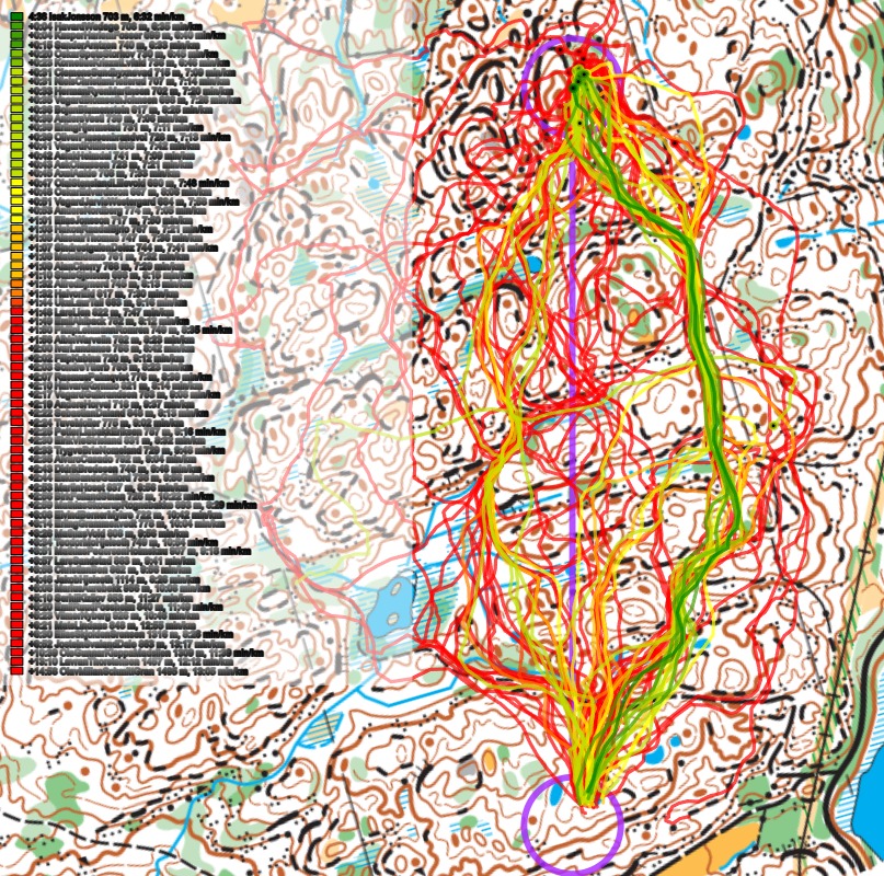
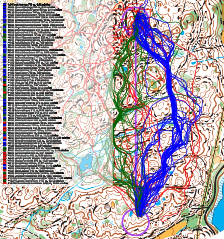
Below the routes are colored according to variant to give a clearer view of the how many runners chose each variant. As you can see the 8 fastest routes were run to the right.
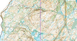
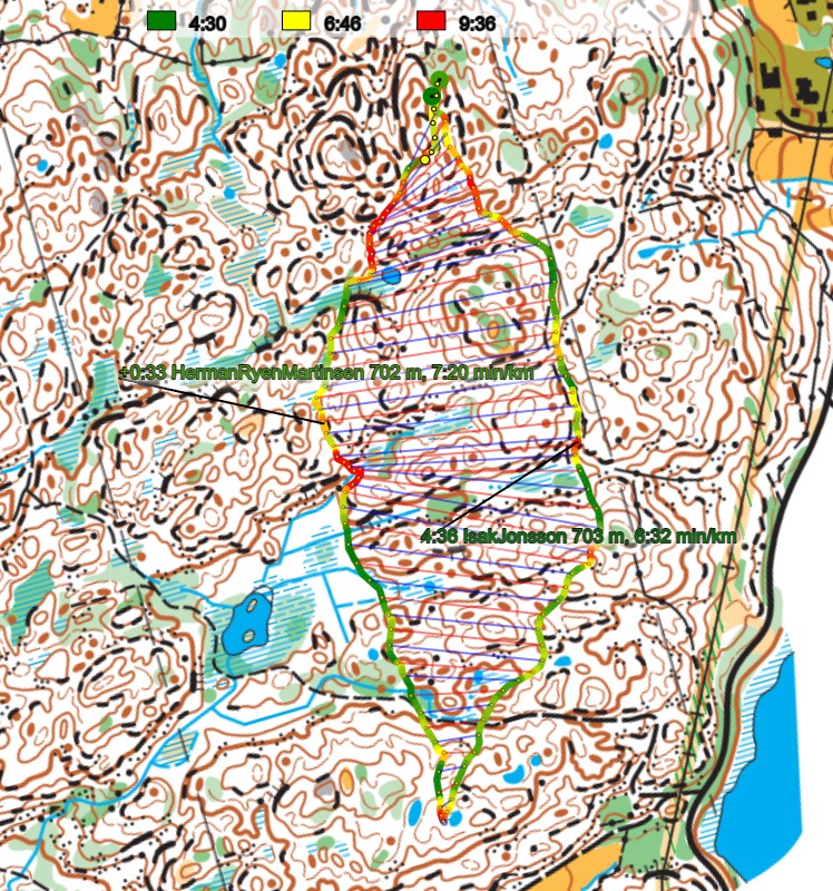
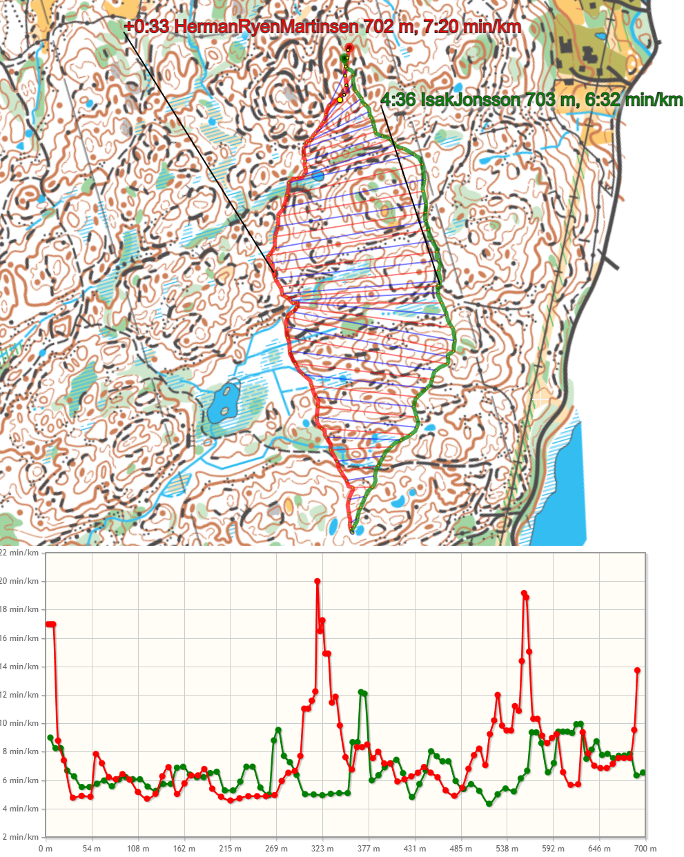
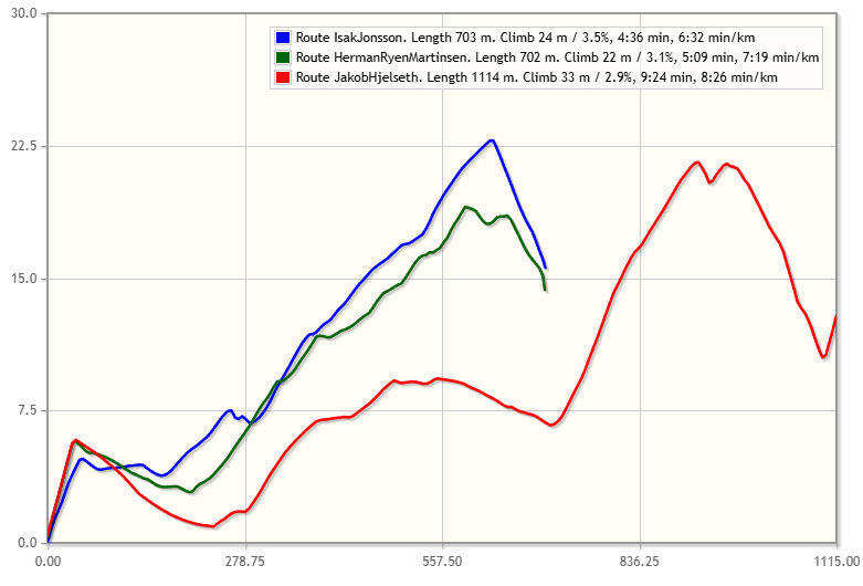
Looking at the pace-colored plot of the two main alternatives below – and also the pace graph below, you can see clearly how there are two areas (approximately halfways on the leg and approximately 3/4 along the leg) where you move slowly due to the terrain.
Below an elevation plot for the three main alternatives is provided as well – note that right actually has some additional ascent.
Density map
See below for a density map of some of the ones who have drawn their routes so far (available during the day when some readers have drawn their route).
![]()
Additional information
You find the complete map in omaps.worldofo.com at this location.
Route to Christmas series
The Route to Christmas series is a pre-Christmas tradition at World of O – giving the readers the opportunity to do one Route Choice Challenge each day from December 1st until December 24th. If you have got any good legs in GPSSeuranta, 3DRerun, Loggator or Livelox from 2025-competitions, or old forgotten ones which are still interesting, please email me the link at Jan@Kocbach.net, and I’ll consider including it in Route to Christmas if it looks good. Route to Christmas gets interesting due to YOUR contribute!
Not all legs are taken for the interesting routechoice alternatives – some are also taken because the map is interesting – or because it is not straightforward to see what to do on a certain leg. Any comments are welcome – especially if you ran the event chosen for todays leg!