World of O News
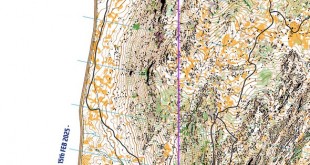
Today’s leg in Route to Christmas 2025 is from a really cool terrain in southern France. Looking at the map you get the feeling that this is an artifically generated map for theoretical route choice training, but this terrain and leg was actually used for second stage of the Provence Orienteering Meeting last February.
Thanks a lot to Eva Jurenikova for the tip! The terrain description does not tell too much about the challenges ahead: – Mediterranean forest with numerous gullies, steep slopes and cliffs. But there is at least a warning about the dangers out here: Be careful – don’t approach the edge of high cliffs.
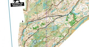
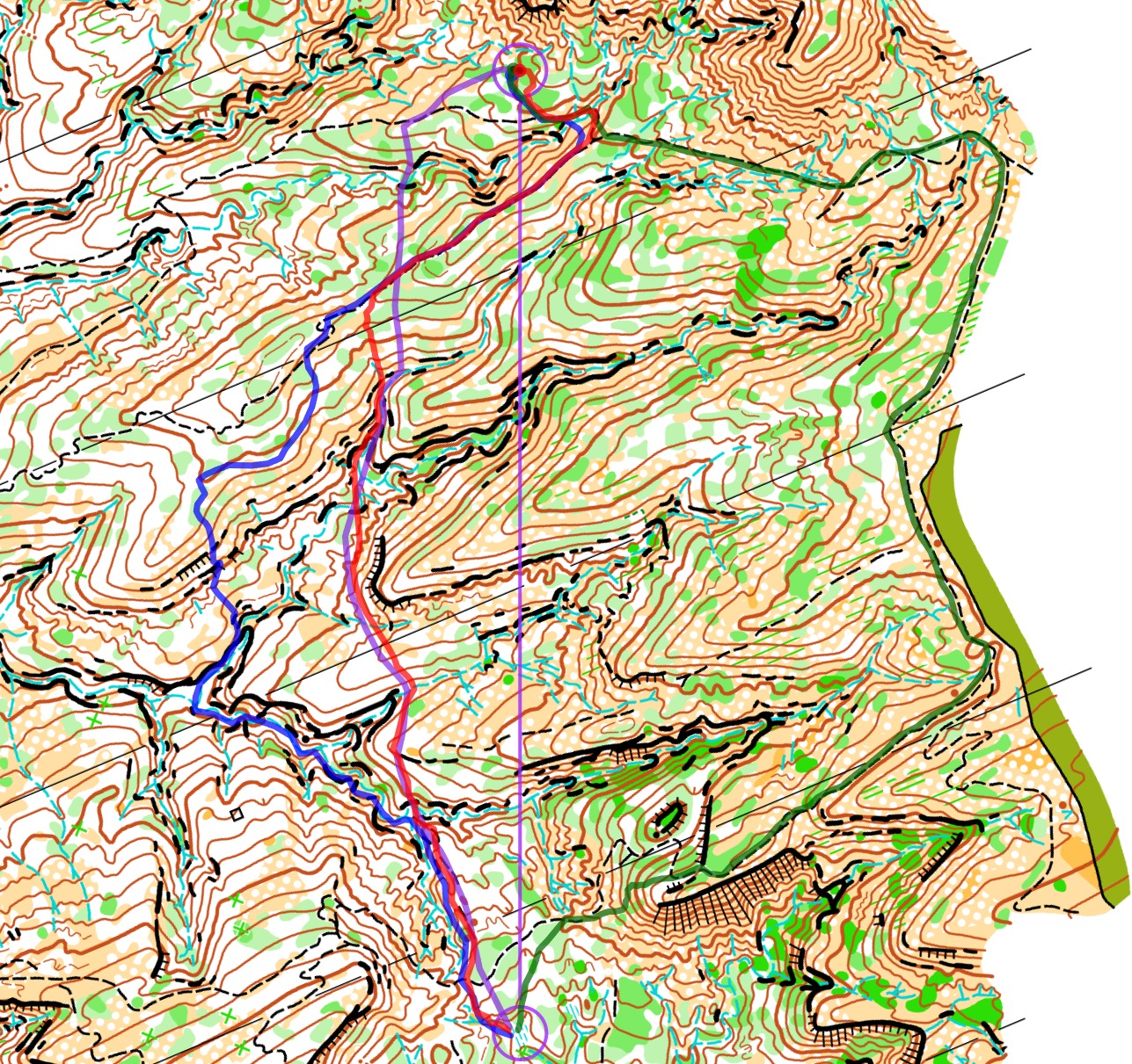
With that it is up to you! The leg is as usually first provided without routes – you may take a look at it and think about how you would attack this leg (if the image is too small, you may click on it to get it larger). Note that both the men and women’s main courses ran this leg, and both are included in the analysis below.
![]()
Location
You find other maps from the area in omaps.worldofo.com here. See also latest additions in 3DRerun from this area in order to learn more about this terrain type.
Webroute
Next you can draw your own route using the ‘Webroute’ below. Think through how you would attack this leg, and draw the route you would have made. Some comments about why you would choose a certain route are always nice for the other readers.
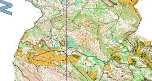
Then you can take a look at how the runners have solved this leg below – starting with the men. The routes are colored according to fastest split time on the leg, with the fastest routes in green and the slowest in red. As you can see, the fastest routes are run to the left (the same is the case for the women further down), but time differences are generally not that big. Running left is surely more challenging technically, mentally and physically, but right is longer 4-600 meters longer – and with approximately the same amount of climb left is probably the best choice for top orienteers while many would benefit from running to the right. Please add a comment below if you have additional thoughts about this leg.
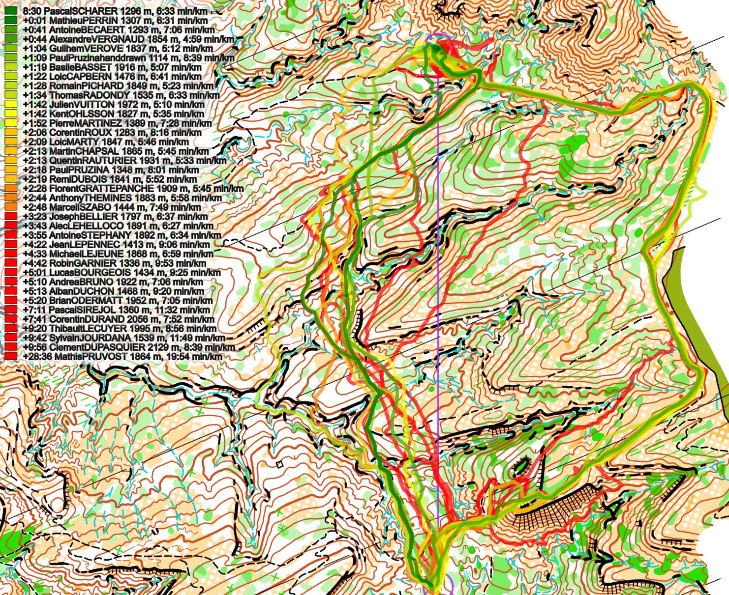
Below the routes are colored according to variant to give a clearer view of the how many runners chose each variant. As you can see the three fastest routes are run to the left, the next two to the right.
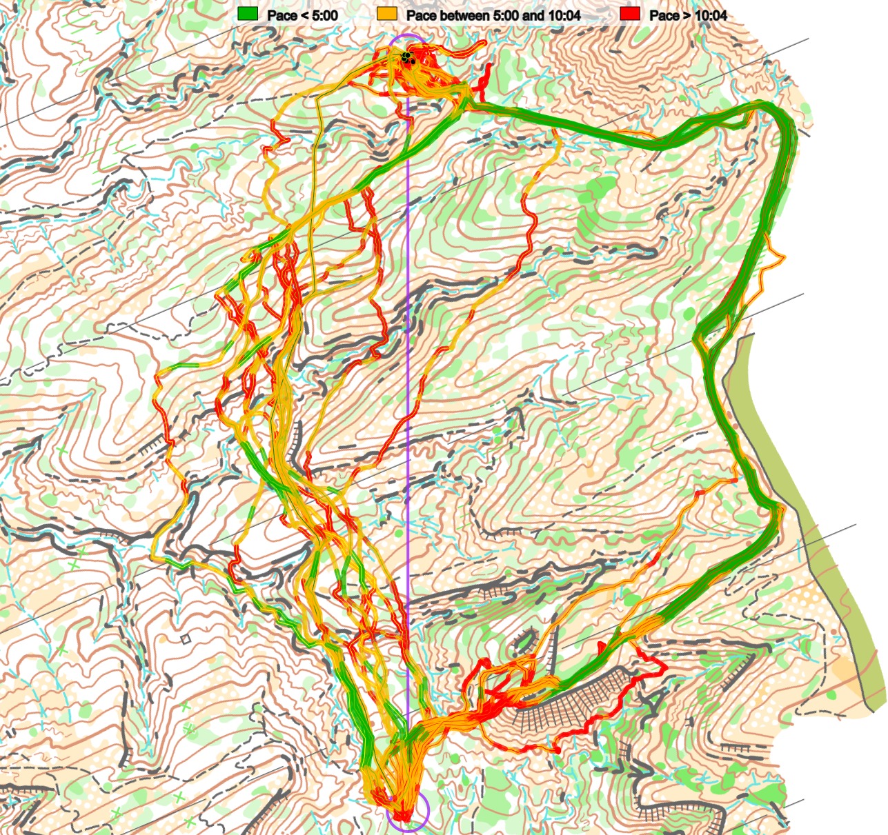
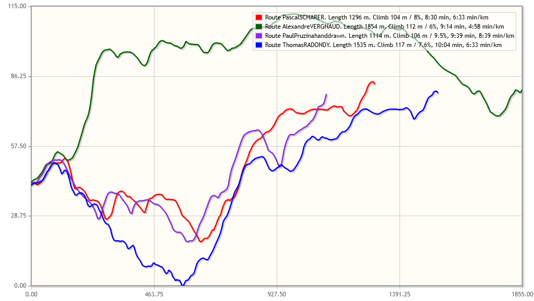
Looking at the pace you can clearly see how you can run quite fast for most of the leg on the variant to the right, but you of course need to take the steep climb first.
Here is also a coarse overview of the elevation profile of the four different alternatives:
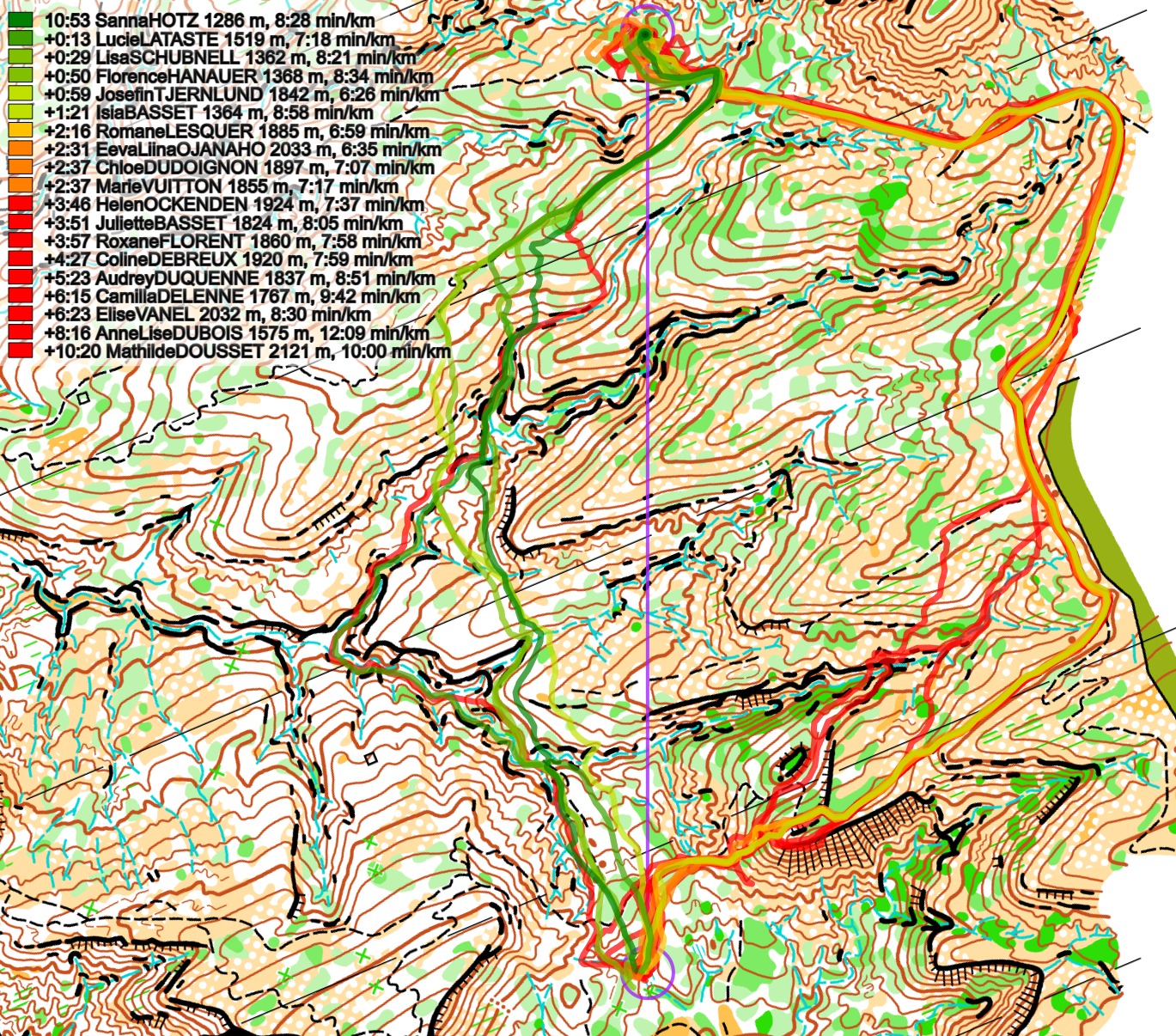
Finally we have the corresponding analysis for the women. Here we can see that 5 of the 6 fastest runners on the leg ran to the left, and these were also towards the top of the results in the end. Of the Top 6 overall, only Josefine Tjernlund ran to the right (3rd overall), so this is a clear sign that the top runners chose variants to the left while the overall slower runner took the route to the right.
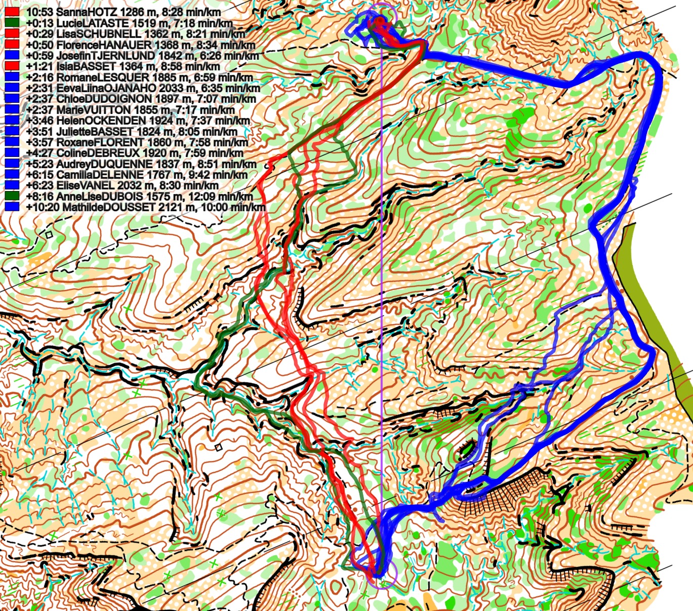
Density map
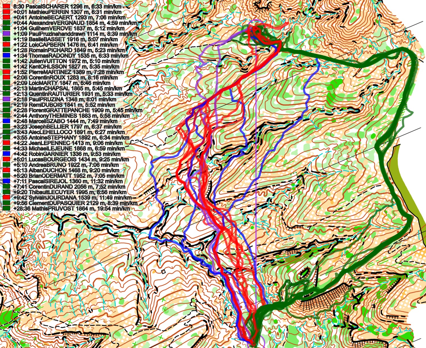
See below for a density map of some of the ones who have drawn their routes so far (available during the day when some readers have drawn their route).
![]()
Additional information
You find the complete map in omaps.worldofo.com at this location.
Route to Christmas series
The Route to Christmas series is a pre-Christmas tradition at World of O – giving the readers the opportunity to do one Route Choice Challenge each day from December 1st until December 24th. If you have got any good legs in GPSSeuranta, 3DRerun, Loggator or Livelox from 2025-competitions, or old forgotten ones which are still interesting, please email me the link at Jan@Kocbach.net, and I’ll consider including it in Route to Christmas if it looks good. Route to Christmas gets interesting due to YOUR contribute!
Not all legs are taken for the interesting routechoice alternatives – some are also taken because the map is interesting – or because it is not straightforward to see what to do on a certain leg. Any comments are welcome – especially if you ran the event chosen for todays leg!