World of O News
Today we travel to Kongsberg, Norway – to a long and interesting leg from the last day of the traditional Kongsberg Pinseløpet. The leg we focus on in today’s Route to Christmas is leg 3 in the H40 course. Thanks to Terje Mathisen for the tip.
As a bonus for today, we have got an analysis of the leg by former WOC bronze medalist Kjetil Bjørlo, who is one of the runners who has drawn his route for this particular leg. Thanks a lot to Kjetil for the analysis.
If Kongsberg sounds familiar to some of you, the Kongsberg area was also the venue for the World Orienteering Championships in 1978 and CISM 2010.
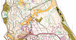
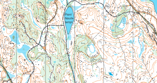
The leg without routes
The leg is as usually first provided without routes – you may take a look at it and think about how you would attack this leg (if the image is too small, you may click on it to get it larger). When drawing your route, take note of the fact that this was a very wet day with wet marshes.
![]()
Webroute
Next you can draw your own route using the ‘Webroute’ below. Think through how you would attack this leg, and draw the route you would have made. Some comments about why you would choose a certain route are always nice for the other readers.
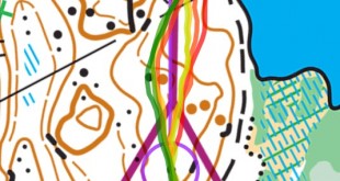
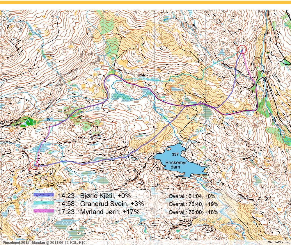
Then you can take a look at how the runners who have drawn their route choice solved this leg. Today’s analysis:
– Normally the Kongsberg-terrain is very fast and a terrain you never loose much time going straight ”on the line”. This of course, if you have enough power in your legs ;-). I guess I overestimated my strength when I chose to go straight south of the big hill and west of the ”Briskemyr dam”. It was quite wet in the marshes which brought me to the felled area. The felled area also had a bit tougher ground than I hoped. When I reached the road, I did my second route choice mistake, not continuing further along the road approaching the control from south east. The best route choice, in my opinion, is to run the left route choice along the path/road, go left 200 m east of the road bend and use the path in the felled area, approaching the control from southwest, like Svein Granerud (light blue line) did.
Complete map in Omaps.worldofo.com
You find the complete map and Routegadget info in omaps.worldofo.com at this location.
Omaps.worldofo.com
The ‘Route to Christmas’ series at World of O has been very popular the last years – and I’ve therefore decided to continue the series this Christmas as well. If you have got any good legs in RouteGadget from 2011-competitions – or old forgotten ones which are still interesting – please email me the link at Jan@Kocbach.net, and I’ll include it in Route to Christmas if it looks good. Route to Christmas will not be interesting if YOU don’t contribute.
There will be no analysis about the best routechoice for each leg – you can provide that yourself in the comments or in the Webroute. Not all legs are taken for the interesting routechoice alternatives – some are also taken because the map is interesting – or because it is not straightforward to see what to do on a certain leg. Any comments are welcome – especially if you ran the event chosen for todays leg!
Note that there may be some errors in the Routegadget data (sometimes somebody draws a route for another runner just for fun). Please add a comment below if you spot en error.