– One of my nicest training ever, Thierry Gueorgiou wrote about his training on the Cap de l’Aljub map last January. – Super precise with all the single vegetation details – amazing, he continued about the map which is one of the embargoed areas for this years World Orienteering University Championships (WUOC) which starts on Tuesday near Alicante.
The WUOC starts with a hilly long distance on Tuesday – and continues with sprint on Wednesday, middle on Thursday and finished off with a relay on Friday.
WUOC: One step towards the top
The WUOC has traditionally been a popular way to get championships experience for orienteers – many great orienteering names have had the university championships as one step on their ladder towards the top. In 2010 Swedish sprint star Jerker Lysell won the sprint ahead of Scott Fraser – EOC 2012 sprint medalist Kyril Nikolov finishing 5th – while Amalie Chataing took the women’s sprint. WOC long favourite Mattias Merz took both the long and the middle distance back in 2010 – while Sara Lüscher and Radka Brozkova took the titles in long and middle for the women. Fabian Hertner, Fredric Tranchand, Francois Gonon, Dana Brozkova, Carl Waaler Kaas and Philippe Adamski are other top names who have run WUOC in recent years.
Maps and terrain 2012

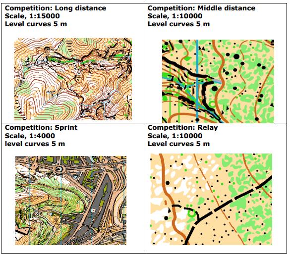
The map above is Adam Chromy’s map from the model event from WUOC 2012. The terrain varies from big hills to areas with a lot of small contour details. The long distance terrain hilly terrain with a height difference o f320 – 590 meters above sea level – the area being crossed by ravines -impassable in some cases. The middle and relay terrain is described as having height difference of between 20 and 90 meters with lots of small contour details and a presence of a large number of stones and rocks.

 World of O News


