World of O News
Todays Route to Christmas travels to Germany – to the German Championships Ultralong at April 21st! As it is a rainy(?) Saturday today, I have prepared two long legs for you with the help of course setter Bjarne Friedrichs.
– It was a great challenge to do the mapping and course setting for the German Champs in Ultralong Orienteering right behind my home in a forest where I had already trained hundreds of kilometers, Bjarne explains in an e-mail.
– Although it is not the most technical forest (unfortunately), this was quite a different perspective than running through the terrain. Anyway, I wanted to set courses that were as challenging as possible – physically and mentally. This resulted n 20.1 km with 1080 meters of climb and 35 controls in the men’s category. With this information in mind: Have a lot of fun with the two longest legs of the course!
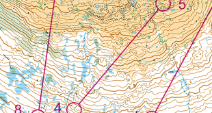
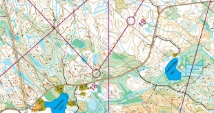
We take one leg at a time. The first leg we consider is the shortest leg – the leg to control number 22. The leg is as usually first provided without routes – you may take a look at it and think about how you would attack this leg (if the image is too small, you may click on it to get it larger):
![]()
Location
You find other maps from the area in omaps.worldofo.com here. See also latest additions in 3DRerun from this area in order to learn more about this terrain type.
Webroute
Next you can draw your own route using the ‘Webroute’ below. Think through how you would attack this leg, and draw the route you would have made. Some comments about why you would choose a certain route are always nice for the other readers.
Then you can take a look at how the runners who have drawn their route choice solved this leg below.
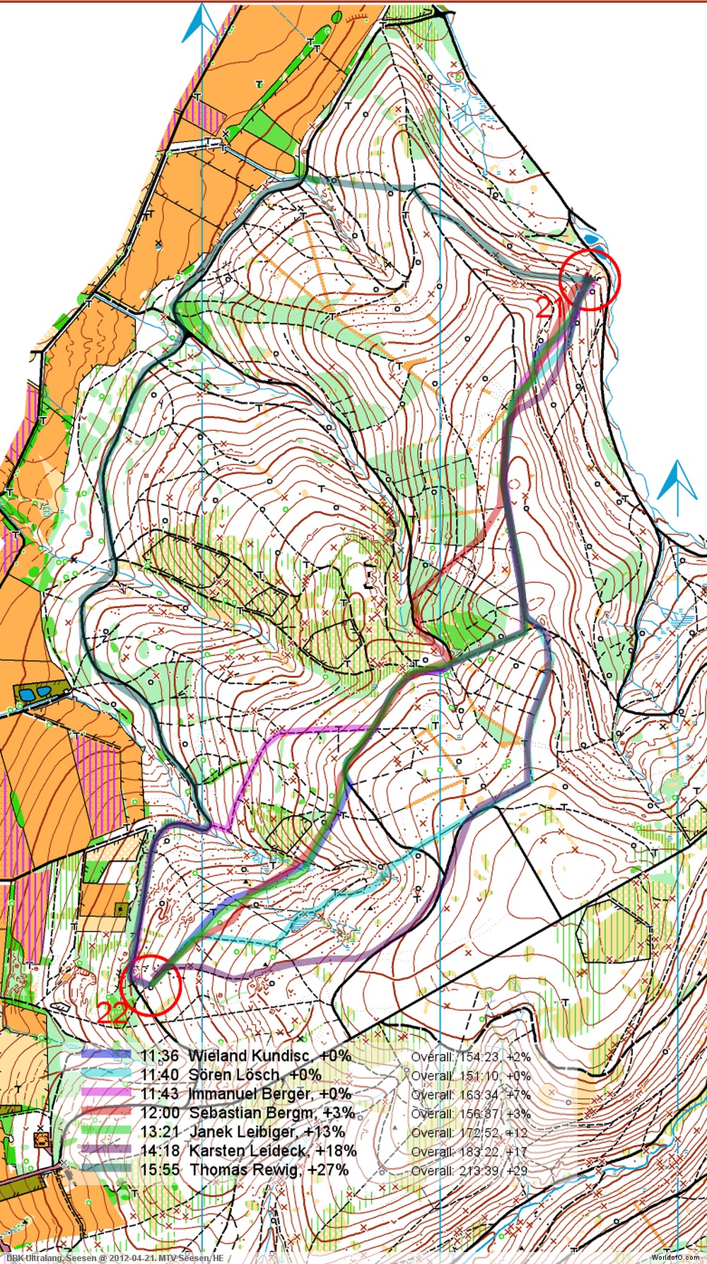
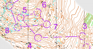
Second leg: Leg 18
The second leg we consider is a lot longer – but with some of the same choices to be made. Now you have some knowledge of the terrain after looking at what runners did on the “short” leg. See below for the analysis from Bjarne for both legs together,.
![]()
Location
You find other maps from the area in omaps.worldofo.com here. See also latest additions in 3DRerun from this area in order to learn more about this terrain type.
Webroute
Next you can draw your own route using the ‘Webroute’ below. Think through how you would attack this leg, and draw the route you would have made. Some comments about why you would choose a certain route are always nice for the other readers.
Then you can take a look at how the runners who have drawn their route choice solved this leg below.

Comments
– Now that you have chosen your routes (hopefully…), let me tell you that all possible routes have nearly the same amount of climb, Bjarne writes about the routes.
– So taking the legs isolated, it should always be the fastest choice to run straight. But in a 2.5 hours race, saving energy is a very important aspect as well. Therefore I would have taken some extra meters and stayed on the western roads at least on leg 18 (like Wieland Kundisch did), which is not slower according to my test runs. Maybe because of the mass start format, most of the runners did not do so. I am really wondering about this as I know all those hills, and how much it can hurt to climb them…
Regarding the long leg to number 22 – the conclusion is somewhat different.
– Leg 22 is slightly different as the way around is quite long, so here I guess straight is the best option.
Have you got any comments to these legs?
Additional information
You find the complete map in omaps.worldofo.com at this location.
Route to Christmas series
The ‘Route to Christmas’ series at World of O has been very popular the last years – and I have therefore decided to continue the series this Christmas as well. If you have got any good legs in RouteGadget, GPSSeuranta or 3DRerun from 2012-competitions – or old forgotten ones which are still interesting – please email me the link at Jan@Kocbach.net, and I’ll include it in Route to Christmas if it looks good. Route to Christmas will not be interesting if YOU don’t contribute.
Not all legs are taken for the interesting routechoice alternatives – some are also taken because the map is interesting – or because it is not straightforward to see what to do on a certain leg. Any comments are welcome – especially if you ran the event chosen for todays leg!
Note that there may be some errors in the Routegadget data (sometimes somebody draws a route for another runner just for fun). Please add a comment below if you spot en error.