 World of O News
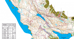
Today we travel all the way to USA to a nice, long leg in the US Championships Ultralong which was organized less than a month ago close to Washington. The area for the first part of the course were we found today’s leg has never been used for orienteering before. The chosen leg is the 10th leg in the blue course (M21) and 9th leg in the red course (W21 / M40).
Thanks a lot to “colorconverter” for the tip! Thanks also to Lacho Iliev/Loggator who provided GPS-tracking of some of the runners – giving us some interesting data for analysis. About the race, Lacho writes: – The course was really nice. I talked to the course setter and he said that he spent lots of time to prepare a good ultra-long course. Note also that the area until the men’s 10th control (today’s Route to Christmas) has never been used for an o-event before.
The leg is as usually first provided without routes – you may take a look at it and think about how you would attack this leg (if the image is too small, you may click on it to get it larger):
![]()
Location
You find other maps from the area in omaps.worldofo.com here. See also latest additions in 3DRerun from this area in order to learn more about this terrain type.
Webroute
Next you can draw your own route using the ‘Webroute’ below. Think through how you would attack this leg, and draw the route you would have made. Some comments about why you would choose a certain route are always nice for the other readers.
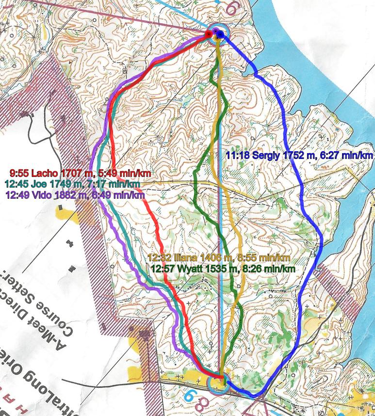
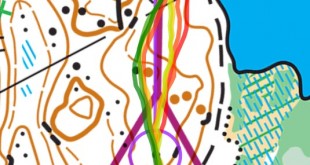
Then you can take a look at how the runners have solved this leg below. We have GPS-data for some runners from different classes – so the speed of the runners is not 100% comparable. Lacho (M21) is the winner of the longest (blue) course. Sergiy (M40) is the winner of the red course. Iliana was second on red course and first on W21. Joe is the winner of M45. Lacho writes in his e-mail about the race that “- Sergiy is a fast guy but still I think I am about 30 sec per km faster than him on the race”.
Lacho describes the leg as follows:
– My tactic [overall for the race] was to run with a steady pace and almost straight with a little bit to the left or to the right. But for this leg – 9 to 10 – I decided that straight will not be the perfect route choice. My first intention was to run to the right with almost half of the leg on a path, but I had lots of time to count the contour lines and evaluate the left route choice. Maybe if the organizers did a map change on control 9 (there was a refreshment point) then it might have been more difficult to find the best route choice immediately. On the left route choice there are only 6 contours to climb. And on the right one there are at least 9. Distance wise the left route is about 1.7 km and 50 meters shorter than the right one.
Some additional analysis: It is interesting to note that Sergiy seems to loose a lot of time when going down the steep hill at the end of the leg – and crossing the lake in the small bay – maybe even swimming? But the alternative for Sergiy – going more to the left – would have cost some more meters of climb and is maybe not better that either.
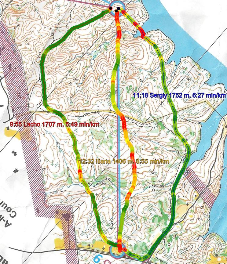
Density map
See below for a density map of some of the ones who have drawn their routes so far.

Additional information
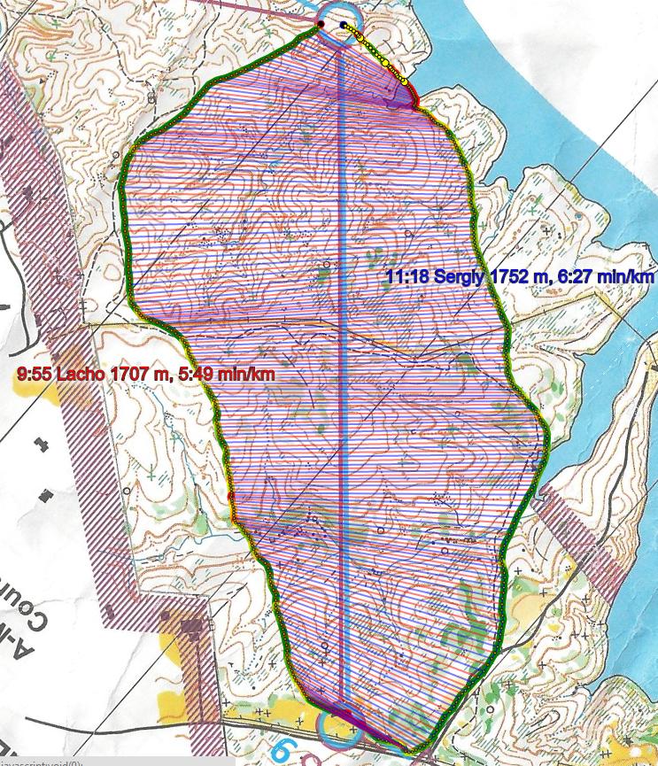
You find the complete map in omaps.worldofo.com at this location.
Route to Christmas series
The Route to Christmas series at World of O has been very popular the last years – and I have therefore decided to continue the series this Christmas as well. If you have got any good legs in RouteGadget, GPSSeuranta or 3DRerun from 2014-competitions – or old forgotten ones which are still interesting – please email me the link at Jan@Kocbach.net, and I’ll include it in Route to Christmas if it looks good. Route to Christmas will not be interesting if YOU don’t contribute.
Not all legs are taken for the interesting routechoice alternatives – some are also taken because the map is interesting – or because it is not straightforward to see what to do on a certain leg. Any comments are welcome – especially if you ran the event chosen for todays leg!
Note that there may be some errors in the Routegadget data (sometimes somebody draws a route for another runner just for fun). Please add a comment below if you spot en error.
What sort of forest is this? Just trying to work out how the paths could be so much faster than the forest. The climb on the direct route is not huge…
I preferred the set-up with the names and times at the bottom of the image with the leg. There was space for percentage behind on total and overall in the race. I think that is important. Sometimes the competitor taking one route is slower, so we think the route is slower, but that could be the competitors ability and we don’t see that in the pictures above like before.
@lorrieq: That setup is based on actual results in RouteGadget. For this specific case it would have been impossible anyway since these runners run different courses, and the overall time does not give any meaning. The same for the Day 11. But generally, all the routes from this year have been based on GPSSeuranta/2DRerun, and then there is no info in there about total results => this info is not available. Yes, it is nice info, but not so easy to include when people have stopped drawing their routes in RouteGadget…