The first day of Route to Christmas 2015 takes us to Czech Republic – and to guide us towards the challenges to be met at the European Championships in Czech Republic 2015, we have one of the best Czech orienteers Jan Prochazka.
This leg is one of the best examples on the way towards EOC 2016
In some days of the 2015-edition of Route to Christmas, some of the top elite runners will guide us through a leg which they find especially interesting in the 2015 season. Today’s leg in Route to Christmas is leg 16 in the M21 course from the Czech Champs, organized at September 27th 2015. This is not a very long and complex leg, but the analysis will give you some interesting insight into how to choose your route in this kind of terrain.
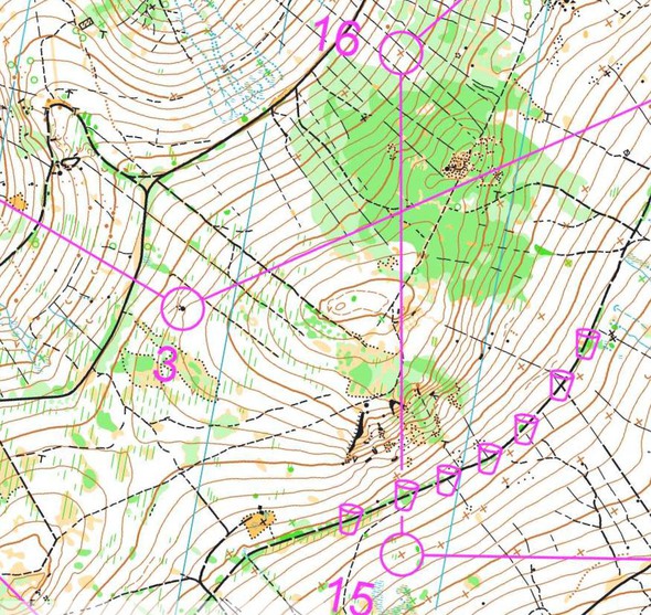
The leg is as usually first provided without routes – you may take a look at it and think about how you would attack this leg (if the image is too small, you may click on it to get it larger):
Jan Prochazka gives us the introduction to the leg:
As I am looking to the future, this leg is one of the best examples on the way towards EOC 2016. I have chosen one leg from the Czech long distance Champs 2015. There were about 3-5 interesting legs, but this one I did extremely well, and I was even surprised by the margin to the second best time. The terrain of Czech long distance 2015 was similar to EOC 2016 long. However, this terrain is situated on other side of the Jeseniky mountains and have in overall higher altitude. This leg comes up after 70 minutes of running, and its highest parts are over 1000 meters above see level – a last physically challenging leg of the course.
Location
You find other maps from the area in omaps.worldofo.com here. See also latest additions in 3DRerun from this area in order to learn more about this terrain type.
Webroute
Next you can draw your own route using the ‘Webroute’ below. Think through how you would attack this leg, and draw the route you would have made. Some comments about why you would choose a certain route are always nice for the other readers.
Then you can take a look at how the runners have solved this leg below. But first some analysis from Prochazka:
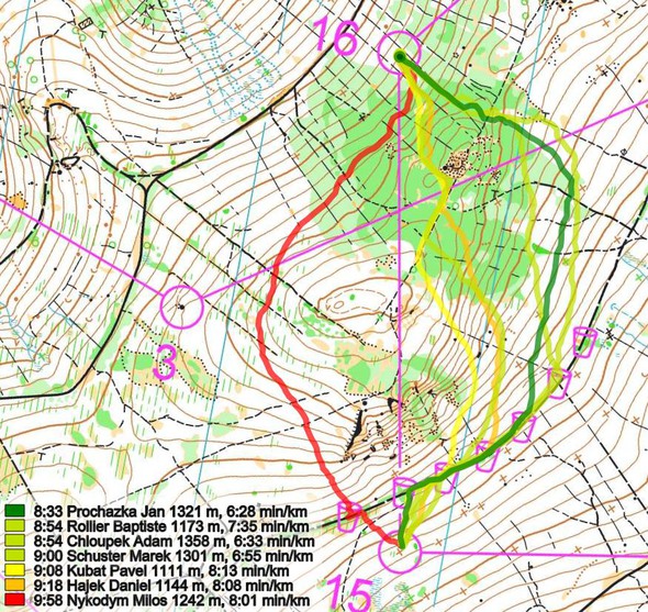
– Even if I knew this is the last physically difficult leg, and that I can push up to the limit, I chose to run a bit around to right. The reason was that going straight means to run over the highest parts of terrain with extra blueberries and through mountain surface. Especially green in those high parts might be extremely slow.
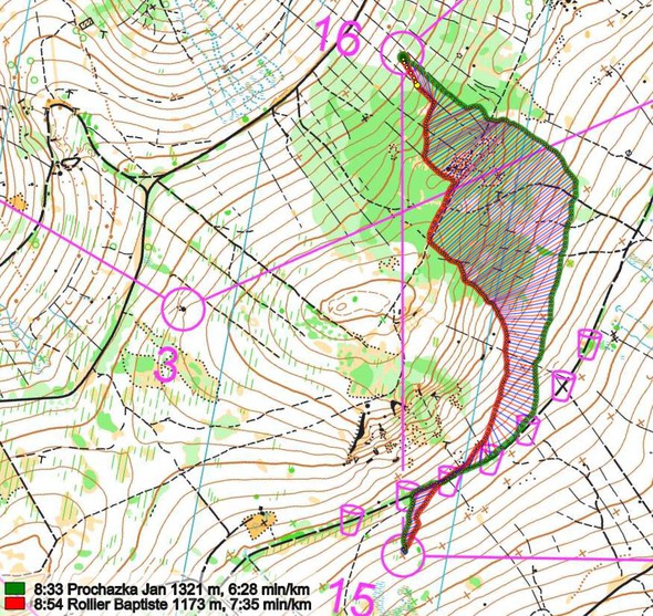
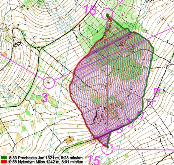
The other runners did not climb the hill straight, but took the other options. However, they step into the green earlier and lose significantly time in there. Second best time achieve together future winner Baptiste Rollier and Adam Chloupek. Adam chose the same option as me. This clearly shows the importance of avoiding the green area of the upper parts in this terrain. Milos Nykodym was the only one choosing the left option, but he was already physically too weak due to sickness so we do not have a real comparison in there.
Thanks a lot for Jan Prochazka for taking the challenge and suggesting HIS leg for Route to Christmas 2015!
Density map
See below for a density map of some of the ones who have drawn their routes so far.
Additional information
You find the complete map in omaps.worldofo.com at this location.
Route to Christmas series
The Route to Christmas series at World of O has been very popular the last years – giving the readers the opportunity to do one Route Choice Challenge each day from December 1st until December 24th. If you have got any good legs in RouteGadget, GPSSeuranta or 3DRerun from 2015-competitions – or old forgotten ones which are still interesting – please email me the link at Jan@Kocbach.net, and I’ll include it in Route to Christmas if it looks good. Route to Christmas will not be interesting if YOU don’t contribute.
Not all legs are taken for the interesting routechoice alternatives – some are also taken because the map is interesting – or because it is not straightforward to see what to do on a certain leg. Any comments are welcome – especially if you ran the event chosen for todays leg!
 World of O News


What’s the meaning of the black “long dash” lines running down the fall line, in parallel, near CP 16?
How are they different from black “short dash” lines indicating trails?
That’s the “ride” symbol. Picture a forest that had a strip cleared for logging at some time – not a trail any longer, but distinct and possible quite runnable versus dodging trees in regular forest.
http://orienteering.org/wp-content/uploads/2010/12/International-Specification-for-Orienteering-Maps-2000.pdf
Density map?
Added now, thanks for reminder!