 World of O News
Today’s leg in Route to Christmas is from Norwegian Championships Ultralong 2015 – the 5th leg in the H21E course .
[Did you vote for Course of the Year 2015 yet? More than 2.500 Euro prizes for voters – vote here!]
The Norwegian Championships Ultralong has often been stages in wilderness in the mountains with few paths and great views. This year the setting was differen, the race being organized near Hønefoss in eastern Norway. The runners did still get interesting challenges though. One factor making the route choices interesting is that the terrain is divided in two very different parts: One flat part with very good runnability and one hilly part in which the runnability varies. The chosen leg today takes you from the flat part to the hilly part – and the question is how direct to you dare to go?
The leg is as usually first provided without routes – you may take a look at it and think about how you would attack this leg (if the image is too small, you may click on it to get it larger):
![]()
Location
You find other maps from the area in omaps.worldofo.com here. See also latest additions in 3DRerun from this area in order to learn more about this terrain type.
Webroute
Next you can draw your own route using the ‘Webroute’ below. Think through how you would attack this leg, and draw the route you would have made. Some comments about why you would choose a certain route are always nice for the other readers.
Then you can take a look at how the runners have solved this leg below.
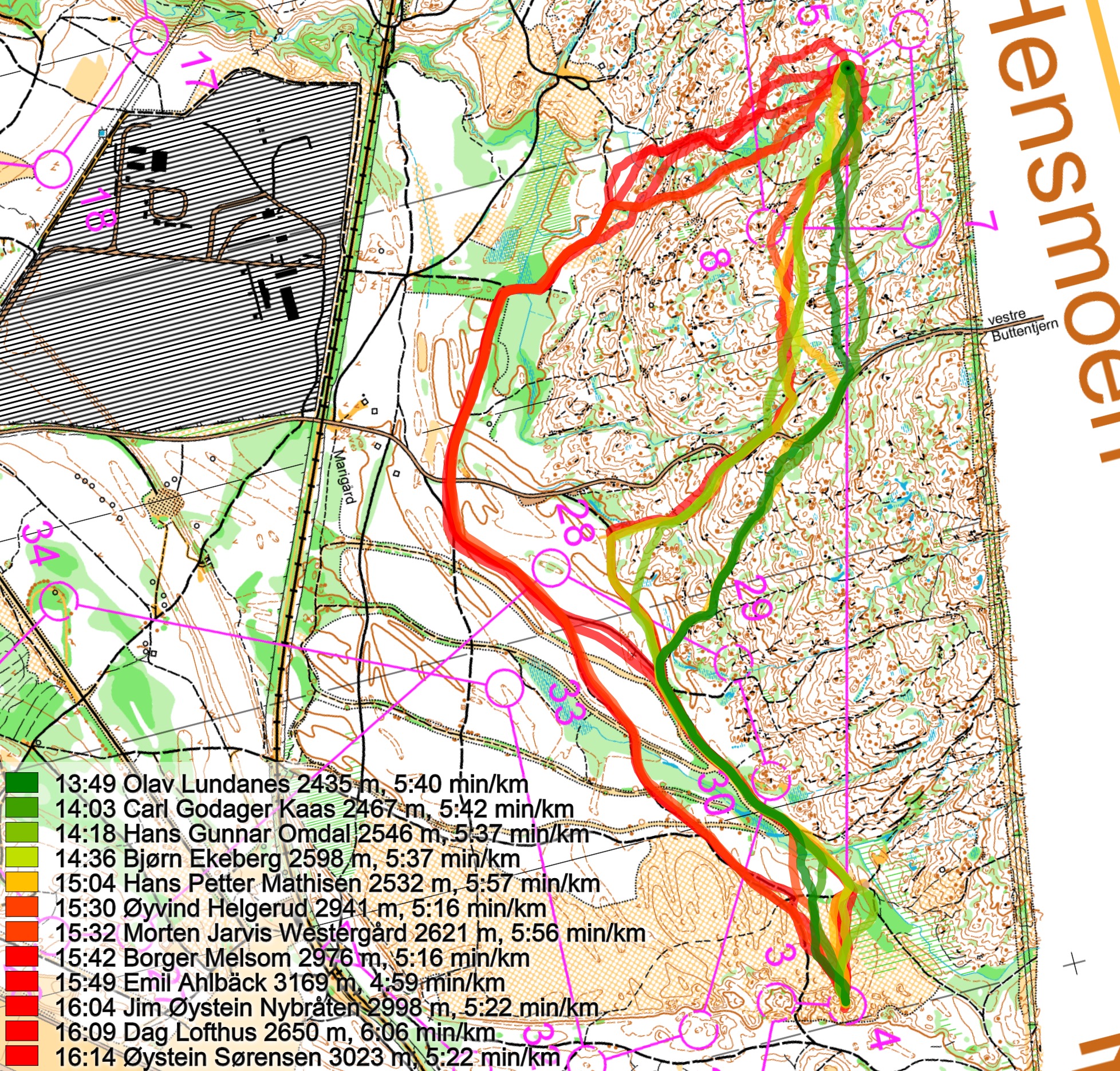
As you can see from the routechoice analysis, the more direct approach has clearly been run faster. On the other hand, it is also the best runners who took this choice; maybe the weaker runners want to save themselves for the long day ahead and take the route around to the left. For this leg isolated though, the left variant is probably a bit faster. The reason for this is that it is not that much terrain running on the direct variant – and you actually need to run a bit in the terrain also on the left variant. The below comparison shows which parts you need to slow down on both variants – the last uphill on the left variant is quite tough!
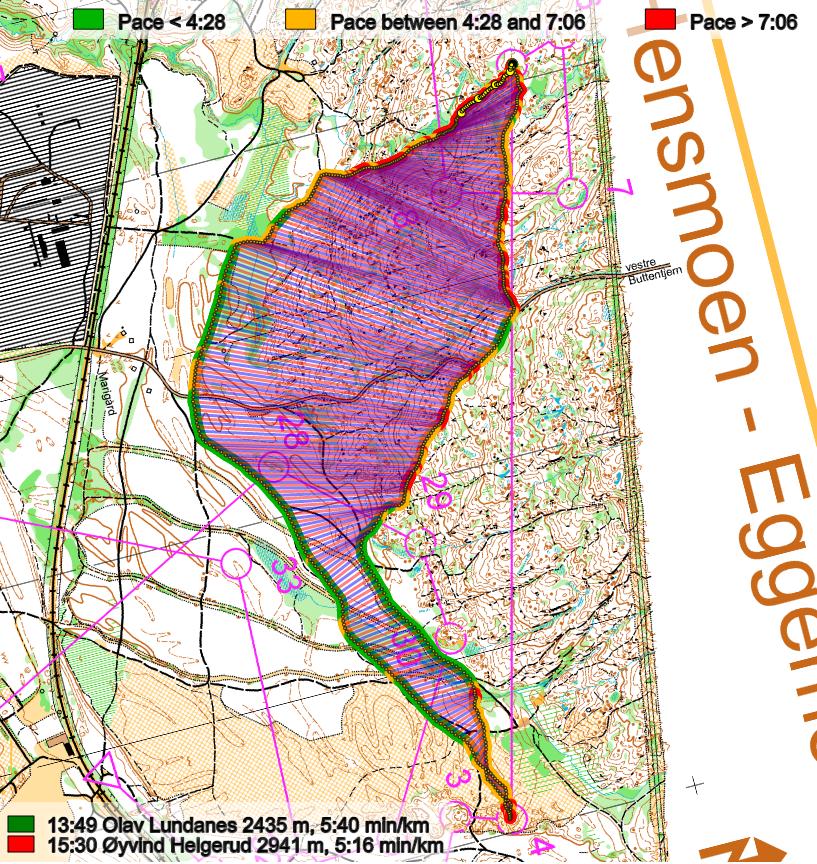
Density map
See below for a density map of some of the ones who have drawn their routes so far.

– The last uphill on the leftmost route is quite tough
Additional information
You find the complete map in omaps.worldofo.com at this location.
Route to Christmas series
The Route to Christmas series at World of O has been very popular the last years – giving the readers the opportunity to do one Route Choice Challenge each day from December 1st until December 24th. If you have got any good legs in RouteGadget, GPSSeuranta or 3DRerun from 2015-competitions – or old forgotten ones which are still interesting – please email me the link at Jan@Kocbach.net, and I’ll include it in Route to Christmas if it looks good. Route to Christmas will not be interesting if YOU don’t contribute.
Not all legs are taken for the interesting routechoice alternatives – some are also taken because the map is interesting – or because it is not straightforward to see what to do on a certain leg. Any comments are welcome – especially if you ran the event chosen for todays leg!


I take it the black lines along the far right of the map represent power lines?
Yes! Don’t think they are fast, though!