 World of O News
Today’s leg in Route to Christmas is a 2.7 km long leg in Finland – organized in the same terrain as the first World Orienteering Championships back in 1966. The event this time was the Finnish Championships Long distance, and the chosen leg is the 6th leg in the M21E course.
Thanks a lot to Teppo Salmia for suggestions for a variety of interesting legs from Finnish races in 2019; one of the races was the Finnish Championships Long (although the suggested leg was a different leg). This course has also been highlighted as one of the best orienteering courses in 2019, getting a 14th place in Course of the Year 2019.
The leg is as usually first provided without routes – you may take a look at it and think about how you would attack this leg (if the image is too small, you may click on it to get it larger):
![]()
Location
You find other maps from the area in omaps.worldofo.com here. See also latest additions in 3DRerun from this area in order to learn more about this terrain type.
Webroute
Next you can draw your own route using the ‘Webroute’ below. Think through how you would attack this leg, and draw the route you would have made. Some comments about why you would choose a certain route are always nice for the other readers.
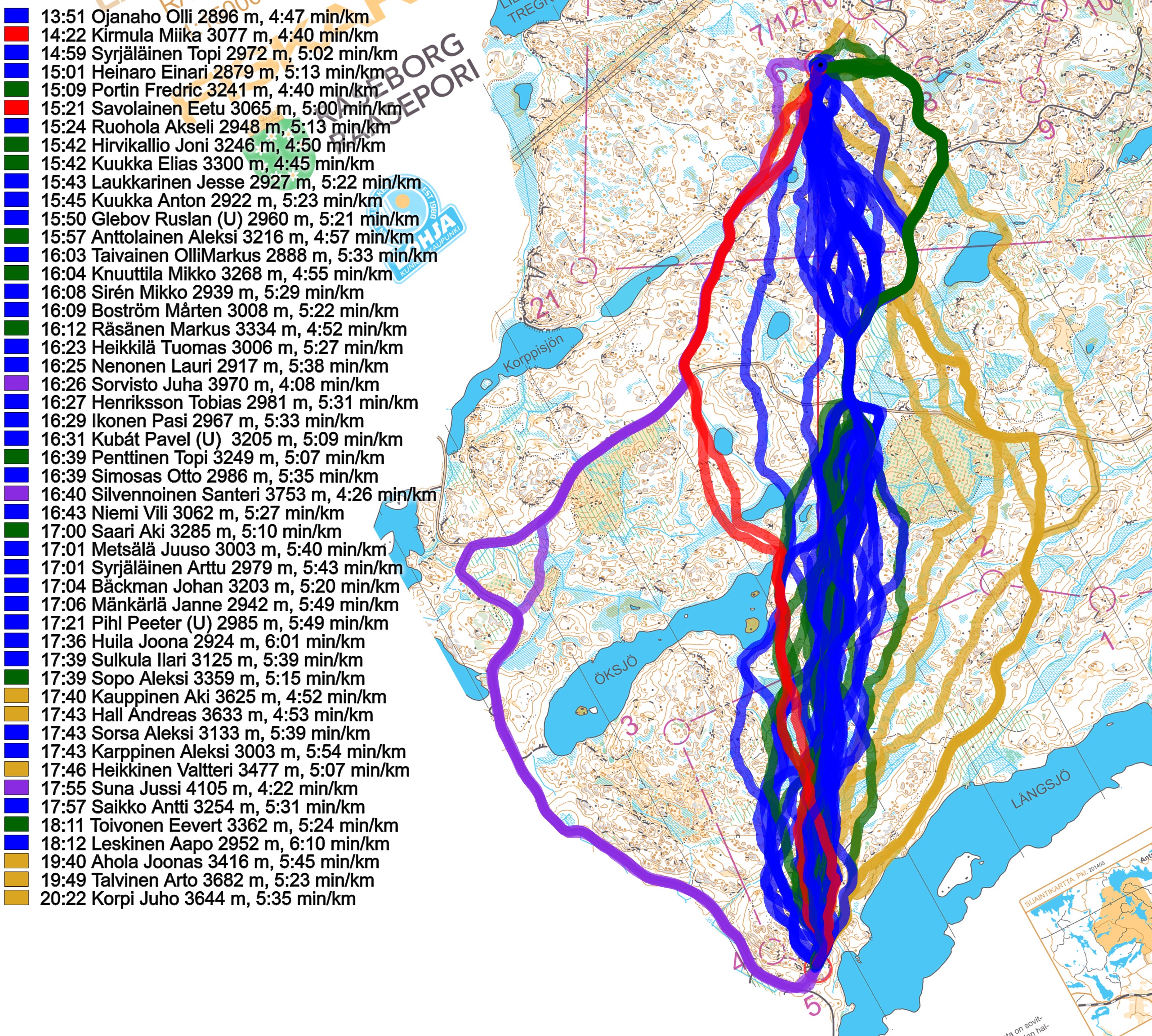
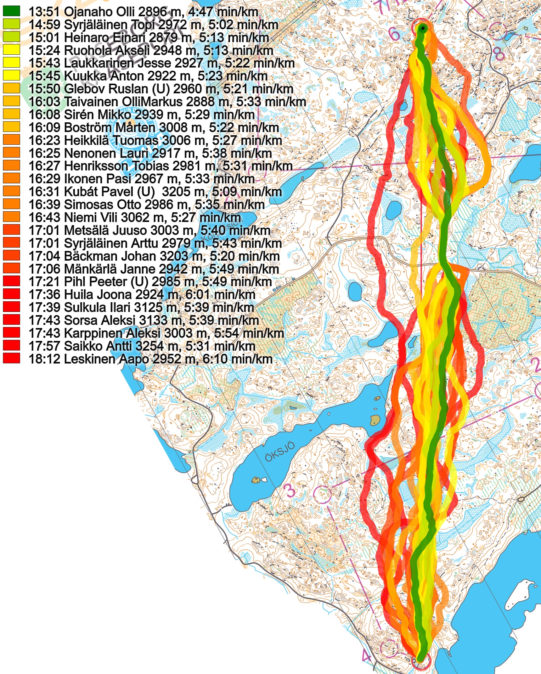
Then you can take a look at how the runners have solved this leg below. As you can see, many runners tried to exploit the various roads in their routechoices, but in the end the terrain is so fast that the fastest route is nearly straight on, and just touches a road for a few hundred meters (more analysis below the first two illustrations). Going left on the road is too long, although the ones taking this route are not the fastest and “only” run around 3:50 min/km – it is still too long, though, even for the fastest runners. The same can be said for the variants to the right which have a lot less road running.
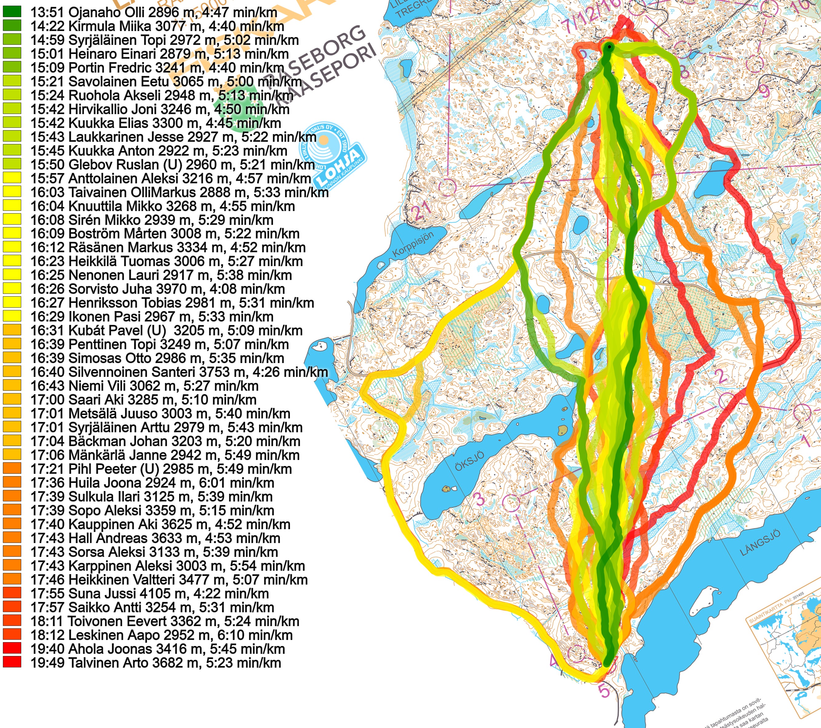
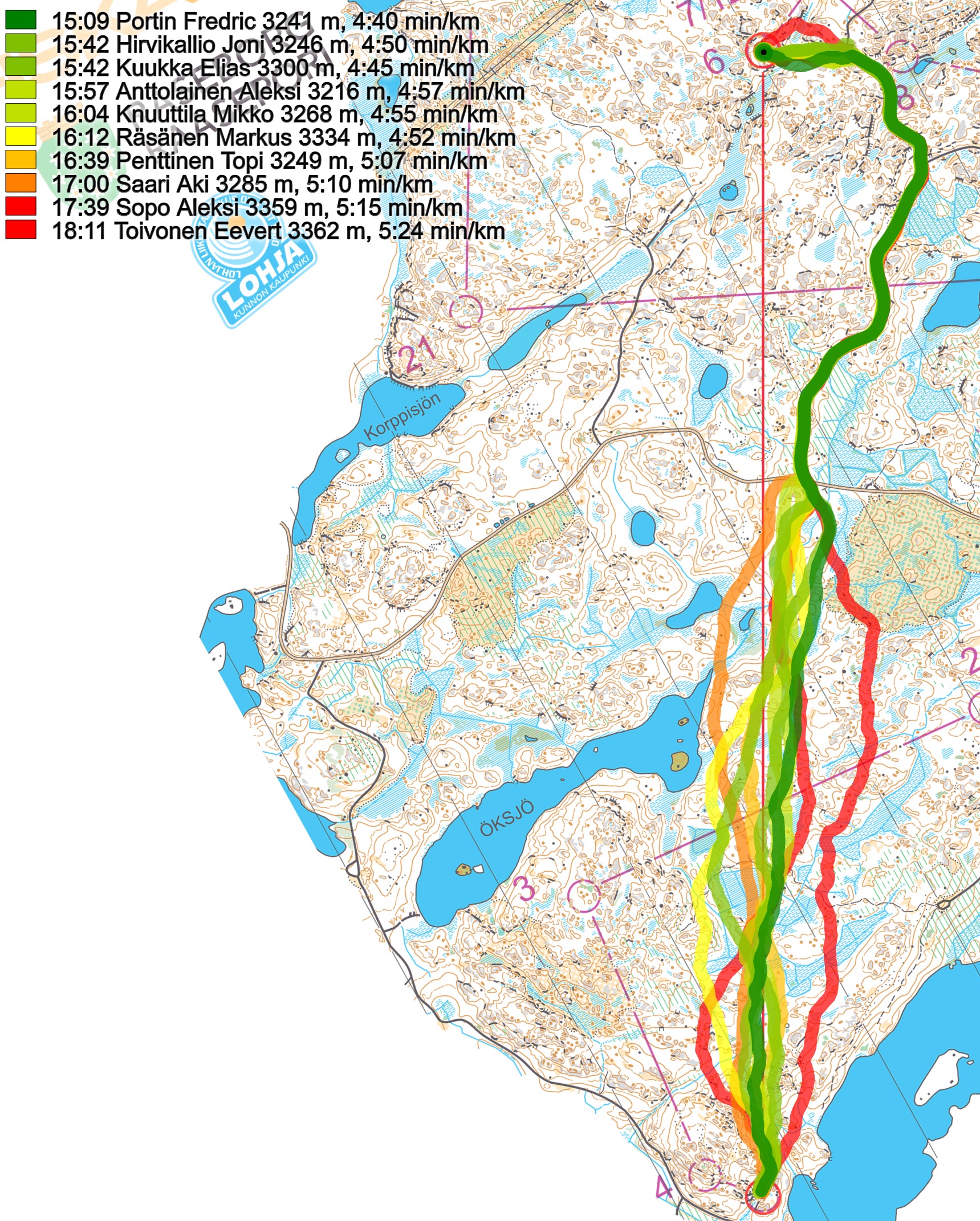
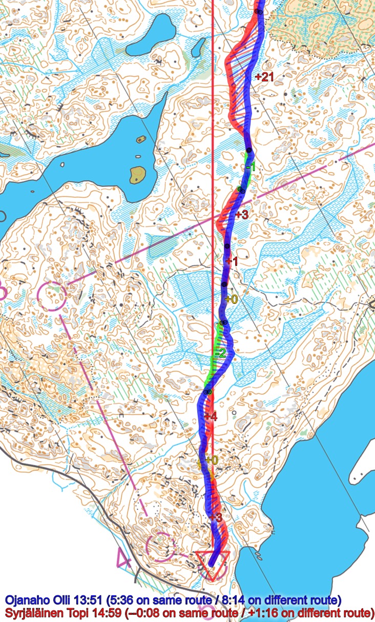
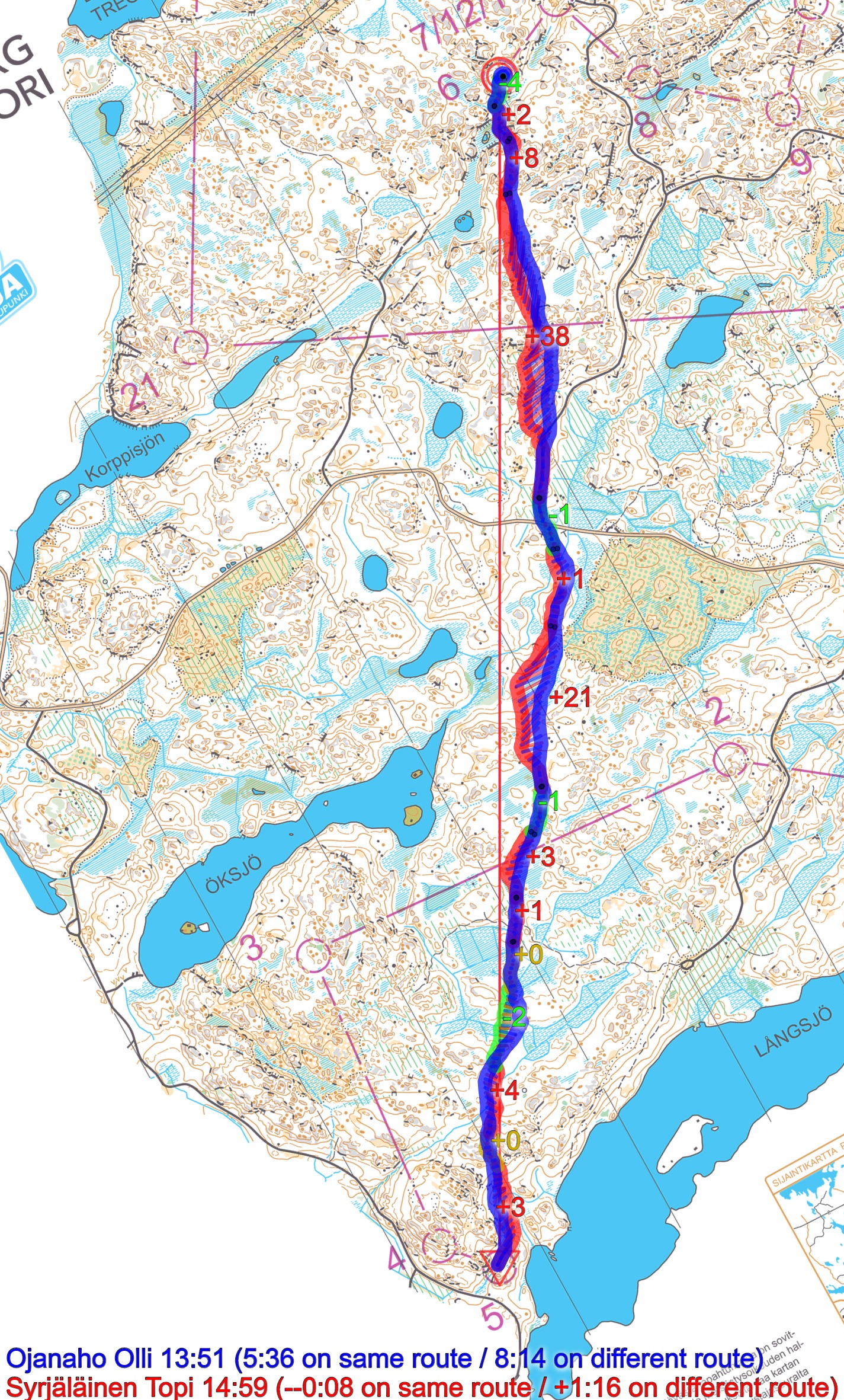
Going straight for most of the leg and getting some extra road running to the right on the last part of the leg (Portin’s route) is around 40-45 seconds slower (adjusted for difference in running speed):
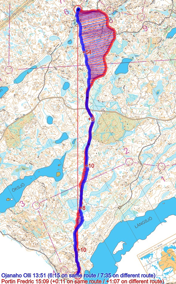
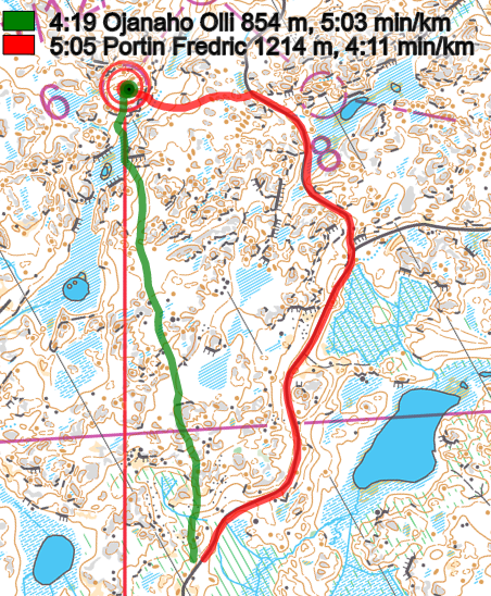
The reason this is so much slower is that the running speed on the road is not enough faster compared to the extra distance that must be run: Portin’s route on the road is 360 meters longer, but as Ojanaho runs around 5:03 min/km in the terrain here, Portin’s 3:40 min/km on the road is far from enough for the extra length.
Here you see all the “straight” routes; clearly you should use your compass a lot here, and run as straight as possible.

Density map
See below for a density map of some of the ones who have drawn their routes so far (available during the day when some readers have drawn their route).
![]()
Additional information
You find the complete map in omaps.worldofo.com at this location.
Route to Christmas series
The Route to Christmas series is a pre-Christmas tradition at World of O – giving the readers the opportunity to do one Route Choice Challenge each day from December 1st until December 24th. If you have got any good legs in GPSSeuranta or 3DRerun from 2019-competitions – or old forgotten ones which are still interesting – please email me the link at Jan@Kocbach.net, and I’ll include it in Route to Christmas if it looks good. Route to Christmas will not be interesting if YOU don’t contribute.
Not all legs are taken for the interesting routechoice alternatives – some are also taken because the map is interesting – or because it is not straightforward to see what to do on a certain leg. Any comments are welcome – especially if you ran the event chosen for todays leg!


