 World of O News
Today’s leg in Route to O-Season 2020 is a leg from the route setting competition of the Norwegian Orienteering Federation, on the map where O-Festivalen 2019 was organized.
The chosen leg is the longest leg in the course set by Olav Lundanes. Lundanes finished third in the course setting competition -the winner will be revealed today, so check out the webpage of the Norwegian Orienteering Federation for news about that.
The leg is as usually first provided without routes – you may take a look at it and think about how you would attack this leg (if the image is too small, you may click on it to get it larger). The course setter from O-Festivalen has run through the course, but we have no other GPS-analysis available. Any comments on the leg and on the best routechoice in your opinion are therefore highly appreciated. Note that this is really slow and tough terrain!
![]()
Location
You find other maps from the area in omaps.worldofo.com here. See also latest additions in 3DRerun from this area in order to learn more about this terrain type.
Webroute
Next you can draw your own route using the ‘Webroute’ below. Think through how you would attack this leg, and draw the route you would have made. Some comments about why you would choose a certain route are always nice for the other readers.
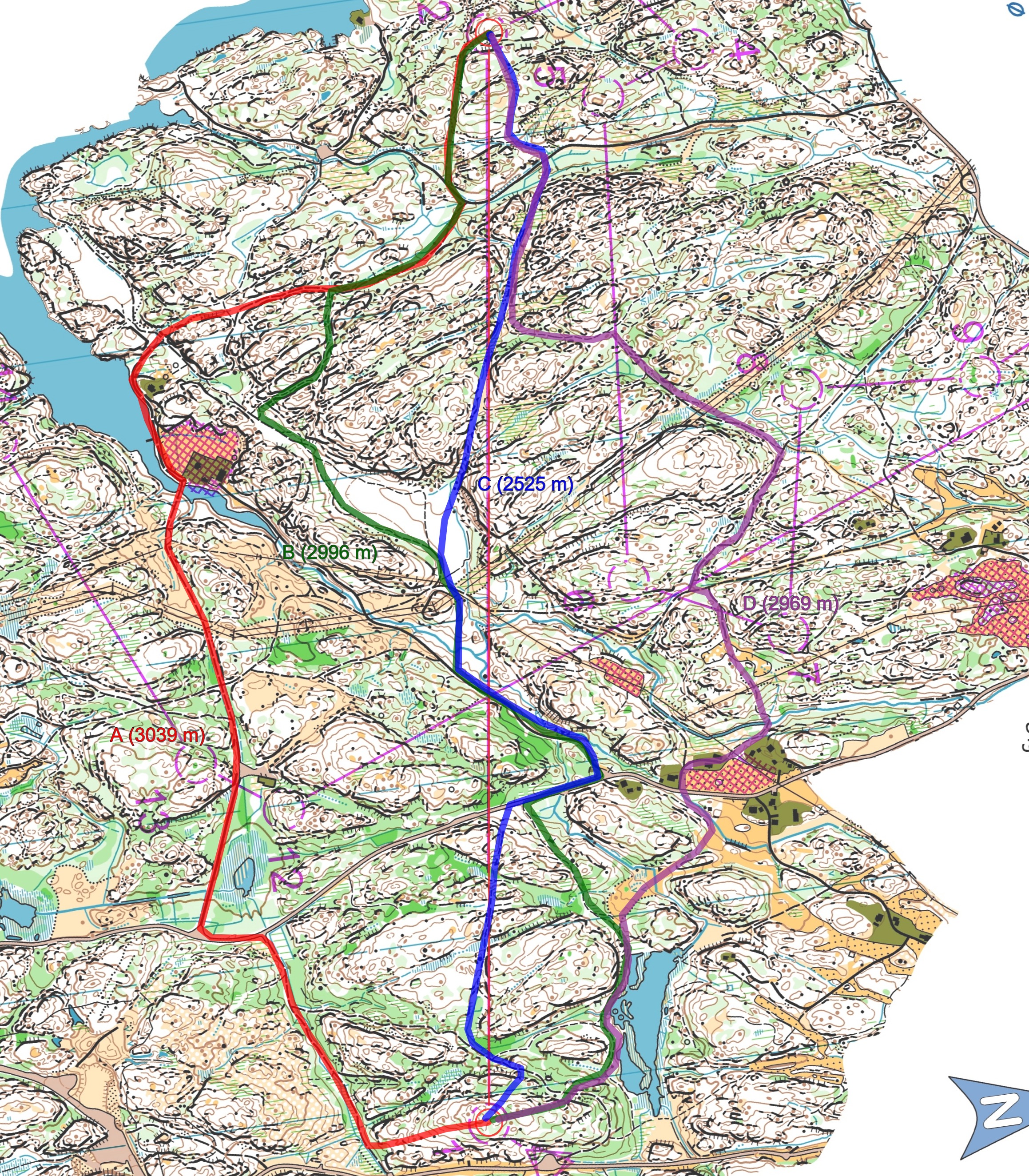
Then you can take a look at four possible routes (drawn by the editor). The red one (A, 3039 meter) was the one chosen by the course setter from O-Festivalen, and is thus the only route which has been tested. From a theoretical standpoint, this is the safest route here. It is the route with most road/bit path running and is also the flattest route. With only 500 meter extra length compared to the shortest, straight route (blue, C, 2525 m) and less than 100 m extra length to the two other alternatives, I don’t think you can lose much time by going red. But that’s just my analysis – if you think I am wrong, please add a comment and I will update the text.
Update – comment from course setter Olav Lundanes:
My thoughts with the leg was to make a leg with many different possibilities, where straight look tempting with the first look (to trick runners like my self:)), but if you look more carefull the straight is not as good as i looks like, even though the line is quite nice (big cliff just after the 1 ctr, a big U when crossing the road, and a really tough climb, some green strips a indistinct path and some though terrain (the last 300 m) in the second part of the leg.
My opinion is therefor that the red route to the south is the best choice. It is just ca 425 m longer than the variant north to the lake and than straight on to with the blue one. I think that it is a better choice than blue all the way, even though there is a path going more or less all the way to the road. The red has significant less climb than green/blue 90 m vs 125 m and has a lot more road running that is significant faster than most of the tracks.
At the end of the red route I don’t know if the fastest is to do like Jan has draw with red or if it is better to go straight in the end (down to the parking, the road and than bush to the control). The difference is just 150 m and the entrance to the control at the red option is very fast.
There are also some more straight choices of the right route (going straight just before the powerline, and right of the forbidden area), but those are to though. To make shortcuts just after the big road is bad decision both on red, blue and green I think. The purple route to the right is to slow, but I think with moving the control 150-200 m to the NW it would maybe been an even better leg.
Density map
See below for a density map of some of the ones who have drawn their routes so far (available during the day when some readers have drawn their route).
![]()
Additional information
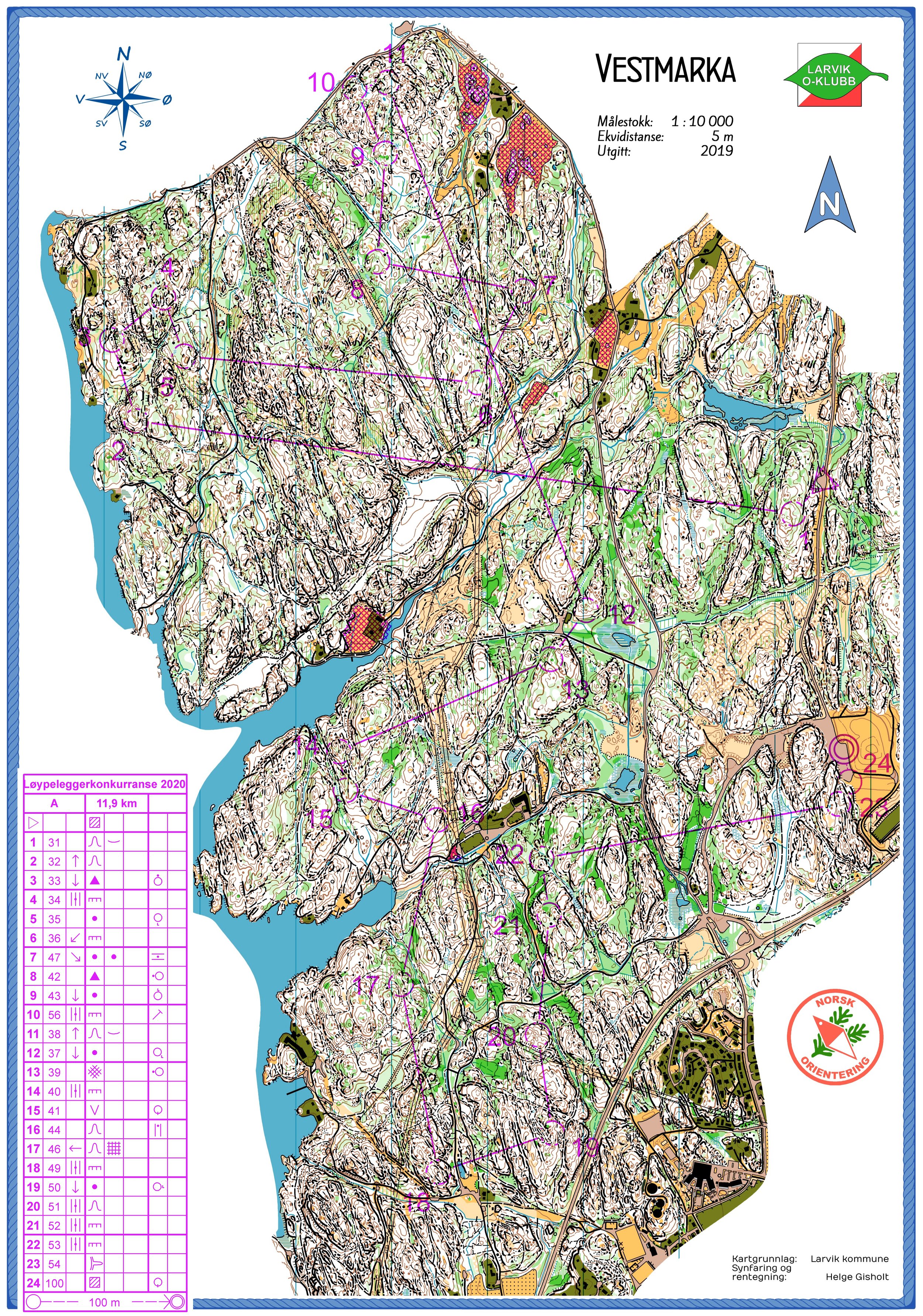
You find the complete course here and the write-up about the course setting competition and the course here (Norwegian text).
Route to O-Season 2020 series
Route Choice Challenges while waiting for the real action: With the upcoming orienteering season indefinitely on hold in large parts of the the world due to COVID-19, regular orienteering route choice challenges may be one way to make sure those orienteering skills don’t get completely rusty. I’ll try to keep these coming daily, but need help from all of you out there to keep them coming and to keep up a certain quality.
Tips on good route choice challenges – either from races/trainings (even cancelled ones) or theoretical ones with accompanying analysis – are very welcome (please e-mail to jan@kocbach.net).
Not all legs are taken for the interesting routechoice alternatives – some are also taken because the map is interesting – or because it is not straightforward to see what to do on a certain leg. Any comments are welcome – especially if you ran the event chosen for todays leg!


I won my class both days in the O-Festivalen event here, I think the red (left) route is the best option, particularly because it is the start of the race and it has enough good (dirt) road running that you can use it to check out and plan the routes for the rest of the course. The course setter, Olav Lundanes might have been able to get away with a combined green start + blue direct finish but it would cost significant energy for anyone else!
Thanks, Terje. I guess it would even cost significant energy for Lundanes :)
Thanks for including this leg in Route to O-season and all the legs in the previous days Jan! I didn’t used as much time as I had wanted to set the course, it is therefore very nice to see that there are a good spreading in the density map.
My thoughts with the leg was to make a leg with many different possibilities, where straight look tempting with the first look (to trick runners like my self:)), but if you look more carefull the straight is not as good as i looks like, even though the line is quite nice (big cliff just after the 1 ctr, a big U when crossing the road, and a really tough climb, some green strips a indistinct path and some though terrain (the last 300 m) in the second part of the leg.
My opinion is therefor that the red route to the south is the best choice. It is just ca 425 m longer than the variant north to the lake and than straight on to with the blue one. I think that it is a better choice than blue all the way, even though there is a path going more or less all the way to the road. The red has significant less climb than green/blue 90 m vs 125 m and has a lot more road running that is significant faster than most of the tracks.
At the end of the red route I don’t know if the fastest is to do like Jan has draw with red or if it is better to go straight in the end (down to the parking, the road and than bush to the control). The difference is just 150 m and the entrance to the control at the red option is very fast.
There are also some more straight choices of the right route (going straight just before the powerline, and right of the forbidden area), but those are to though. To make shortcuts just after the big road is bad decision both on red, blue and green I think. The purple route to the right is to slow, but I think with moving the control 150-200 m to the NW it would maybe been an even better leg.
Thanks a lot, Olav! Both for the leg and your comments/analysis!
Thanks Olav, both for taking part in the course setting challenge we came up with and for your analysis!
I’m very pleased to see that your evaluation of the leg is pretty much identical to what I wrote above, I consider that a win. :-)