World of O News
Today’s leg in Route to O-Season 2020 is from a recent training race in Huddinge, Sweden. Thanks a lot to Simon Hector for providing the tip and analysis!
Here is Simon Hector’s introduction to the leg:
This leg is from a training in Huddinge, in the south part of Stockholm, on a totally new map. The training was made to resemble a race as much as possible in these times, covid-19-adjusted with different start slots for different clubs. The northern part is quite similar to the terrain of 25manna 2020 which will be held just north of this area.
The terrain is rather fast as it usually is in Stockholm. But with the contours being 5 m every hill does slow you down a bit. Green is not insane bad, but slows you down. In the middle of the leg there is a big forbidden area due to a shooting range. As it was a training there was no tape in the terrain, so some navigation was required to not enter the forbidden area.
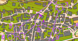
The leg is as usually first provided without routes – you may take a look at it and think about how you would attack this leg (if the image is too small, you may click on it to get it larger):
![]()
Location
You find other maps from the area in omaps.worldofo.com here. See also latest additions in 3DRerun from this area in order to learn more about this terrain type.
Webroute
Next you can draw your own route using the ‘Webroute’ below. Think through how you would attack this leg, and draw the route you would have made. Some comments about why you would choose a certain route are always nice for the other readers.
Then you can take a look at how the runners have solved this leg below. Note that the times are GPS-times and not actual split times.
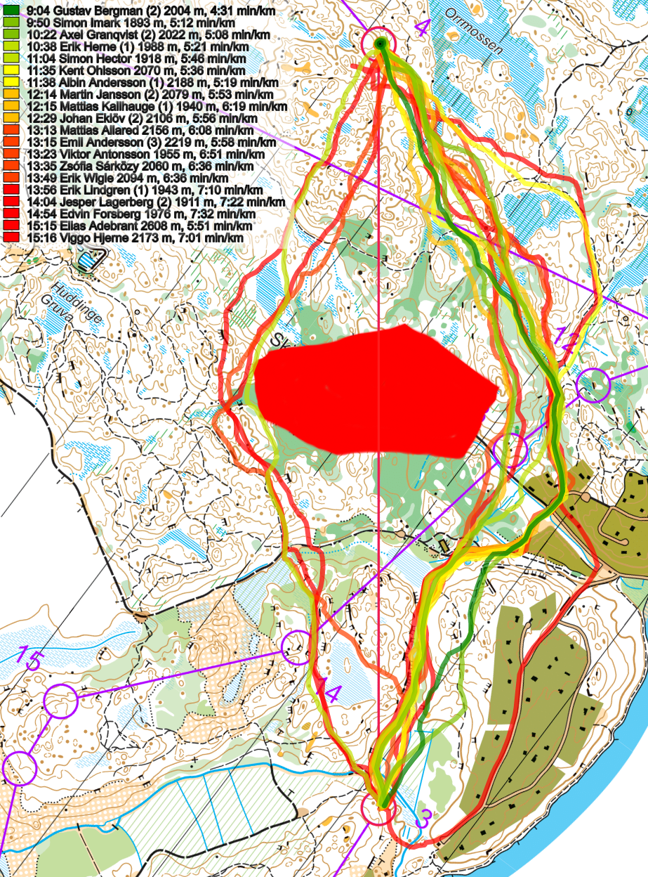
Here are the comments from the runners:
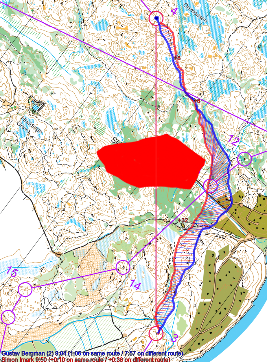
Gustav Bergman, OK Ravinen, 9.03 (1): I felt like the right option had a nice smooth line, and some parts were you can push hard and run really fast. Looking left, I was a bit concerned about the green before the road, and wasn’t really happy about the passage close to the forbidden area (too green and hilly closest to the border, and the tracks to the left looked like they had too many twist and turns), so I opted for right.
Simon Imark, Tullinge SK, 9.44 (2): At first glance, the right option around the forbidden area looked fastest, avoiding the smaller hills and having to run up and down. From that point I wanted to run as straight as possible, touching the apex of the forbidden area and surfing down the hill towards the last open part of the leg. Execution was quite good, only some struggles on the green in the middle of the leg. Gustav was strong that day so hard to say how much time I lost by not going around the path as he and others did.
Axel Granqvist, OK Ravinen, 10.17 (3): I thought the left routechoice looked a bit too hilly and dense and with a difficult entrance to the control. I therefore chose the right routechoice and tried to use the paths as much as I could. The flat marsh passage looked ok and safe so I took that and then I had a quite simple last bit to the control.
Erik Herne, OK Ravinen, 10.37 (4): The route choices around the forbidden area looked equal in length so I used the better runability to the right (less elevation and more running on paths)! I’m pretty happy with the execution of my route choice but afterwards I think a route more like Imark’s is the best (you only “save” 10-15 altimeters by going around on the path after the road instead of almost touching the forbidden area over the hill as he did)!
Simon Hector, Snättringe SK, 11.00 (5): At first the route choice to the right looked tempting, but when looking closer I saw that there was a lot of green to the right and that left looked quite okay. It was a “last second choice” to choose left and after a couple of hundred metres of running I thought it must be slower. Not a very good mindset, but at least I executed it quite well apart from 5-10 s in the circle. I know I don’t keep the speed of Gustav but 2 min behind is way too much, so I think I lost quite a bit by choosing left. I think it is because it isn’t shorter and doesn’t give less green (as I initially thought) or nicer runnability, but it gives some extra climbs.
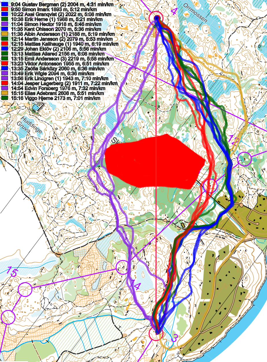
Density map
See below for a density map of some of the ones who have drawn their routes so far (available during the day when some readers have drawn their route).
![]()
Additional information
You find the complete map in omaps.worldofo.com at this location.
Route to O-Season 2020 series
Route Choice Challenges while waiting for the real action: With the upcoming orienteering season indefinitely on hold in large parts of the the world due to COVID-19, regular orienteering route choice challenges may be one way to make sure those orienteering skills don’t get completely rusty. I’ll try to keep these coming daily, but need help from all of you out there to keep them coming and to keep up a certain quality.
Tips on good route choice challenges – either from races/trainings (even cancelled ones) or theoretical ones with accompanying analysis – are very welcome (please e-mail to jan@kocbach.net).
Not all legs are taken for the interesting routechoice alternatives – some are also taken because the map is interesting – or because it is not straightforward to see what to do on a certain leg. Any comments are welcome – especially if you ran the event chosen for todays leg!