 World of O News

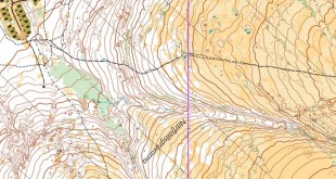
Today’s leg in Route to Christmas is from the Victorian Long Distance Championships at Mount Korong in Australia. This was an epic competition with some extraordinary long legs!
The 5th and 9th leg are even more spectacular than the 4th leg chosen here, but I found the 4th leg more interesting for Route to Christmas due to the balancing of the leg, It is, however, definitely worth taking a look at the rest of the course when finishing today’s Route to Christmas. This course is also one of the 62 courses nominated for Course of the Year 2025 – still a few days left to vote.
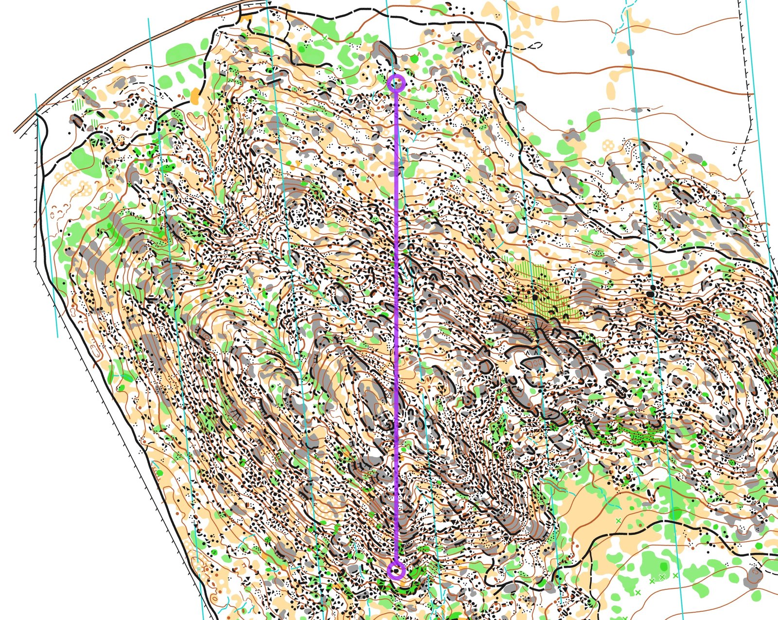
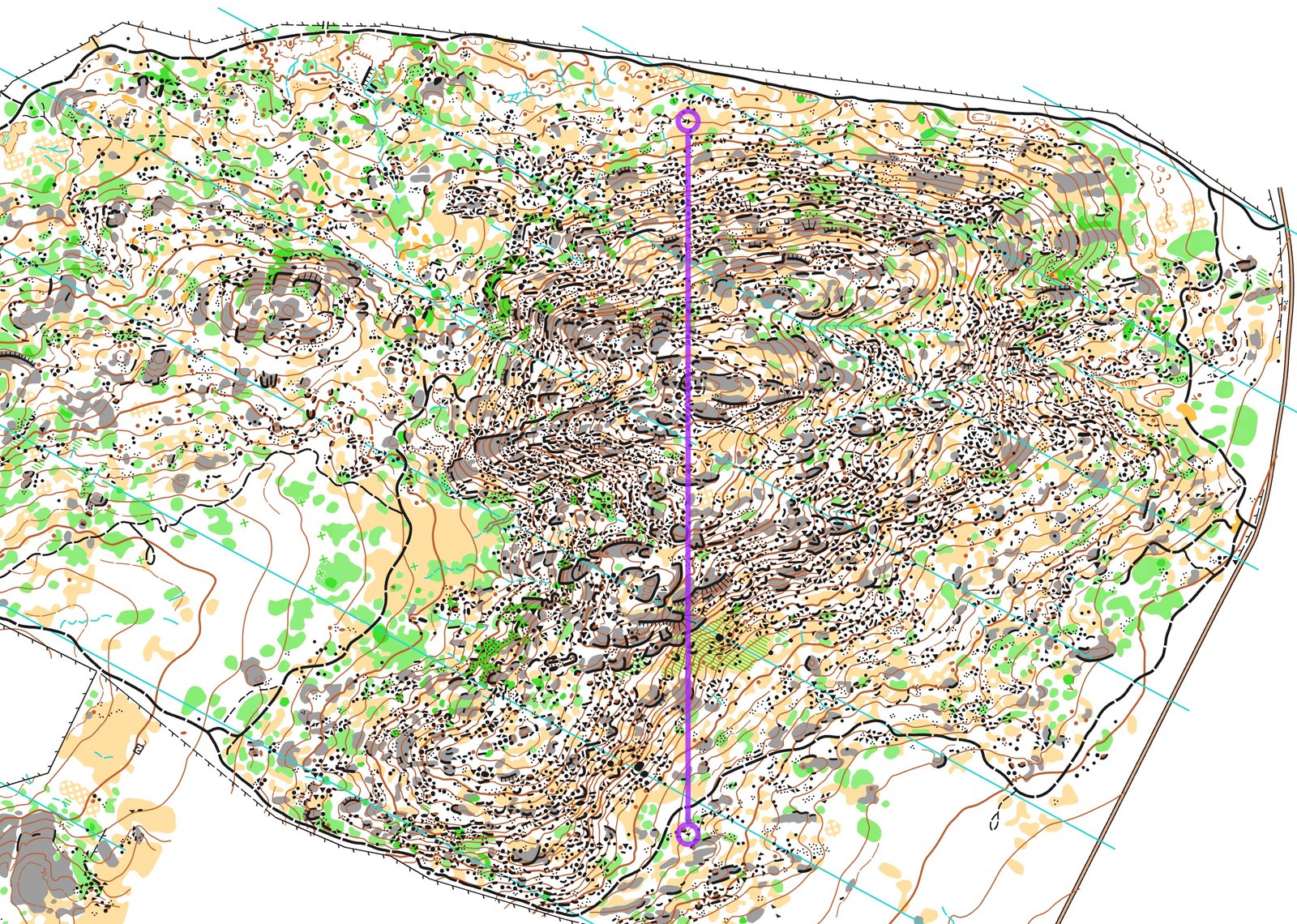
The leg is as usually first provided without routes – you may take a look at it and think about how you would attack this leg (if the image is too small, you may click on it to get it larger):
![]()
Location
You find other maps from the area in omaps.worldofo.com here. See also latest additions in 3DRerun from this area in order to learn more about this terrain type.
Webroute
Next you can draw your own route using the ‘Webroute’ below. Think through how you would attack this leg, and draw the route you would have made. Some comments about why you would choose a certain route are always nice for the other readers.
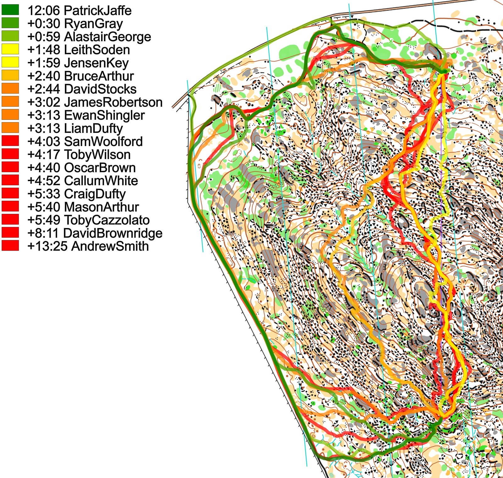
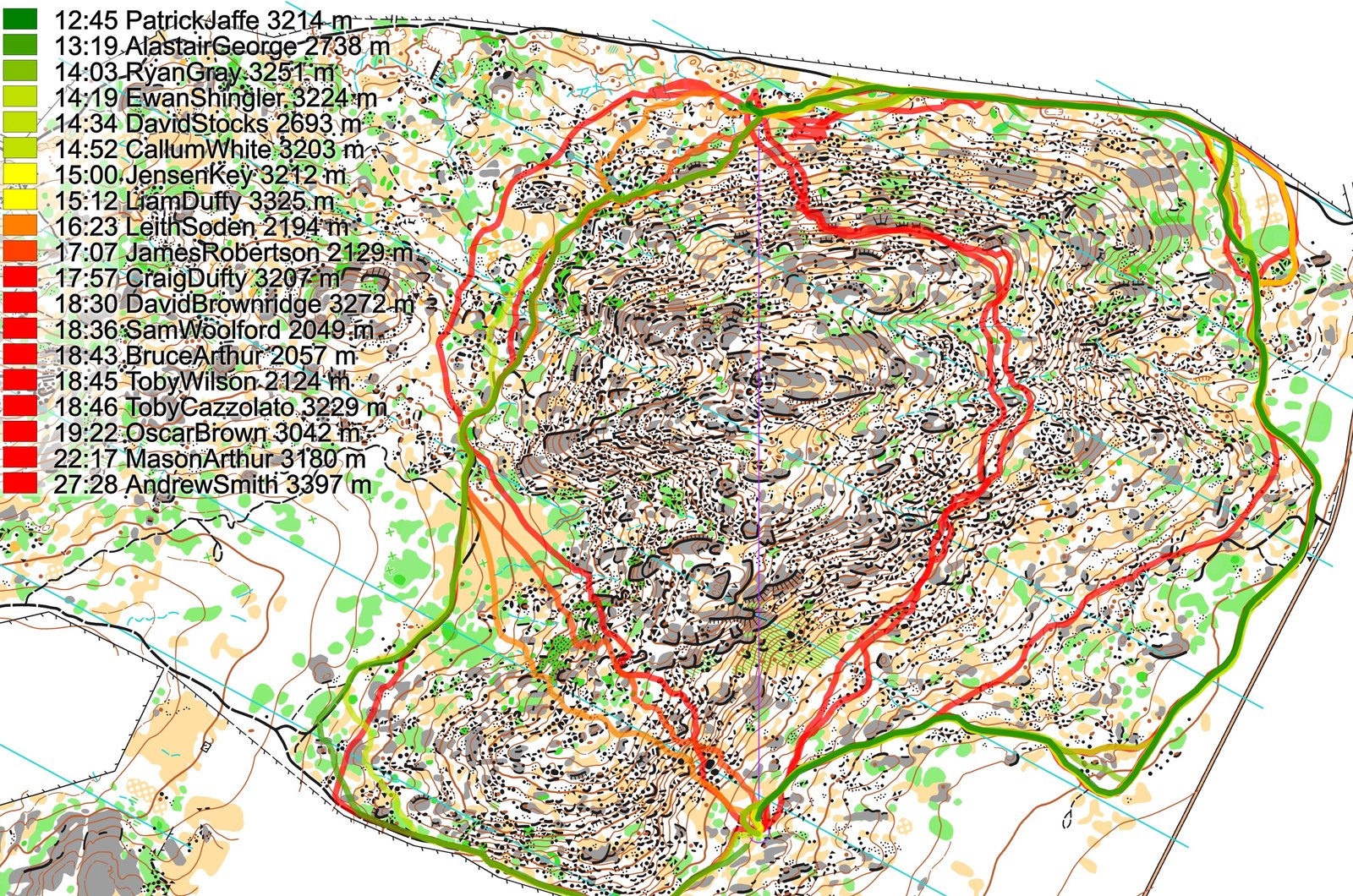
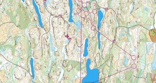
Then you can take a look at how the runners have solved this leg below. The routes are colored according to fastest split time on the leg, with the fastest routes in green and the slowest in red. As you can see, taking one of the variants to the left is clearly the fastest.
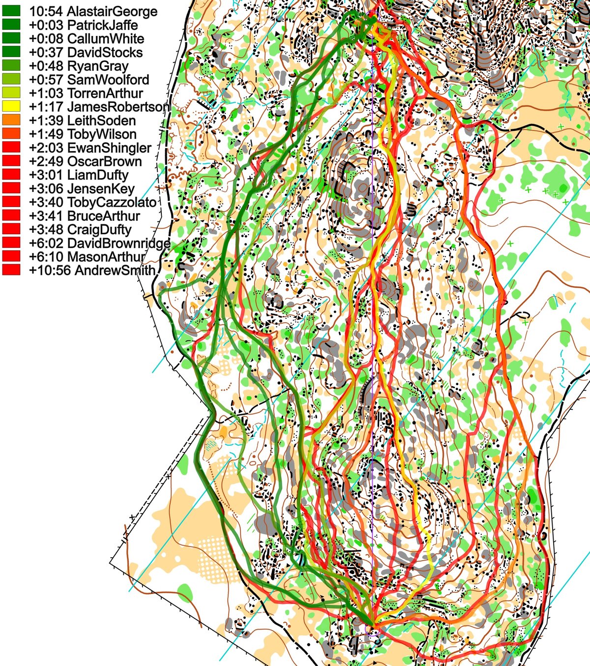
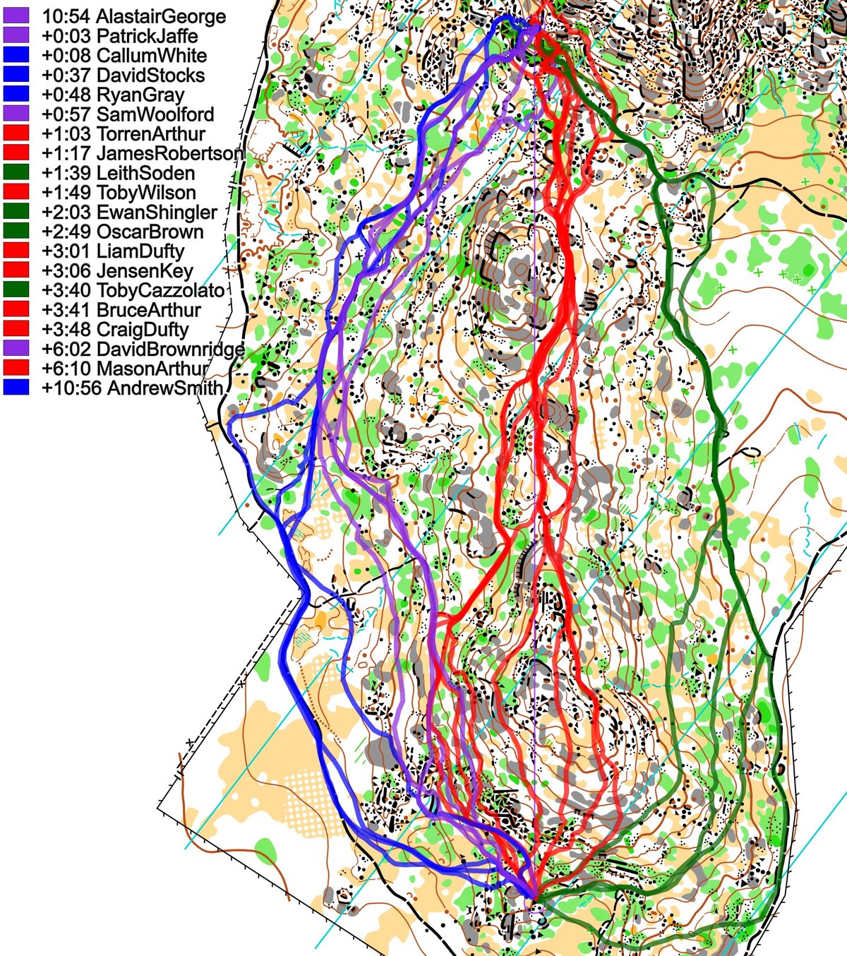
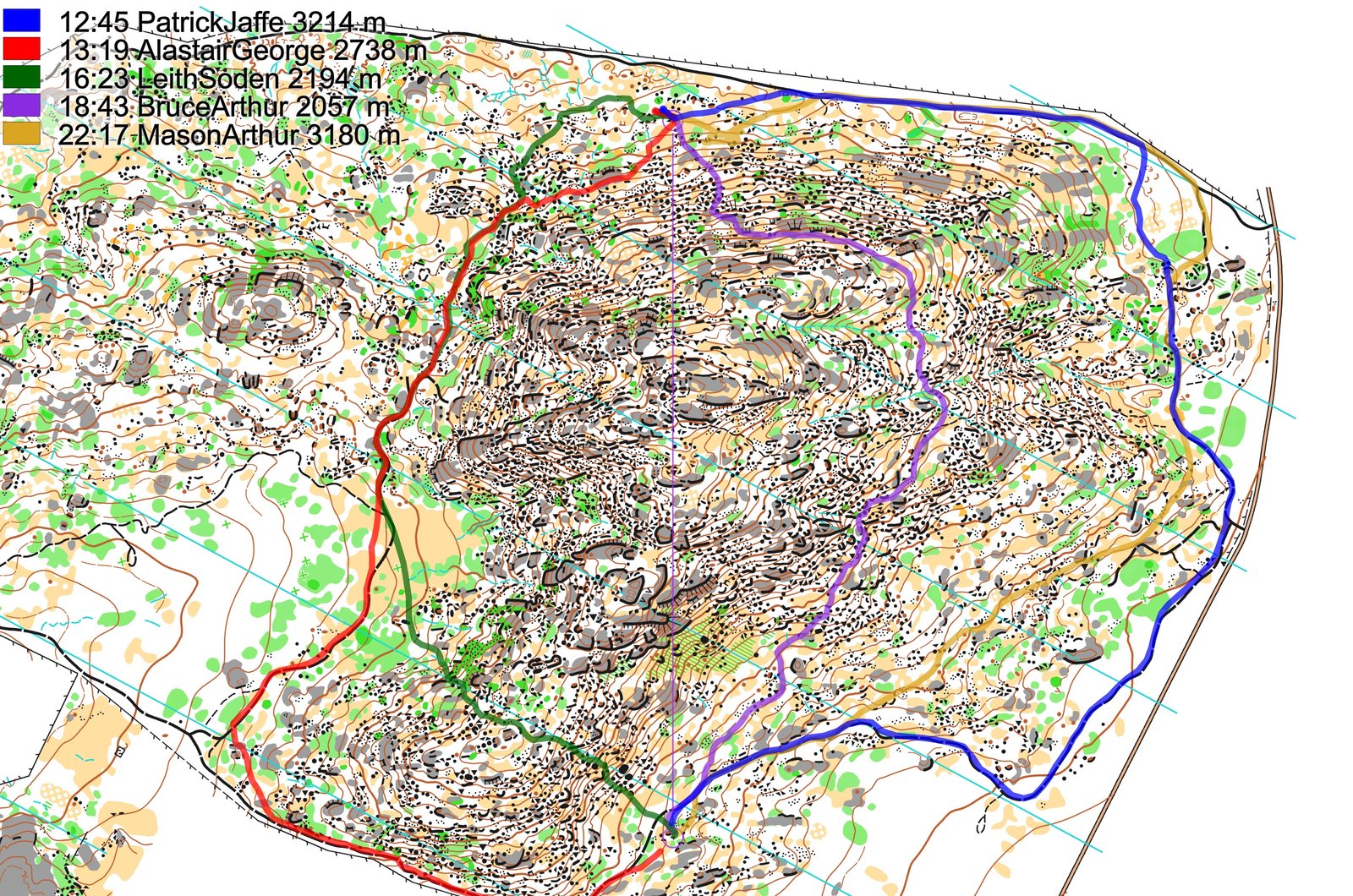
Below the routes are colored according to variant to give a clearer view of the how many runners chose each variant. When we look at it this way, we can see that running all around to the left (blue) was slightly slower than cutting over the “shoulder” of the hill (purple), but the time difference is so small that this is probably relatively equal. The ones running over the top (red) lose from one to several minutes – this route is more challenging to execture and that is probably one of the reasons we see most spread for this route. Running around to the right (green) seems to be the slowest, mainly because it is longer than the route to the left but with poorer runnability.
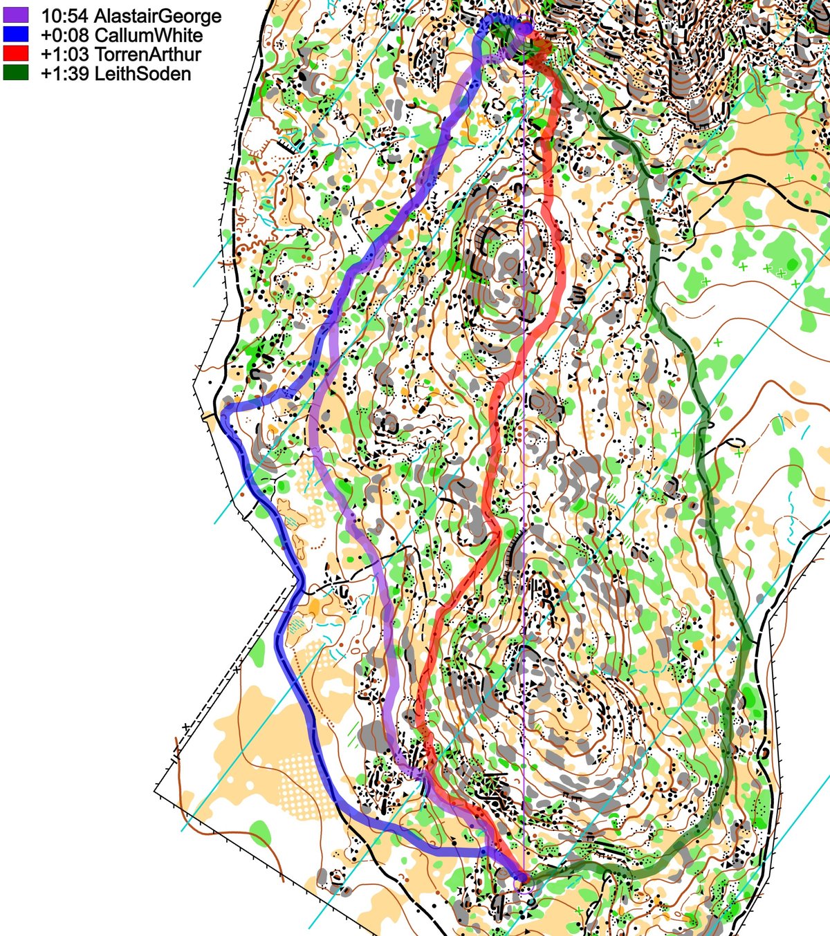
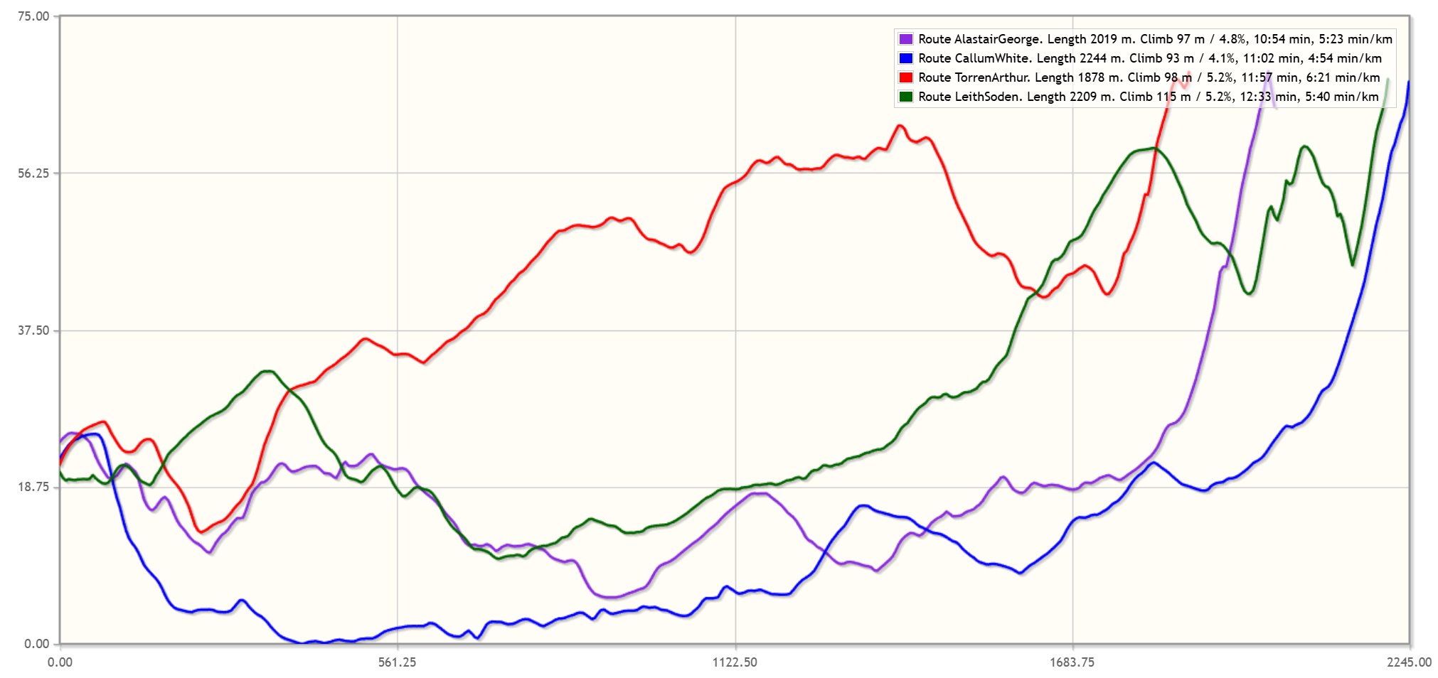
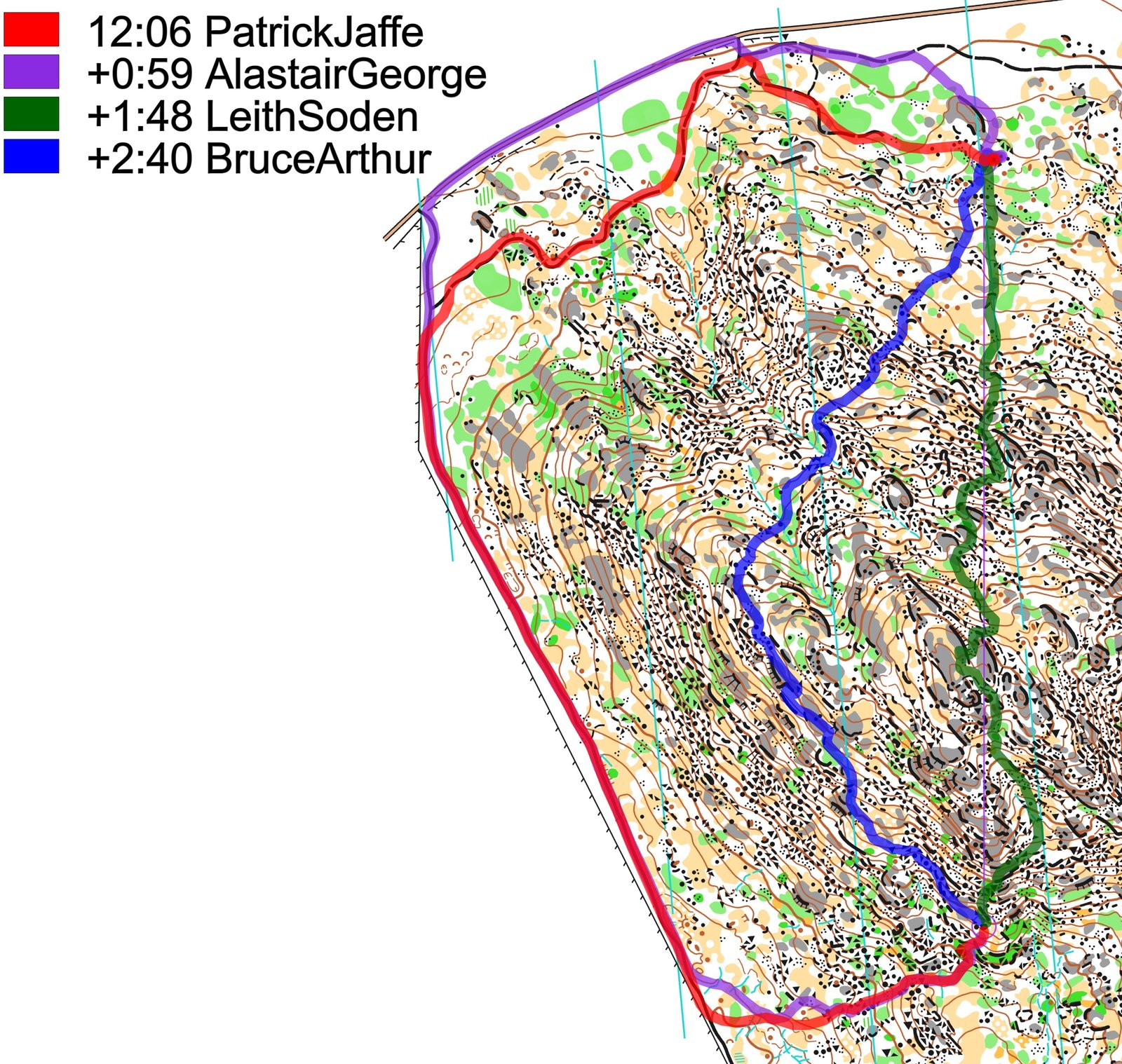
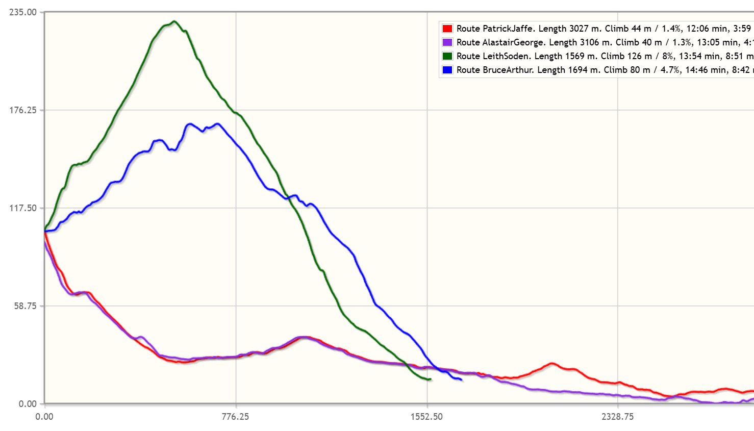
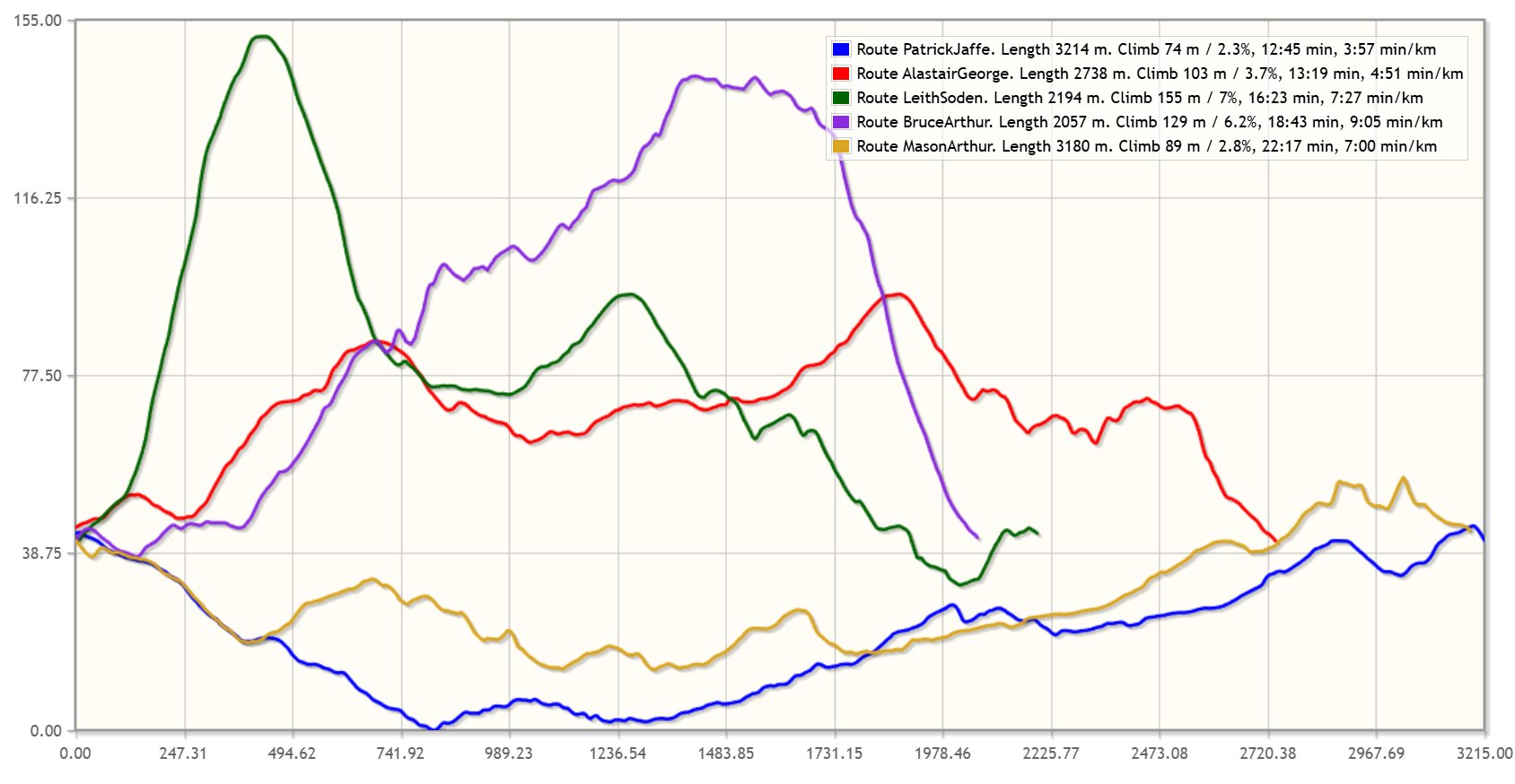
Here the fastest route on each of the four variants are shown, with a coarse elevation profile for each below.
And finally also a look at the two even more epic legs on this course – read on below the legs for some additional information.
Leg 5

Leg 9

There was an article in the June edition of the Australian orienteering magazine “Australian Orienteer” about this leg, where some interesting insights were given:
The course setting team used OCAD Route Analyser to plan the long legs on Mt Korong. The algorithm predictions of optimal routes did not match the routes chosen on competition day. On the third long leg for the elite courses we hoped to entice more runners to take the route across the southern slopes that was preferred by Route Analyser. Most runners found the wide track options much more appealing, even to the extent of running backwards out of the control [including Patrick Jaffe who ran the leg in 12:45, at 3:58 min/km pace, and ran the furthest south].
The controller tested the Route Analyser optimal route and found it quite viable. It doesn’t have much more climb than the track routes (12 m more than the northern track route, and 2 m more than the southern track route). It is almost all yellow or white and has no rock scrambling. Perhaps it isn’t intuitive to look for a route that sidles and is that far from the straight line. It also requires much more navigation so has a greater risk.
We will use Route Analyser in the future, but will put more effort into tweaking the model parameters given we now have a significant amount of data with which to calibrate. Perhaps in the future all our club maps will have both an embedded Digital Elevation Model and calibrated parameters for the Route Analyser algorithm. This may require new hidden symbols on the map to account for speed variations in rocky terrain.
Density map
See below for a density map of some of the ones who have drawn their routes so far (available during the day when some readers have drawn their route).
![]()
Additional information
You find the complete map in omaps.worldofo.com at this location.
Route to Christmas series
The Route to Christmas series is a pre-Christmas tradition at World of O – giving the readers the opportunity to do one Route Choice Challenge each day from December 1st until December 24th. If you have got any good legs in GPSSeuranta, 3DRerun, Loggator or Livelox from 2025-competitions, or old forgotten ones which are still interesting, please email me the link at Jan@Kocbach.net, and I’ll consider including it in Route to Christmas if it looks good. Route to Christmas gets interesting due to YOUR contribute!
Not all legs are taken for the interesting routechoice alternatives – some are also taken because the map is interesting – or because it is not straightforward to see what to do on a certain leg. Any comments are welcome – especially if you ran the event chosen for todays leg!

Amazing terrain but I believe the route choices are somewhat hidden by the amount of ink on the map:
It is hard to see/guess that some routes allow you to avoid all the slow stuff when it wiggles through green and black almost everywhere. For the final leg to control 9, the fact that both the two previous very long legs were fastest when you ran up to twice as long around makes it even harder to find and execute the “OCAD optimal” but still from direct option.
Thanks for the comment, Terje! And yes, I agree. Also, I think I would have balanced at least one leg in such a course so that straight would be better…
It looks like to need deeper analysis of results, route choices, map itself and the reality out in the terrain to understand what’s going on here… In my opinion despite the general white and yellow, the microdetails of green and black features discourage the most of the athletes to cross this “paradise of adventure” in competition mood…
Lastly I would like to change my vote for course of the year. Thumbs up and single vote just for Mount Korong experience!!
This looks like amazing adventure terrain. It’s a shame that the track options were the winning ones. On the other hand, can’t blame the runners for these choices knowing there are abundance of things in Australia with the potential to kill.