 World of O News

Now it is really simple – and it looks perfect! It takes less than 5 minutes to get a orienteering map on your Garmin GPS device – and then you can see exactly where you are on the map using your GPS. And the map looks exactly like it does on paper, as this procedure uses raster maps. There are some small catches regarding map size in the simple procedure explained below, but it is not too difficult to overcome this.
As in the first part of this series all software is freely available – the main difference is that this one is really easy ; you’ll have your first map up in no time! On your GPS unit you can then use the generated map in the same way as any other Garmin map – showing your position on the map, aligning the map correctly, panning and zooming. If you want to get going straight away – click here to go directly to the conversion details.
Garmin Custom Maps
How come you haven’t heard about this before? Garmin only recently made it possible to use Garmin Custom Maps on the newest Garmin GPS units – the Oregon, Dakota and Colorado series – and for now it is only available in a beta version of the firmware for the GPS units. Garmin Custom Maps are actually a special type of kml/kmz-files – the native file format of Google Earth. The good thing for you as an orienteer is that QuickRoute can export kml/kmz-files, and only small modifications are necessary to these kml/kmz-files to make Garmin Custom Maps which you can use directly in your GPS.
Series about GPS and Orienteering
This article is the second in a series about GPS and orienteering here at WorldofO.com, exploring what new technology can do to get orienteering and orienteering maps out to more people. This first article considered the conversion of any OCAD-file to a Garmin vector map (.img-file) – usable for most Garmin GPS units which have a map mode. This second article considers how to show orienteering maps on the newest Garmin GPS units (Oregon / Dakota / Colorado) as raster maps using a much more straightforward procedure taking you only a few minutes for a map. The third article considers showing your position on a modern mobile phone with GPS receiver (e.g. the Iphone or an Android phone).

Why orienteering map on a GPS?
As detailed in the first article in this series, there are a number of reason why you would want to put orienteering maps on your GPS unit. The work described in the first article was mostly done while I was working in the orienteering club Varegg. In our particular case, the interest was in getting youngsters interested in orienteering – and learning them how to understand and use an orienteering map. With founding from Gjensidigestiftelsen and some funding from the Norwegian Orienteering Federation, Varegg had the possibility to buy a set of 10 Garmin Oregon 300 GPS units and develop a method to convert orienteering maps to maps which could be used on the GPS units.
The work described in this article was done while focusing on making orienteering maps useful and accessible for people outside the orienteering community. In particular, there are interesting possibilities for the “Tur-orientering” concept when orienteering maps can be used directly on a GPS unit or especially on a mobile phone with GPS receiver. I will hopefully get a dedicated project going in this direction during winter time.
Vector maps and Raster maps
To understand the difference between the maps generated using the procedure described in the first article and the maps generated using the procedure described in this article, it is important to understand the difference between vector maps and raster maps.
- The maps you usually use on your Garmin GPS unit (and also most other available GPS units) are vector maps. For a vector map on a Garmin GPS, each symbol from OCAD is mapped to a symbol in the Garmin map file, and new symbols must be constructed in the Garmin map file which resemble the symbols in the OCAD file as closely as possible. This is a difficult process, and generally very difficult to get 100% correct.
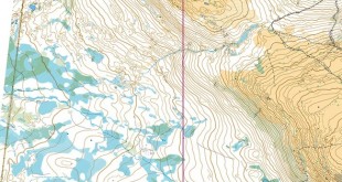
- The orienteering maps you usually see in your web-browser (for example at omaps.worldofo.com) are raster maps . These raster maps can be looked upon as a “photo” of the map, and this photo can contain anything imaginable (even a photo of you in the corner of the map). Recently Garmin has made it possible to use raster maps on the newest GPS units – the Oregon, Dakota and Colorado-series – via a custom map feature using a subset of the kml-format. These raster maps behave like any other map on the GPS unit – and they can look exactly like a normal orienteering map!
What does it look like?

Some photos of the GPS screen of an Garmin Oregon 300 GPS with different maps from QuickRoute loaded. In the third image from the left you see several orienteering maps loaded at different positions.
Contrary to the first article in this series, it looks exactly like the original orienteering map. The pictures above and below are photos of a Garmin Oregon 300 GPS units with maps converted using the procedure described below. The embedded video below shows an example of the usage of an orienteering map converted via the same procedure. As you can see, this looks exactly like a orienteering map – and it is possible to zoom and pan the map. It is a little bit slower than the vector map, but still very usable.
The procedure is so much simpler – and the maps look so much better – that Varegg will probably switch completely from vector maps to raster maps in the work they are doing with GPS units and orienteering maps as described in the first series of this article.
Conversion details: O-map to Garmin Custom Map
The conversion of an orienteering map to a Garmin Custom Map is very simple. At Garmins website you find some background information about how to make Garmin Custom Maps in 5 easy steps and some technical details from the Garmin Tech support forum. GPSFix has also some nice article on Garmin Custom Maps.
It is straightforward to follow the procedure given by Garmin to convert your orienteering map – but following the QuickRoute road described below is probably the fastest way to a georeferenced orienteering map – especially if you are already familiar with the QuickRoute program. If you are a technically interested orienteer with a GPS unit, you have probably already got lots of maps in QuickRoute format, ready to export to Garmin Custom Map format. I found 10 maps on my computer – and within a few minutes I had all loaded on my GPS unit.
Step by step procedure
- Download and install QuickRoute! Note! If you download the lastest development version of QuickRoute, you get a Garmin Custom Map directly from QuickRoute!
- Adjust your route to the map the usual way (see instructions here) – but use only two points for the adjustment procedure in order to get best results. Your custom map will not be better than you manage to adjust your route with two points. If you have taken a photograph of the map, there will probably be a lot of distortion making the resulting Custom Map bad quality. An export from OCAD will give you best results. There are other procedures available which warp your map, but QuickRoute is not able to do this. If your map is larger than 1 megapixel (1024 x 1024 pixels or 512 x 2048 pixels or similar), the GPS unit will scale the map. Thus you get best results with small maps. Your map file must be smaller than 3 MB to work.
- Export the map to kmz (under the File -> Export menu). You can check the exported map in Google Earth to see how well your georeferenced map fits the real world.
Now you have got a kmz-file which is very similar to the Garmin Custom Map format. However, when QuickRoute exports a kmz-file, it puts the map in a separate folder within the kmz-file called “files/”, whereas in the Garmin Custom Map format the map must be in the main folder. Thus to convert the QuickRoute exported kmz-file to a Garmin Custom Map you must unpack the kmz-file (actually a zip-file), move the map-file to the root directory of the zip-file, change the href-tag in the doc.kml-file and rezip the file. Sounds complicated? I’m sure Mats Troeng will fix this in the next release of QuicKRoute if there is demand for it, as it is a very simple fix. Until then, you may download this small compiled perl-script which I have made which makes the job automatically (Note! Windows only, and very briefly tested. Use on your own risk – source code here). Place the file on your desktop, and drag any kmz-file made with QuickRoute onto it, and you will get a Garmin Custom Map which you can transfer directly to your GPS unit.If you use the latest developer version of QuickRoute – you’ve now got a working Garmin Custom Map!- Transfer the file to the folder “/Garmin/CustomMaps” on either the GPS itself or on the SD-card (set the GPS in USB mass storage mode by connection a USB cable).
Note that you need to install the latest beta software release for your Garmin GPS unit in order to use Garmin Custom Maps – but this feature will hopefully soon proceed to a non-beta release of the firmware. For information about how to install the beta firmware see links in Garmins Blog Entry about Garmin Custom Maps.
Limitations – Garmin Custom Maps
There are some limitations/features regarding Garmin Custom Maps (from here):
- It is ok to have more than one jpeg inside the kmz file.
- doc.kml, inside the kmz file, is the only kml file that will be processed.
- Jpegs are the only type of image supported.
- kmz files are read from \Garmin\CustomMaps directory on both the unit’s internal memory and on the sd card.
- Images over 1 mega pixel (1024×1024 pixels, 512×2048 pixels, etc.) will be rendered at a reduced resolution on the unit. If this is causing a problem for your map, you can split the image and use multiple jpegs inside of one kmz file.
- Each jpeg should be less than 3MB.
- The max number of Custom Map jpegs you can load is 100.
- The time it take to draw the map is directly proportional to the file size of the jpegs being drawn.
It is possible (although not straightforward) to take a QuickRoute exported kmz-file, automatically split jpg-files which are larger than 1024×1024 pixels into smaller jpg-files, and repack the kmz-file to a working file at higher resolution. That is however beyond the scope of this article.
If you see improvements to the procedure, please add a comment below to let people know about it. If you are trying to get things to work and have problems, please do not send me an email, but rather add a comment below as that may then help others having the same problems.


1. About the Oregons: For our use they have been perfect. The maps look a lot better on the Oregon than on the GPSMAP 60, and touch screen is nice for the kids (an me:). For more professional use, I don’t know. I guess you have to find somebody who has tested them. There have been som accuracy issues I’ve read about, but the latest firmware updates are supposed to have fixed that.
2. Regarding accuracy and clearity for mapping fieldworker / professional use
The procedure I describe using QuickRoute is not geared towards the professional (map maker) use I think. But accuracy gets as good as your georeferenced image is, and using the QuickRoute road it is easy & fast to georeference the map with quite good accuracy. However, if you have the pro-version of OCAD, you can export as geotiff (and “geojpg” also as far as I remember from the trial version I once had) – even divided into tiles. I am sure methods to go from geotiff to the Garmin Custom Map type is either available somewhere or in the works. In this case, you will be able to get the same accuracy as for the vector maps, and I think it would be excellent for fieldwork.
One brief question: Can you load these custom maps into the Garmin Mapsource and / or Garmin Trainingcenter software?
@ts Not in the current version of Mapsource / Trainingcenter as far as I am aware of. But the custom maps are very new (only beta firmware), so who knows what will come later on?
you indicate map size limit is 3MB. How big (approx) a piece of a 1:15000 can you you fit on 3MB?
@steve: You can get quite a bit in on 3 MB – the problematic limit is the 1 megapixel limit (e.g. 1024×1024). However, you can tile your map into several tiles and put them in the same kmz-file – giving good quality for really BIG 1:15000 maps – should cover most normal races.
Global Mapper (www.globalmapper.com) is very useful to both georefence and create KMZ files with image tiles. It costs 349 USD. Here is a description:
1. Export a 200 dpi jpg image from Ocad
2. Open the ocad file or another georefenced map in Global Mapper (it supports many different formats. For example ocad, sosi, shape, geotiff)
3. Open the jpg file and rectify the image. (use the online help if you don’t understand how)
4. Export raster kmz file. Choose a tile size not bigger than 1024×1024 which is default.