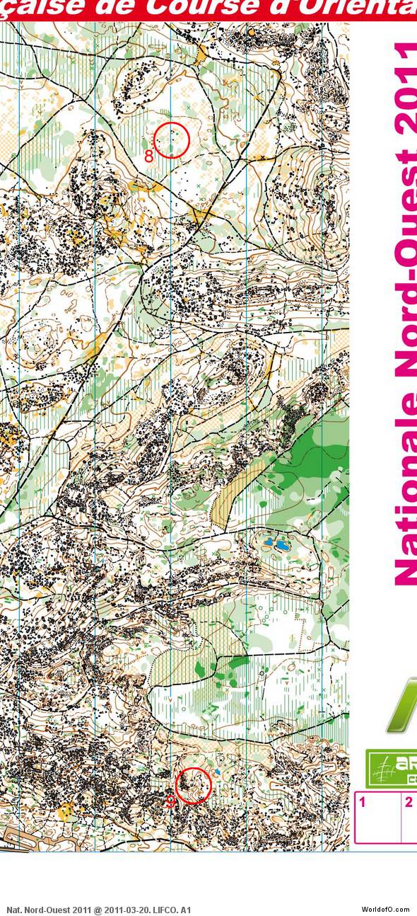
A long leg and many stones and boulders! Today’s leg in Route to Christmas brings us back to France again – but to very different terrain from what we have visited earlier in the 2011 edition of Route to Christmas. This leg is taken from a national league championship that was the first important race of the season. Thanks to Mathieu Kern-Gillard for information about the terrain.
The reason for choosing another leg from France is simple: France is one of the countries (along with Finland, Czech Republic and Great Britain) who uses RouteGadget the most. In addition France has some very interesting terrain – and runners who share their routes with others in RouteGadget.
Fontainebleau: choose your route!
The leg is as usually first provided without routes – you may take a look at it and think about how you would attack this leg (if the image is too small, you may click on it to get it larger):
A terrain description is always nice to have as a background when choosing your route – although it is not like really being there:
The race took place in Fontainebleau forest, a very nice place with some hilly slopes full of big boulders, and intricated contours separated by flat “empty” areas. The forest is a mix of decidious and pine trees, with heather on the ground. In some places (some paths and those yellow/orange open area) there is sand which slow you. The running speed, and visibility is mostly very good.
Webroute
Next you can draw your own route using the ‘Webroute’ below. Think through how you would attack this leg, and draw the route you would have made. Some comments about why you would choose a certain route are always nice for the other readers.
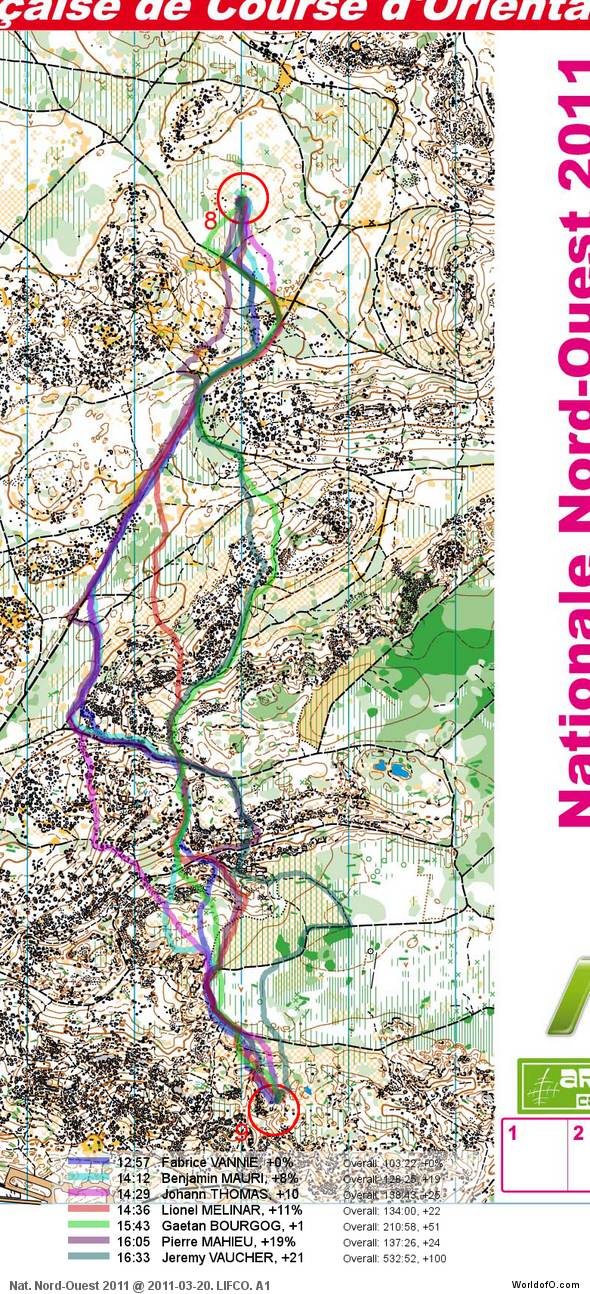
Then you can take a look at how the runners who have drawn their route choice solved this leg below. The most tricky part on this leg is probably to spot where the paths are going between the stony areas. It would probably be easier to choose the optimal route on a contour-only map. Although some runners choose to depart from the big track very early (the two green routes), the best option is probably to stay on the big track all the way until the middle of the leg where the big track departs like the blue, cyan and magenta routes do. This saves you some altitude, and you run just as much on paths.
For the last half of the leg, there are several options, and I would guess that the most direct variant (magenta) is actually just as fast as the blue one which is the fastest of the day. What do you think?
Complete map in Omaps.worldofo.com
You find the complete map and Routegadget info in omaps.worldofo.com at this location.
Omaps.worldofo.com
The ‘Route to Christmas’ series at World of O has been very popular the last years – and I’ve therefore decided to continue the series this Christmas as well. If you have got any good legs in RouteGadget from 2011-competitions – or old forgotten ones which are still interesting – please email me the link at Jan@Kocbach.net, and I’ll include it in Route to Christmas if it looks good. Route to Christmas will not be interesting if YOU don’t contribute.
There will be no analysis about the best routechoice for each leg – you can provide that yourself in the comments or in the Webroute. Not all legs are taken for the interesting routechoice alternatives – some are also taken because the map is interesting – or because it is not straightforward to see what to do on a certain leg. Any comments are welcome – especially if you ran the event chosen for todays leg!
Note that there may be some errors in the Routegadget data (sometimes somebody draws a route for another runner just for fun). Please add a comment below if you spot en error.
 World of O News


