 World of O News
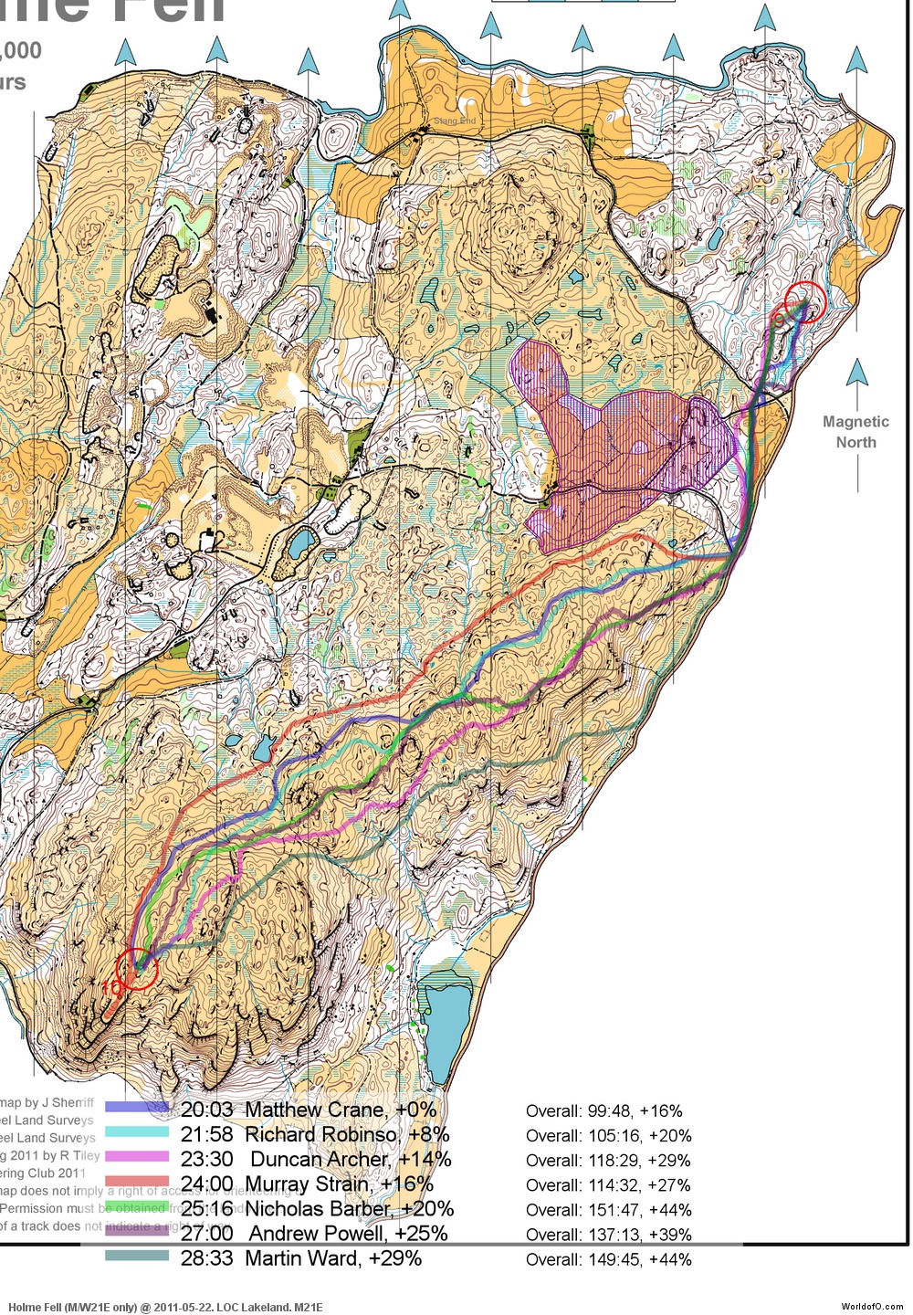
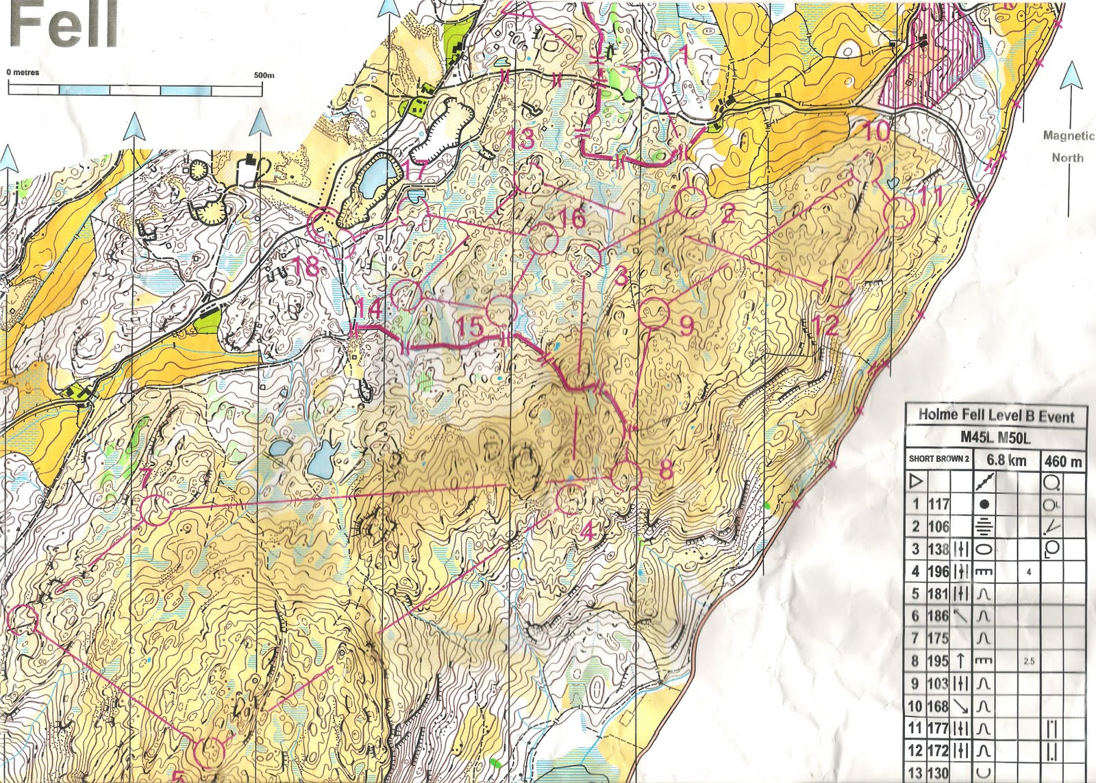
Today’s leg in Route to Christmas is a long leg up in the northern UK on Holme Fell. The event was used as World Champs selection races, and thus there were a lot of top runners present. The terrain is quite marshy, with a lot of contours to be fought. The leg in question is leg number 10 in the Men 21 Elite course.
To get in the mood for the leg, you can read the organizer’s comment after the race (see the full report and results here):
– There cannot be a much more rewarding area than Holme Fell to plan on and almost everyone we spoke to after their runs was very complimentary about the courses, even though many of them found the area tough, both physically and technically. It isn’t often that courses can be planned which maintain a TD5 level throughout whilst providing some subtle changes of terrain and several testing long legs as well as a control-picking series of short legs.
Here is an image from the area to give you a bit of an impression about what it is like.
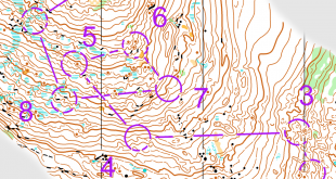
The leg is as usually first provided without routes – you may take a look at it and think about how you would attack this leg (if the image is too small, you may click on it to get it larger). I suspect that the road is forbidden to run on as you can see on this other competition map from the race (but there is a path beside it). From the comments below: The road was out of bounds, and there were compulsory crossing points on the fence half way. This makes a big difference to route-choice. You can see the fence crossing points here.
![]()
Webroute
Next you can draw your own route using the ‘Webroute’ below. Think through how you would attack this leg, and draw the route you would have made. Some comments about why you would choose a certain route are always nice for the other readers.
Then you can take a look at how the runners who have drawn their route choice solved this leg. Unfortunately only a few of the top runners decided to draw their route – so I can’t use that in an analysis. Based on the ones who have drawn their routes, it looks like the best option would be to keep on the western side of the hill – and not be tempted to stay down at the path beside the road for too long. On the other hand, it would be interesting to see how fast it is to take the path by the road all the way to the small lake, and then climb up to the top. There is also the possibility to run around the forbidden area on the western side, but that looks too long as it is now. I think I would have moved the 9th control a bit more to the left if it was my course:) Did you run this event? Do you know anything about which routes were the best? If yes, then please add a comment!
(Note! The 16% behind for total time for Matthew Crane is not true, that is behind a DSQ runner. Crane was less than 2 minutes behind the winner.)
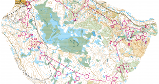
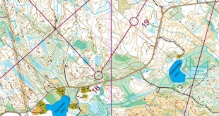
Complete map in Omaps.worldofo.com
You find the complete map and Routegadget info in omaps.worldofo.com at this location.
Omaps.worldofo.com
The ‘Route to Christmas’ series at World of O has been very popular the last years – and I’ve therefore decided to continue the series this Christmas as well. If you have got any good legs in RouteGadget from 2011-competitions – or old forgotten ones which are still interesting – please email me the link at Jan@Kocbach.net, and I’ll include it in Route to Christmas if it looks good. Route to Christmas will not be interesting if YOU don’t contribute.
There will be no analysis about the best routechoice for each leg – you can provide that yourself in the comments or in the Webroute. Not all legs are taken for the interesting routechoice alternatives – some are also taken because the map is interesting – or because it is not straightforward to see what to do on a certain leg. Any comments are welcome – especially if you ran the event chosen for todays leg!
Note that there may be some errors in the Routegadget data (sometimes somebody draws a route for another runner just for fun). Please add a comment below if you spot en error.
The road was out of bounds, and there were compulsory crossing points on the fence half way. This makes a big difference to route-choice.
I’ve show the crossing points as a route
The wall/fence in the first forest is also forbidden, the only way to leave is by the gate (see the real race routes)
Those that ran along the path and climbed late found that they had a long slow slog up the hill along muddy paths. Climbing early meant it was a shorter route and you were able to run for a much greater portion of the leg. Underfoot conditions were generally good meaning fast running was possible.
Staying west towards the end of the leg also saved time as you avoided additional climb and the heather was deep and energy saping higher up the hill from control 10.
I ran along the small path beside the road, nearly to the pond and then cut west before picking up the path up the hill. I recall losing some time at the begining of the leg with faffing around the crossing points, etc. Hill climb was steep, but I did quite like my route.
22:39 +13%
107:54 +10%