 World of O News
Todays leg in Route to Christmas is from Poland – the longest leg in the Polish Championships night orienteering organized at September 27th 2013. Thanks to Rafal Podzinski for both suggesting the leg and preparing a map with routes.
Rafal writes the following in his introduction to the leg: – I suggest the 5th leg from Polish Champs in night orienteering (M21E).The map was perfectly made and the course/terrain were really challenging. The colours on the map correspond with the situation in the forest. In some places it was quite wet, but not that bad in general.
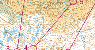
The leg is as usually first provided without routes – you may take a look at it and think about how you would attack this leg (if the image is too small, you may click on it to get it larger):
![]()
Location
You find other maps from the area in omaps.worldofo.com here. See also latest additions in 3DRerun from this area in order to learn more about this terrain type.
Webroute
Next you can draw your own route using the ‘Webroute’ below. Think through how you would attack this leg, and draw the route you would have made. Some comments about why you would choose a certain route are always nice for the other readers.
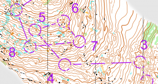
Then you can take a look at how the runners have solved this leg below.
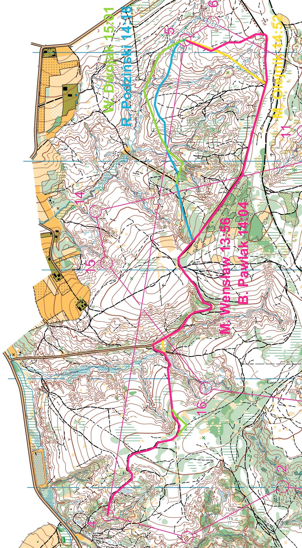
The fastest routes are run to the right – following the road as long as possible and avoiding as much extra height as possible. As you can see, none of the top runners chose an option to the left or direct – the roads and big paths were too tempting. Also you need to do a bit more hills when going direct. Still the direct route (with a slight left bend) looks interesting as it is shorter and does not give that much extra height.
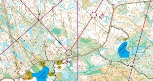
Routechoices of top runners of the complete course
As a small bonus content, Rafal has provided is with route choices and split times for the complete course – served to you below (click to get it larger).
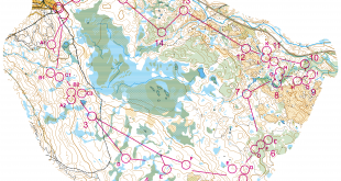
Density map
See below for a density map of some of the ones who have drawn their routes so far.

Route to Christmas series
The ‘Route to Christmas’ series at World of O has been very popular the last years – and I have therefore decided to continue the series this Christmas as well. If you have got any good legs in RouteGadget, GPSSeuranta or 3DRerun from 2013-competitions – or old forgotten ones which are still interesting – please email me the link at Jan@Kocbach.net, and I’ll include it in Route to Christmas if it looks good. Route to Christmas will not be interesting if YOU don’t contribute.
Not all legs are taken for the interesting routechoice alternatives – some are also taken because the map is interesting – or because it is not straightforward to see what to do on a certain leg. Any comments are welcome – especially if you ran the event chosen for todays leg!
Note that there may be some errors in the Routegadget data (sometimes somebody draws a route for another runner just for fun). Please add a comment below if you spot en error.
Particularly interesting leg this morning, nice terrain & map, good route-choice leg. And brand new to me. Thanks Jan and Rafal!
I am not the only one considering the left “out of the map” choice. Would be nice to hear Rafal about this one.
I must say that the leftmost asphalt choice was my first thought. However, I decided that it was too risky (in case of getting lost in the village out of the map).
This is how it looks like outside the map:
http://goo.gl/maps/LiAPL
My choice was about 2850m long and the left one ~3300m. It means that I would have had to go at the average pace of 4:20/km throughout the whole leg to gain the same splittime. I think it’s fairly possible due to the asphalt road almost all the way. If the map had been “full” there, I would have taken this one!
And no informations about the rightest options avoiding extra contours for the same distances. Strange that nobody took this way whereas it seems quite popular for “worldofO chair orienteers”.