 World of O News

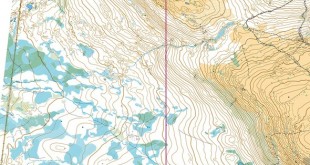
The 2DRerun CoursePlanning Module is a brand new tool for planning orienteering courses – with special emphasis on sprint courses. Focus has been on giving the course setter a fun way to plan courses – which again hopefully will lead to better sprint courses.
The basic functionality has been available in 2DRerun for a long time, but with the separate CoursePlanning module it is now a lot easier to use, you can use local maps without uploading to the server, you no longer have to calibrate the map (it is enough to enter DPI and scale), and there are several simplifications and improvements to the course planning functionality. This tool will not replace OCAD (or your favourite course planning software) – this is a tool which makes it easier to compare lengths for different variants in a nice and visual way.
Quick instructions

See below for an instruction video guiding you through the basics. In short, this is how you use the module:
- Drag a map file (JPG/PNG, GIF should also work) onto the browser window – please use the Google Chrome browser to ensure that everything works as it should. Note that the map never leaves your computer – this is completely safe to use even if you are organizing a major championships and are afraid of the map suddenly surfacing on the Internet.
- Set the DPI and scale of the map. You can change this later on if you find out that you set the wrong DPI/scale.
- Draw a course (or redraw the course if there is already a course on the map)
- Draw route choice alternatives for each leg. For each alternative you get the length of the alternative, and can use this to balance the leg and make better sprint courses.
- In the CoursePlanning module there are function to automatically name the alternatives A, B, C… There is also functionality to modify the course or the variants. See the video for more details – or just open the tool and try without instructions as I would do…
- Finally you can save the course and alternatives. Note that this will NOT save the map. To reload your work, you have to (a) drag the same map over the browser, (b) set the DPI/Scale again, and (c) load the course/alternatives. This might be a bit cumbersome, but there are technical restrictions which make this the preferred way for now.
Developed during Bergen Sprint Camp course planning work
This tool has been developed during the course planning work for Bergen Sprint Camp – and is adapted to the needs you have when planning a sprint course. During the planning of the courses, the main course setters used the measuing tools in OCAD to analyze the legs. The way we could use the 2DRerun CoursePlanning module to measure leg lengths did however make the job a lot easier. Now it is time to give other course setters the same opportunities.
It you have any questions or comments about the 2DRerun CoursePlanning module, please add a comment below. The tools is of course not restricted to sprint courses, but comparing lengths of alternatives is especially important for sprint.


Hi Jan,
thanks for this… we’ll use it to plan our “Oberbayrische Meisterschaften” on an new urban terrain in Jetzendorf.
It really worth to compare and optimize the alternatives before runners do :-)
regards
Veikko
Jan, this is really awesome! Thanks very much.
I did have trouble moving the labels. If I hold Alt then click and drag it moves the whole browser window. If I click and drag and then hold Alt it moves one of the labels, but always the same label. To select a different label I had to hold down Ctrl + Alt and click near a label, then drag and hold Alt to move it. (And I discovered a hidden feature holding Ctrl + Alt will rotate the label.)
I am using Linux. This problem with moving labels seems like a bug, but maybe I am doing it wrong?
@maptalker: This works very well in my Google Chrome browser on windows. It sounds like the problem is that the Alt key has a different function under Linux, and therefore overrides.
And yes, there are lots of hidden features :-)