 World of O News
Today’s leg in Route to Christmas is from the Women Elite course in the Swiss selection long distance race for the second World Cup round – organized May 14th 2015. The chosen leg is the 9th leg.
To match the WOC -81 winners’ speed per km, the selection race winners should have run their courses in 79 min (men) and 72 min (women) respectively. They failed both.
The leg is suggested by former Swiss World Champion Thomas Bührer who was also course setter here. The same race was also suggested by Daniel Hubmann. Thanks a lot to both for suggestions, and to Bührer as course setter for additional discussions about the selected leg. The map is actually the same as the map used for the World Championship in 1981 (quite a few years before Bührer’s big day when he won the WOC Long on homeground in 2003).
Bührer points out an interesting circumstance about the winning times at the WOC selection race compared to WOC in 1991. – The WOC 1981 individual race took place in the same area. Øyvin Thon and Annichen Kringstad were the winners. To match the WOC -81 winners’ speed per km, the selection race winners should have run their courses in 79 min (men) and 72 min (women) respectively. They failed both.
Thus nothing bad to say about the running speed of the old heros 34 years ago. Bührer is also impressed.
– In the WOC race, some other areas were used in addition [to the areas used in this race]. Therefore the courses are not one to one comparable. But still it can be said, that especially Øyvin Thon’s performance was outstanding! Back in -81 I was 13 years old and full of admiration for Oyvin’s race – and still I am.
If you want to take a look at the course from the good old days, you can find it here (but do draw your suggested route for the leg first).
Choose your route
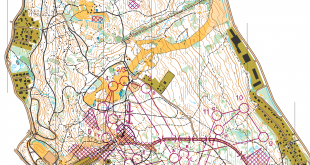
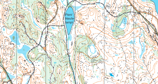
Over to the leg in question. This is the 9th leg in the women’s course, in the last third of the leg. The leg is as usually first provided without routes – you may take a look at it and think about how you would attack this leg (if the image is too small, you may click on it to get it larger):
![]()
Location
You find other maps from the area in omaps.worldofo.com here. See also latest additions in 3DRerun from this area in order to learn more about this terrain type.
Webroute
Next you can draw your own route using the ‘Webroute’ below. Think through how you would attack this leg, and draw the route you would have made. Some comments about why you would choose a certain route are always nice for the other readers.
Then you can take a look at how the runners have solved this leg below.
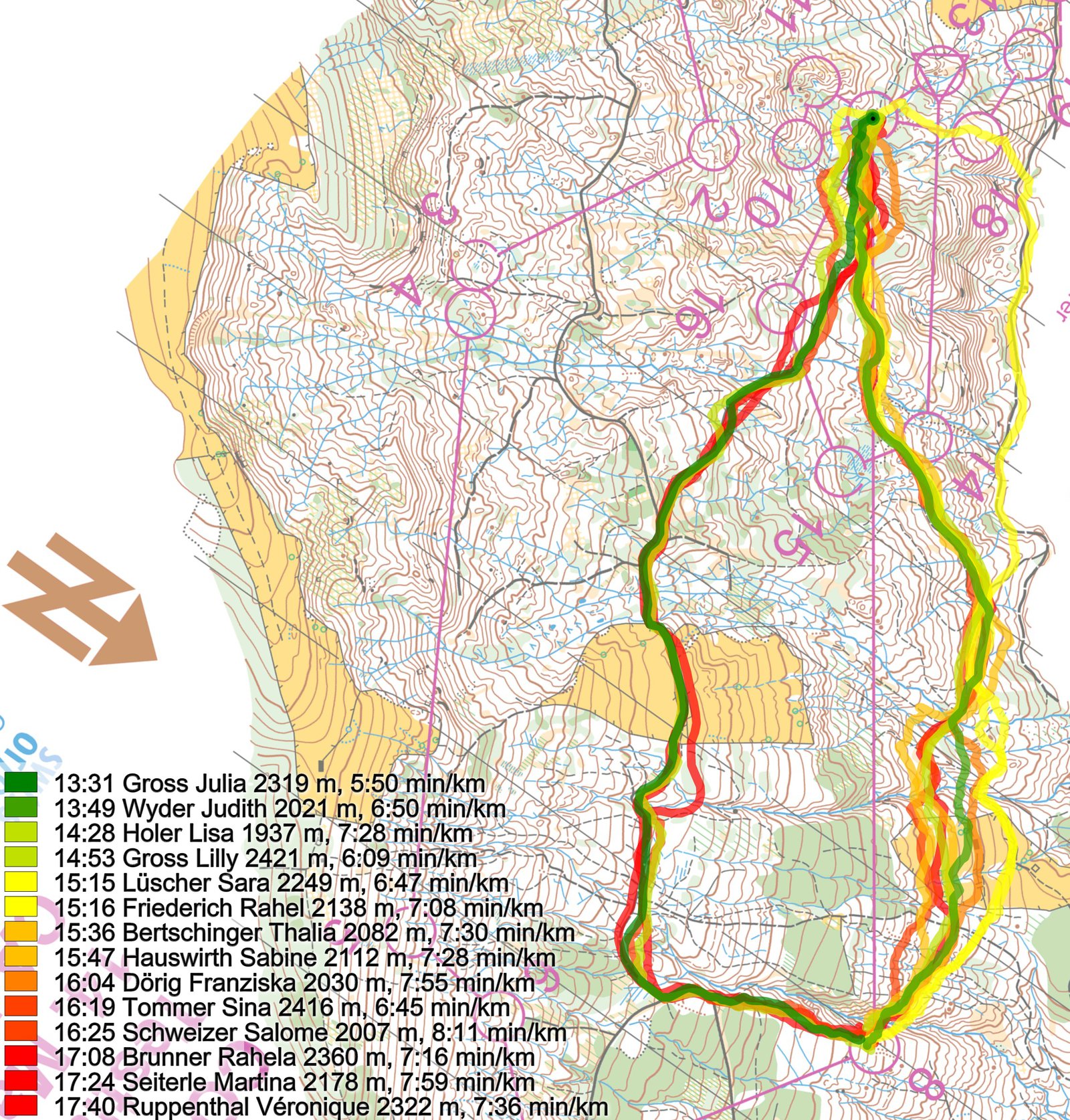
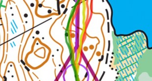
As you can see there are there are three distinct route choices here. Most run either straight or up – and the fastest time is run up. However, as we will see in the analysis further down, Wyder would have been faster direct without a mistake into the control. For better readability the fastest on each of these is shown again below.

Studying the three different routechoices, the upper one (Gross) has around 90 meters climb, the lower one (Lüscher) about 75 meters climb, and the middle one (Wyder) around 65 meters climb. Thus it may be a bit surprising that the lower route of Lüscher is that much slower. Taking a look at Wyder vs. Lüscher shows that they are nearly equal at the middle of the leg, and Lüscher loses all he time up the last hill:
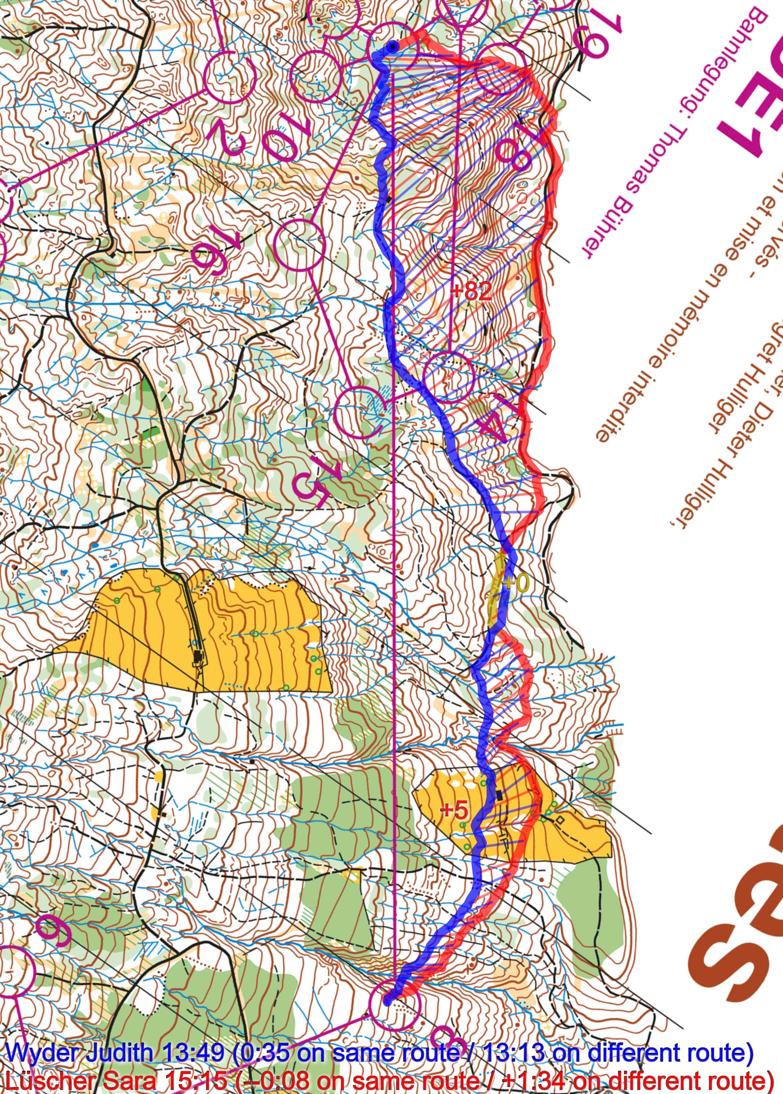
The reason is twofold: (1) Climbing a very steep hill in this terrain costs you extra time – Lüscher especially does not manage to speed up again when it flattens out after the steepest hill and (2) Lüscher makes nearly a minute mistake into the control – even bigger than Wyder’s 25-30 second mistake.
Comparing Wyder and Gross, you can see that 100 meters ahead of the control Wyder was 14-15 seconds faster than Gross. However, she loses nearly 30 seconds into the control (not easy to see that it is that much from the illustration).
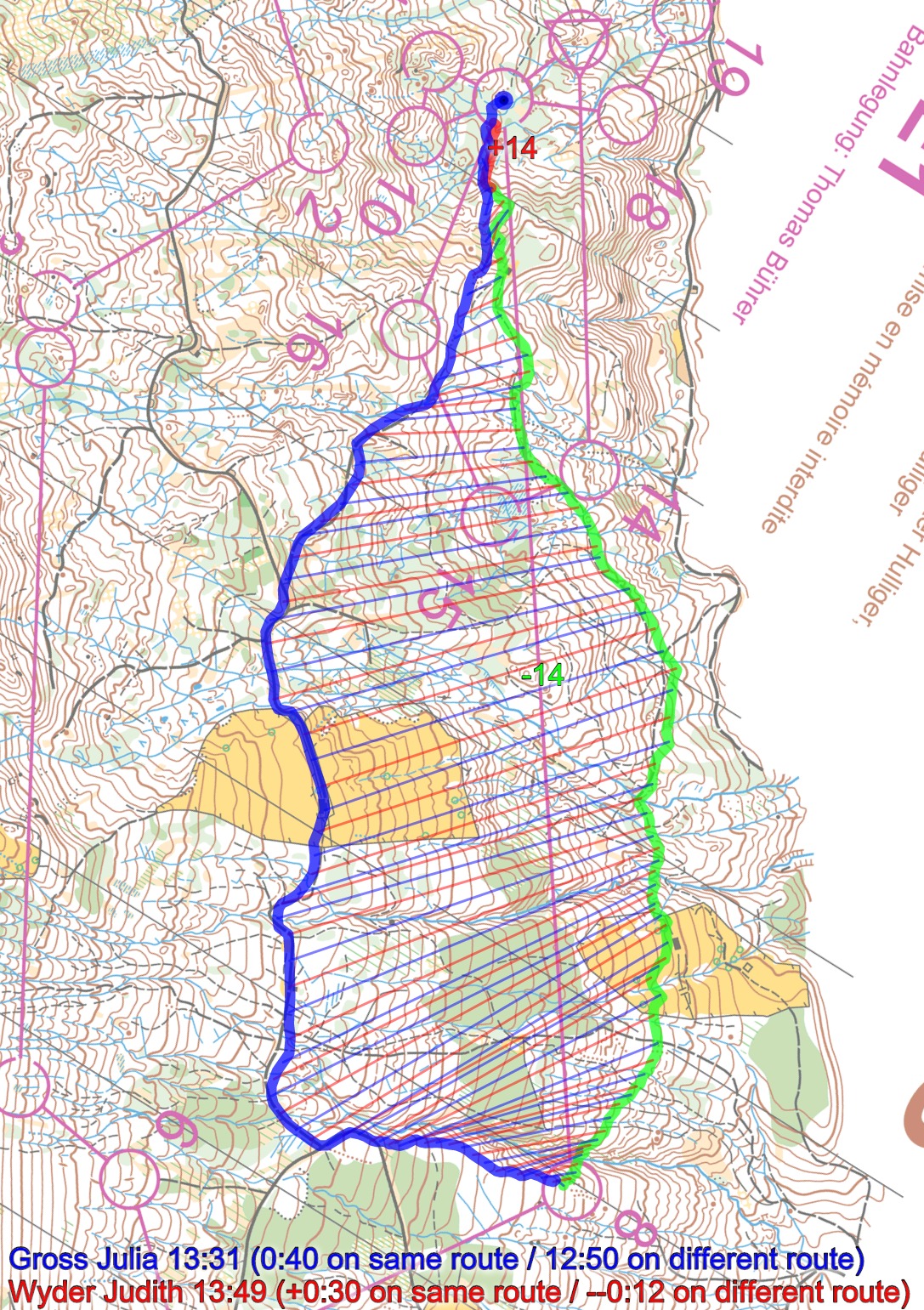
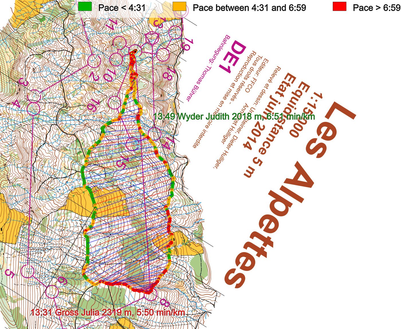
The upper route does make the control easier – that may be a good reason for choosing that route. Generally, however, the direct route should be faster. The final illustration is a pace illustration which shows how the difference in pace along the two fastest routes.
Density map
See below for a density map of some of the ones who have drawn their routes so far.

Additional information
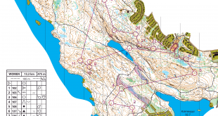
You find the complete map in omaps.worldofo.com at this location.
Route to Christmas series
The Route to Christmas series at World of O has been very popular the last years – giving the readers the opportunity to do one Route Choice Challenge each day from December 1st until December 24th. If you have got any good legs in RouteGadget, GPSSeuranta or 3DRerun from 2015-competitions – or old forgotten ones which are still interesting – please email me the link at Jan@Kocbach.net, and I’ll include it in Route to Christmas if it looks good. Route to Christmas will not be interesting if YOU don’t contribute.
Not all legs are taken for the interesting routechoice alternatives – some are also taken because the map is interesting – or because it is not straightforward to see what to do on a certain leg. Any comments are welcome – especially if you ran the event chosen for todays leg!
34 years, Jan, “only” 34 ;-)
Thanks, just testing you all :)
nice try Jan :-)
thx for your amazing work throughout the year – wish you a nice (“no-work”) Christmas time! all the best for 2016!