In this third part of the series, we look at how to show your position on an orienteering map on your phone – using your phones built-in GPS receiver. In a few years, most mobile phones will come with built-in GPS receiver. This will be the chance for the orienteering community to make orienteering maps accessible also for people outside the community. If used in a good way, this may make it possible to increase the interest for orienteering.
This will be the chance for the orienteering community to make orienteering maps accessible also for people outside the community.
The functionality described in this article is applicable for Android phones and Iphones – but similar applications have been shown on other phones (for example Nokia series 60 phones) earlier. By starting to develop the solutions now, we’ll be ready when the technology comes along in a few years time. The solution described in this article is to be considered as “proof of concept” – to show that it is actually quite easy to get this to work. Building on this work, many interesting applications are possible.
Series about GPS and Orienteering
This article is the third article in a series about GPS and orienteering here at WorldofO.com, exploring what new technology can do to get orienteering and orienteering maps out to more people. The first article considered the conversion of any OCAD-file to a Garmin vector map (.img-file) – usable for most Garmin GPS units which have a map mode. The second article considered how to show orienteering maps on the newest Garmin GPS units (Oregon / Dakota / Colorado) as raster maps using a much more straightforward procedure taking you only a few minutes for a map. This third article considers showing your position on a modern mobile phone with GPS receiver (e.g. the Iphone or an Android phone).
The work described in this article series was done while focusing on making orienteering maps useful and accessible for people outside the orienteering community. In particular, there are interesting possibilities for the “Tur-orientering” concept when orienteering maps can be used directly on a GPS unit or especially on a mobile phone with GPS receiver. I will hopefully get a dedicated project going in this direction during winter time.
What does it look like on the phone?

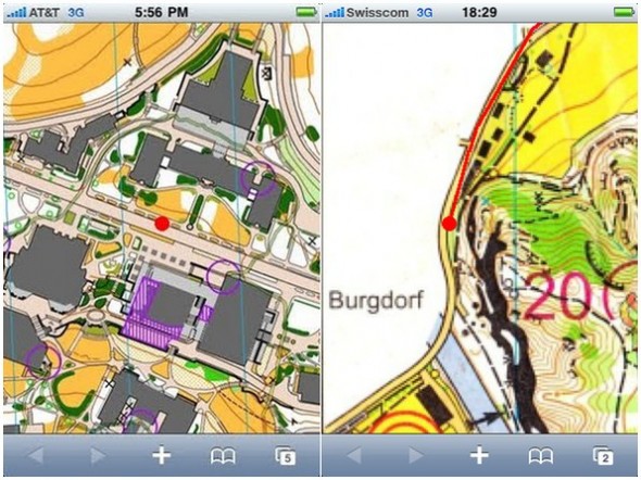
Orienteering Map on the Iphone in the US (left) and in Switzerland (right) using the functionality described in this article.
The functionality is actually a web-application – which means that you use the web-browser of your mobile phone to load the orienteering map. The web-browser determines you position based on data it receives from the GPS receiver, and calculates your position on the orienteering map based on the GPS coordinates.
A red dot shows your current position – being updated at regular intervals
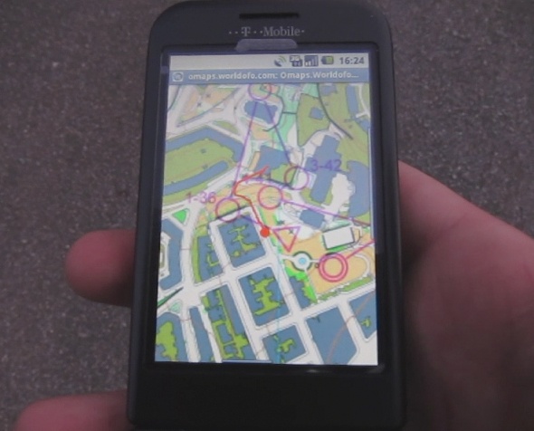
On your mobile phone, you see the orienteering map like you see it on paper. A red dot shows your current position – being updated at regular intervals (every two seconds seconds in the current version). A trailing red line shows your position the last 30 seconds. Depending on which phone you are using, you have the possibility to zoom in and out of the map. In the current test version, your position will always be at the center of the map. You can pan the map away, but at the next position update the map will be centered at your position again (this is a feature which it is easy to change in a later version). Above you see two screenshots from the functionality in use on an Iphone. At the top of the page you see a screenshot from the functionality in use on an Android phone. The links below are short reports/screenshots from people testing the functionality:
You can also see how it works in the embedded video below:
Try it out yourself
If you have got an Iphone or an Android phone – and you are on one of the maps in omaps.worldofo.com which have full location information (look for the “View in 3D” text) – it is easy to test-drive:
- Open omaps.worldofo.com/m/ in the browser of your mobile phone.
- Choose “Closest maps”
- Choose the map which is closest to you
- If you are less than 15 kilometers from the map, you can click the “Experimental” link, and you will get up the map in the browser with your position on.
Remember that this functionality is very experimental – it is only to be considered as a “proof of concept” solution. Please report any problems as a comment below – I am interested in hearing how this works. The “Experimental mode” might be removed later on – but for now it will stay there to give people the possibility to try what the future might look like.
If you need to get a map into Omaps.worldofo.com to testdrive – send me an email to jan@kocbach.net with the map. Functionality to add maps directly to omaps.worldofo.com will be available soon. If you have a Doma map-archive or a Routegadget site missing in omaps.worldofo.com – please let me know the address, and I will include it.
Note! If you get problems getting GPS-signal on your Android phone, you need to turn on your GPS first, and you should start another program using the GPS in the background.
Android application
The functionality described above is a web-application. There are advantages and disadvantages with web-applications compared to phone applications:
- A web-application runs directly in the phone’s web-browser, and thus it is possible to use the same version for both the Iphone, an Android phone, and other phones as well. You reach many people with less work.
- If you want to sell a orienteering map – or a service related to a orienteering map – you should rather use a native phone application which can be sold in the App Market (or Android Market or similar). It is possible to make functionality to sell maps in the mobile web-browser as well, but people will look in the App Market first – and buying an application is much easier.
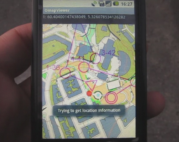
Based on these considerations, I have made a proof-of-concept prototype Android application which does exactly the same as the web-application above, but limited to a single map at the time (see screenshot below). Map size is limited to about 1Mb in the current version, but some extra functionality is added (but not ready for prime-time yet). If somebody is interested in more details, please contact me and I will share.

 World of O News


You should get at least one more prize; to develope our sport!
I think it is important to increase the accessibility of the maps.
I tried your scheme in part I of this thread, to convert an OCAD file to Garmin format. I got the same error 032 about “layer 0 must not be empty” as someone else mentioned. The suggested solution of setting the Coordinate System did not help me. My map is already set to the British National Grid. Does it have to be UTC?
@Alexander: You might try to set it to UTC just to see if it goes through the conversion process (it will get the wrong position, but don’t bother for now). This error message is given by ocad2mp, which I use as part of the process – I haven’t got full control of all the quirks of that program.