 World of O News
Todays bonus leg in Route to Christmas is again from Switzerland – this time it is leg 8 in the Men 21AL course from the 8. TMO at September 19th 2010. The leg is as usually first provided without routes – you may take a look at it and think ...
Read More »Monthly Archives: December 2010
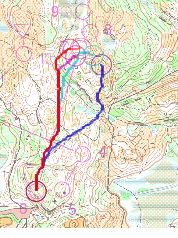
Route to Christmas: Bonus 5 2010
Todays bonus leg in Route to Christmas is from Switzerland. The chosen leg is leg number 10 in the Men 21AL course from the 9. TMO CTCO at September 26th 2010. The leg is as usually first provided without routes – you may take a look at it and think ...
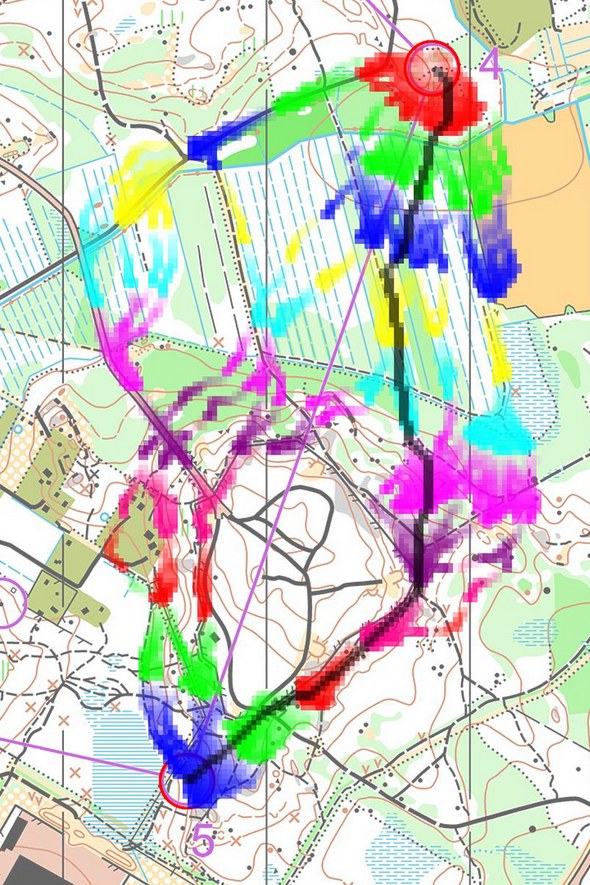
Read More »Route to Christmas: Bonus 4 2010
Todays bonus leg in Route to Christmas is from Czech Republic. We are again visiting the Gigasport event of May 15th – and today we are looking at leg 4 in the Men 21E course. The leg is as usually first provided without routes – you may take a look ...
Read More »Route to Christmas: Bonus 3 2010
We have got another bonus leg in Route to Christmas from the German Championships long distance. Today we are studying leg 3 in the Men Elite course. The leg is as usually first provided without routes – you may take a look at it and think about how you would ...
Read More »Route to Christmas: Bonus 2 2010
Another Bonus leg for Route to Christmas 2010 from Germany: Todays leg is leg number 16 in the HE course of the German Championships long distance in Siegen on October 2nd 2010. The leg is as usually first provided without routes – you may take a look at it and ...
Read More »Route to Christmas: Bonus 1 2010
Today we have a bonus leg in Route to Christmas – a leg from the final of the German Championships sprint. The main part of Route to Christmas 2010 is finished – but some of the legs which didn’t make it into the Top 24 were interesting enough to make ...
Read More »Route to Christmas: Day 24 2010
What would be more fitting than to present a leg from The Course of the Year 2010 – Jukola – at the last day of Route to Christmas 2010? And as a big bonus, you get the winner interview from The Course of the Year 2010 – an interview with ...
Read More »Route to Christmas: Day 23 2010
For the second last day in Route to Christmas 2010 we return to Czech Republic. The leg is from SAXBO 2010 in stony terrain in Czech Republic with quite some hills. Leg number 2 from the H21L course is chosen. The event was organized on May 1st 2010. Today we ...
Read More »Route to Christmas: Day 22 2010
Todays leg in Route to Christmas is from the World Championships middle distance final in Trondheim, Norway. This course has got a lot of negative remarks in the orienteering community, but it still contains some interesting legs. One of these legs is leg number 7 in the mens class, which ...
Read More »Route to Christmas: Day 21 2010
Todays leg in Route to Christmas is from the first competition in the Nordic Tour in Finland. The leg is not as long as the legs of the last days – it is rather chosen because this is the event I have found with the most GPS units applied [77(!) ...
Read More »