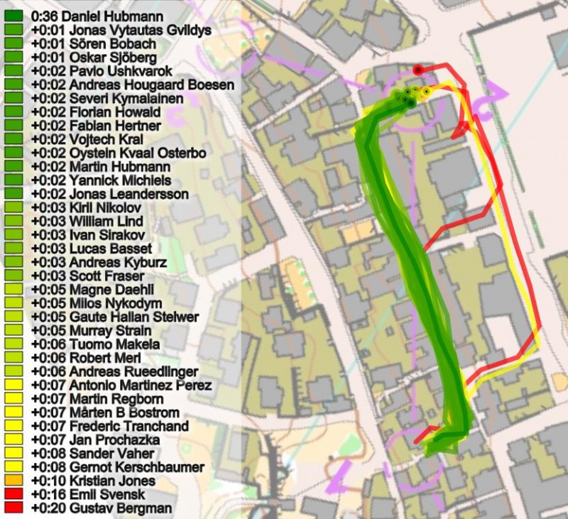
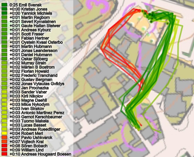
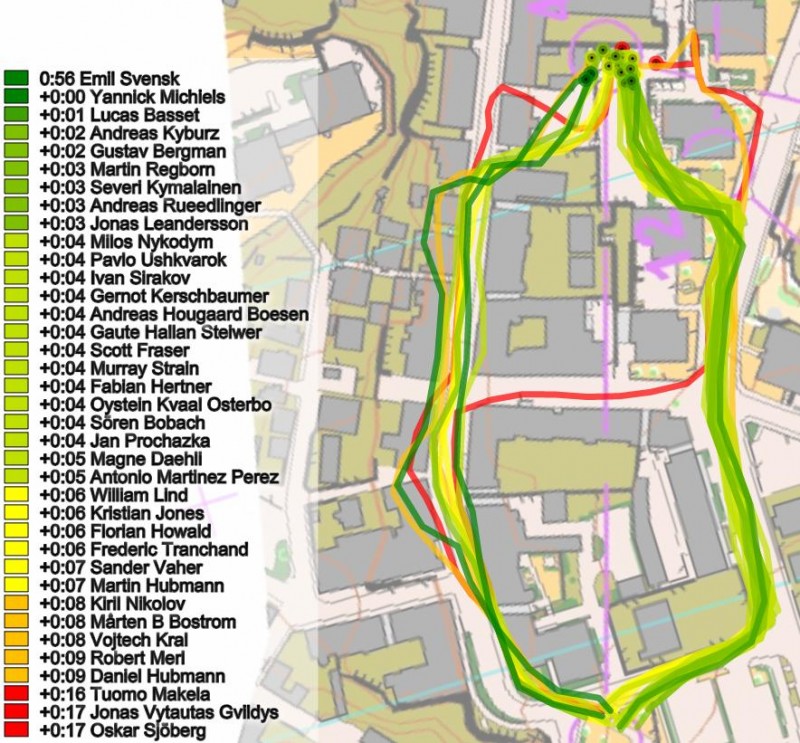
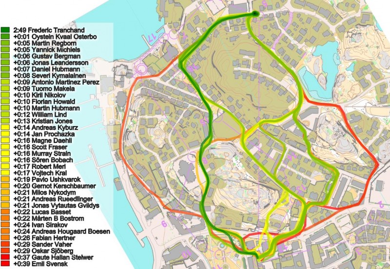
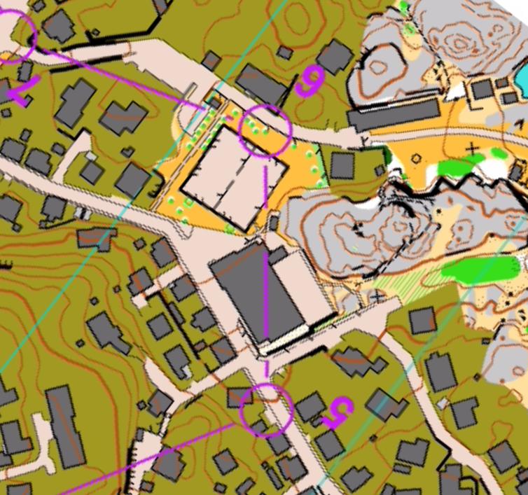
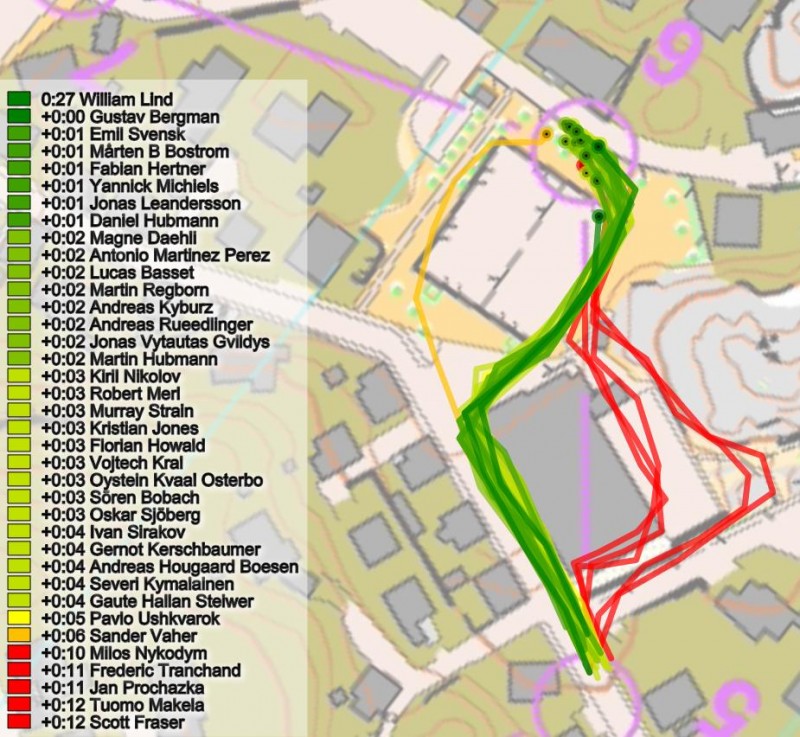
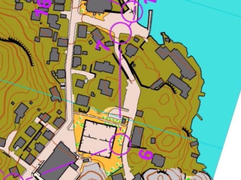
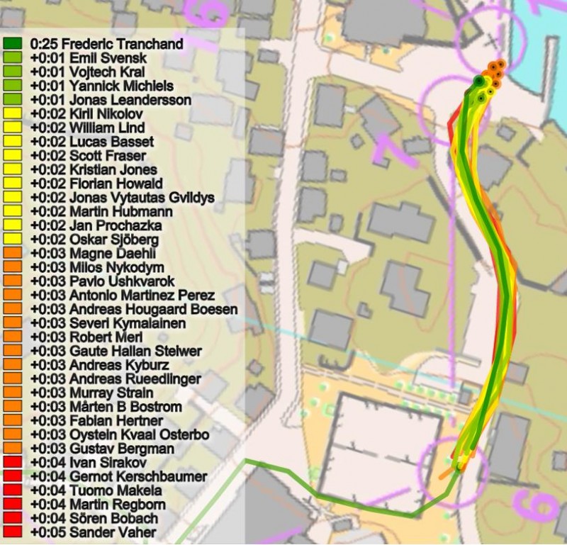
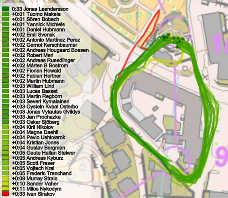
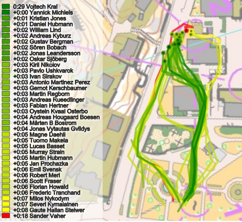
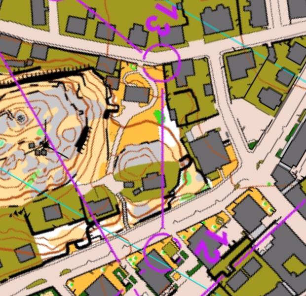
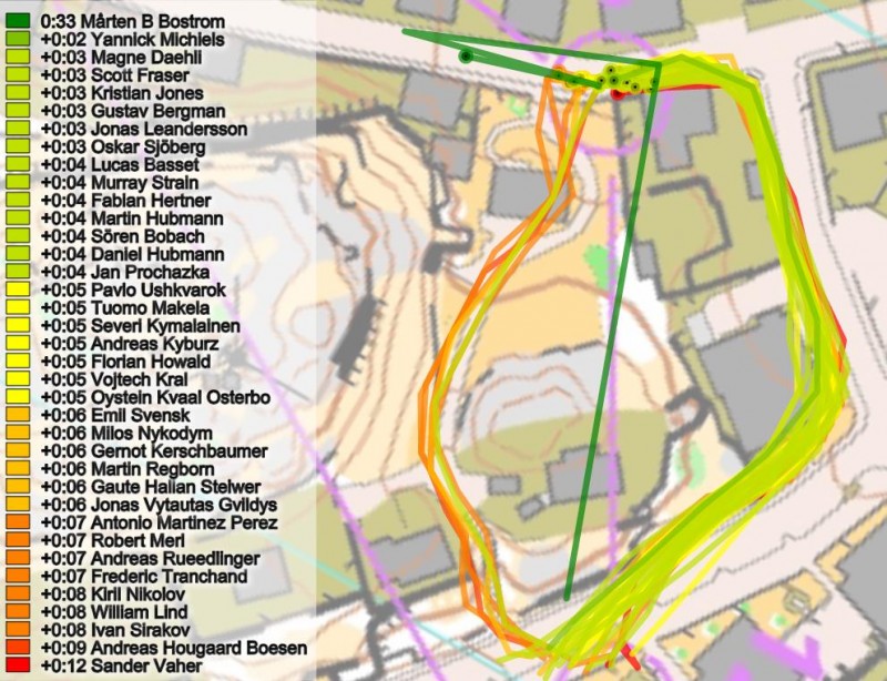
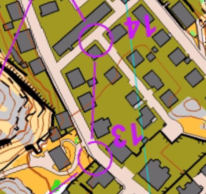
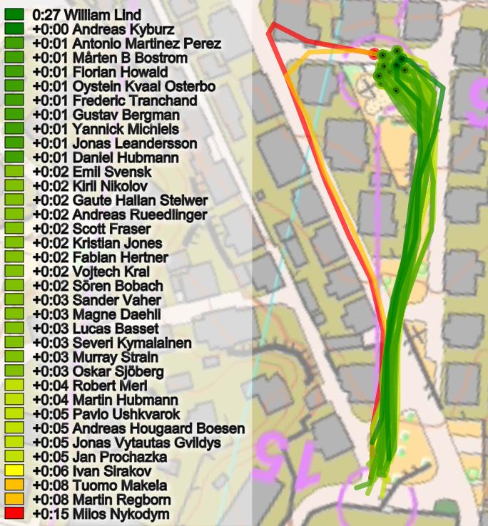
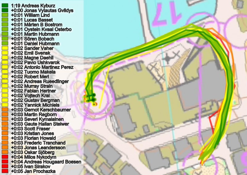
The most interesting legs in the cancelled World Cup sprint in Lysekil were leg 2, the long leg to control 5, leg 6, leg 8, leg 9 and leg 11. For these legs a significant part of the start field chose a slower route than the ideal route – and it is also easy to see from the GPS-data and split times which variant is fastest.
But first a quick analysis of the decision points with respect to the victory. Note that there are some issues with missing split times for various runners and splits. For the GPS-data in 2DRerun see here.
Decision points for the victory
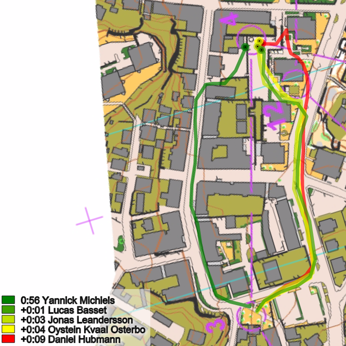
Yannick Michiels had high speed all the way and won 5 legs. Jonas Leandersson in 2nd at +0:09 had nearly the same speed, and lost maximum 3 seconds to Michiels on any control (the 4th control) – for other controls less than 2 seconds is lost. For Daniel Hubmann in third (at +0:17) the situation is similar, although the Swiss lost 9 seconds at control 4 – for other controls less than 2 seconds is lost. While Hubmann does an actual mistake to the 4th control, Leandersson takes the rightmost route which can be run in nearly the same speed as Michiels (Basset runs right only 1 second slower than Michiels left route).
 le
le
For Matthias Kyburz in 4th (at +0:22) the split times are missing, while Øystein Kvaal Østerbø in 5th lost a maximum of 4 seconds on any control – the 4th control also here being the control were most time is lost. Below a comparison between Michiels and Leandersson is shown. As can be observed the speed is very similar, but Michiels has a higher opening speed, giving a 6 second lead at the 4th control. The second half of the course after the arena passage Leandersson is faster – partly due to Michiels wrong route choice to control 11 (going left, losing 5 seconds to the fastest split).
Map Quality
There have been some discussions about map quality in sprint races – and several of the top runners were not impressed by the map quality at the World Cup sprint in Lysekil. One athlete who expressed himself very clearly on the issue is Swiss Daniel Hubmann (see Tweet below and a separate article about it here).
Never ran a WC-Sprint on such a bad map. Too many thicknesses of lines. @IOFOrienteering controlling failed again! pic.twitter.com/XOha3RhXFp
— Daniel Hubmann (@dhubmann) June 9, 2015
Illustrations: Leg by leg
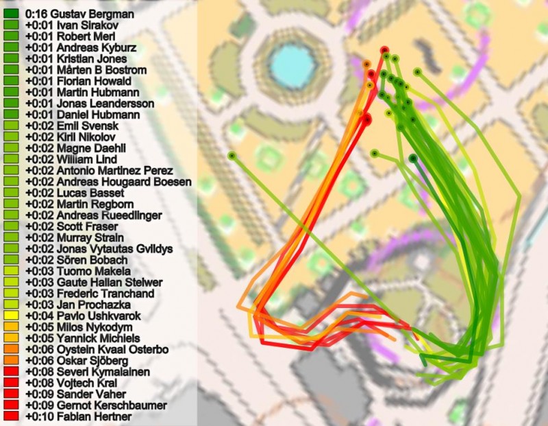
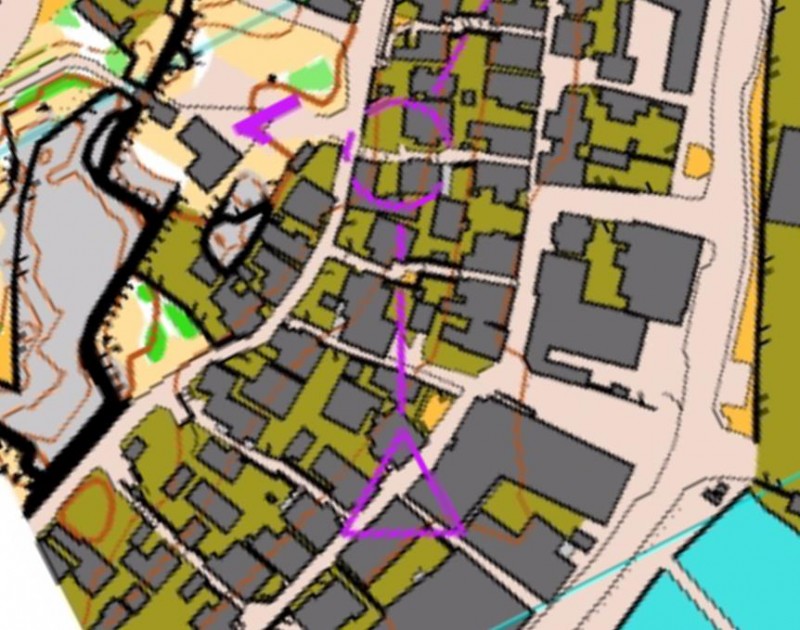
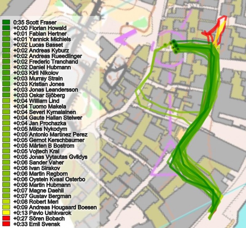
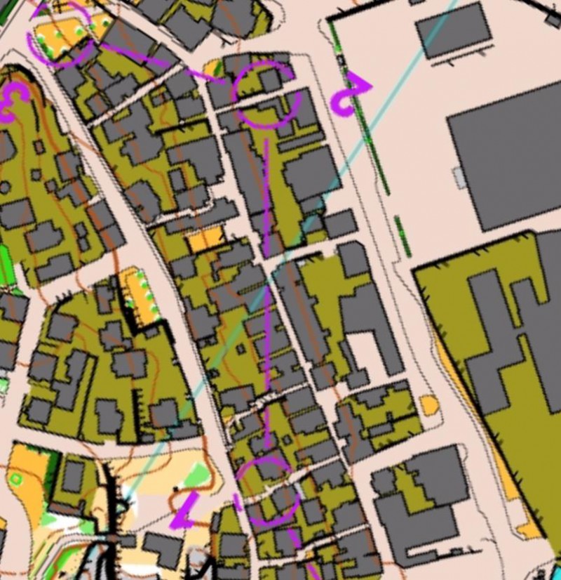
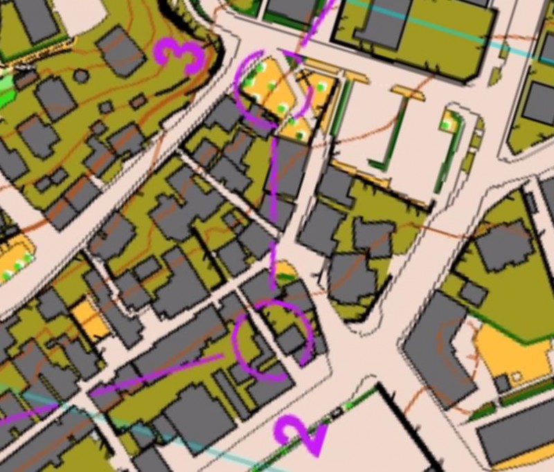
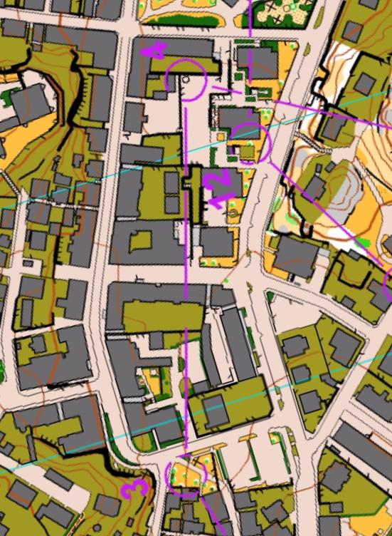
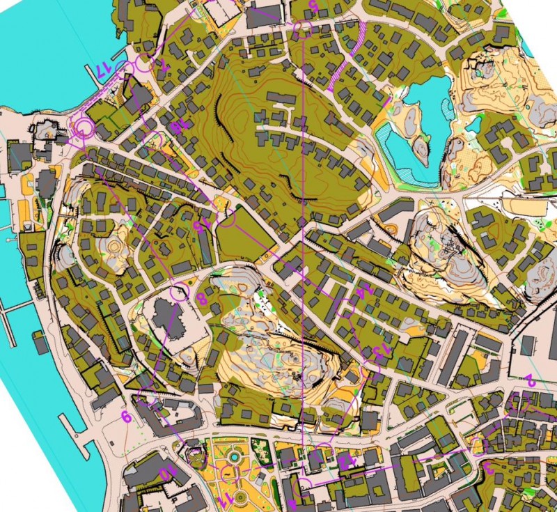
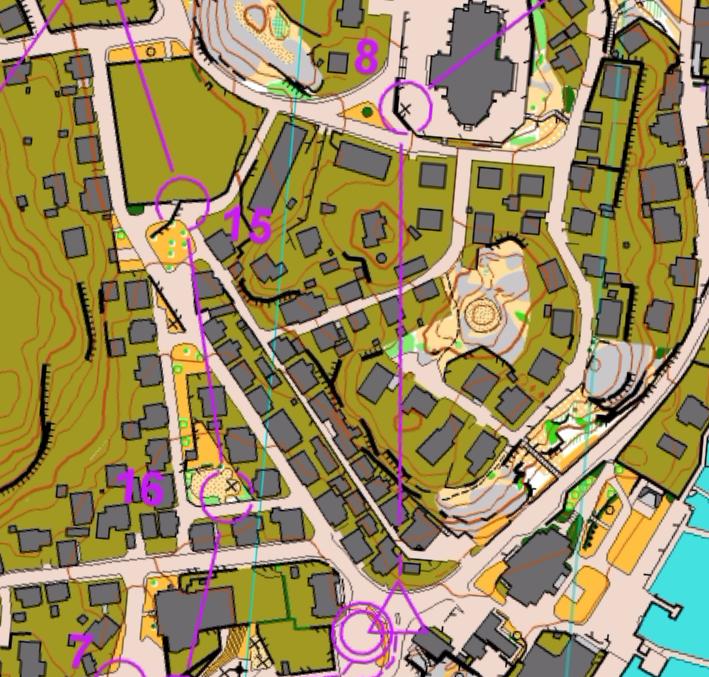
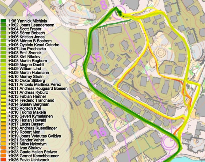
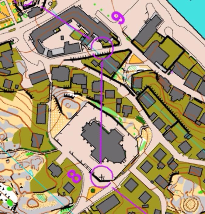
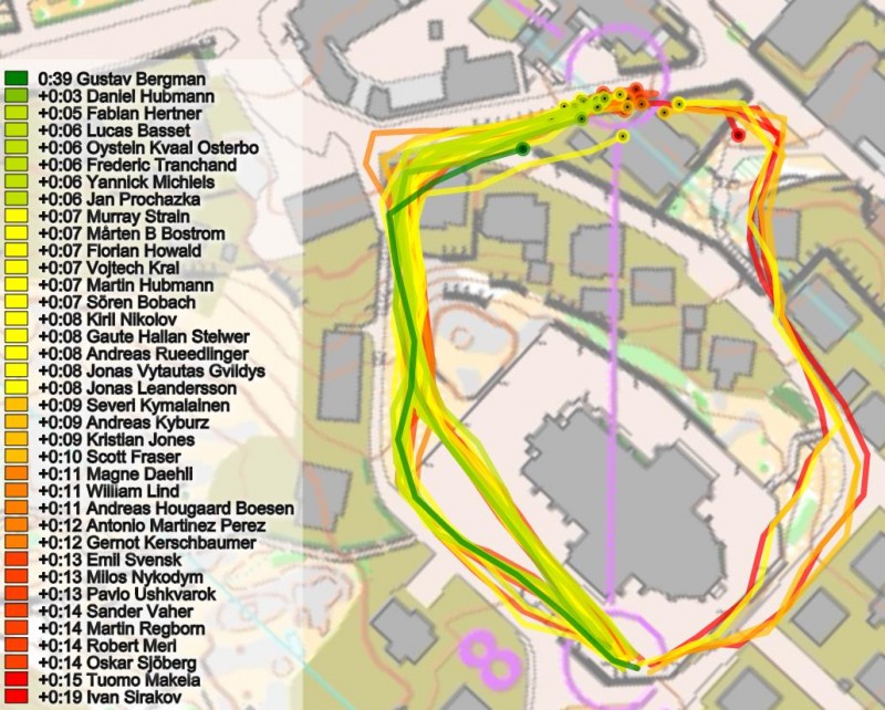
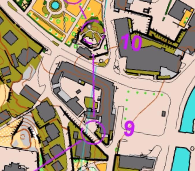
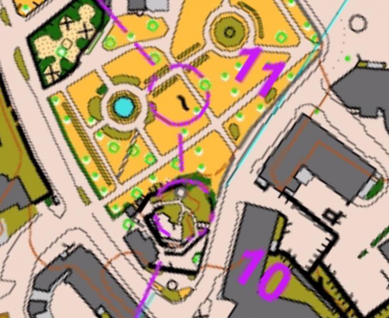
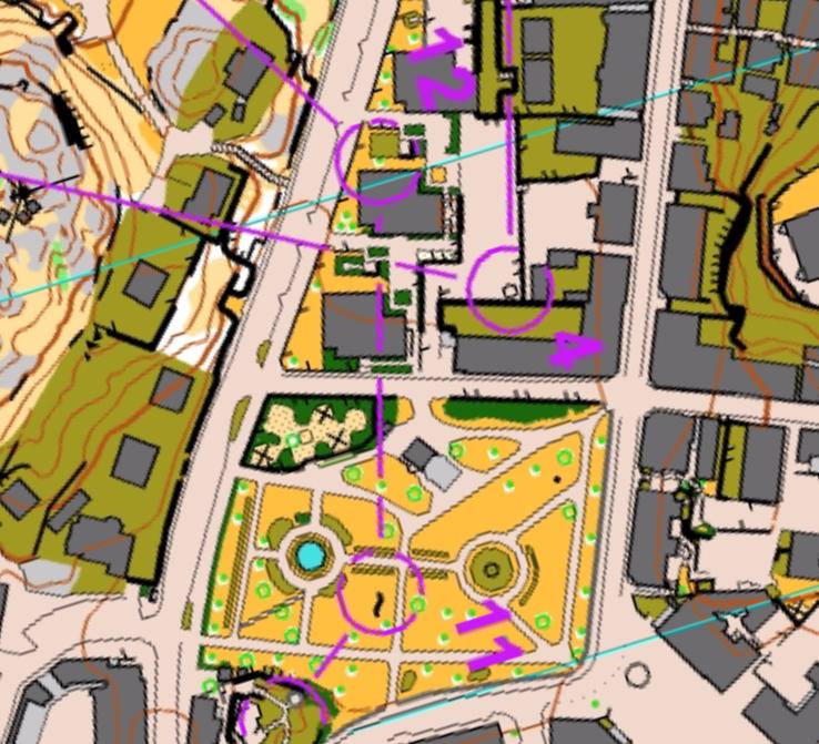
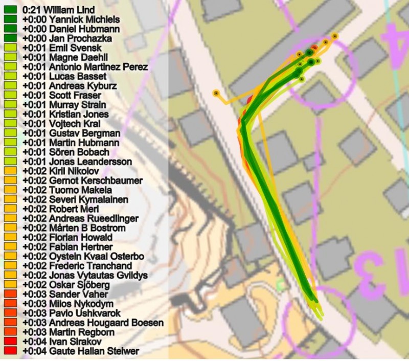
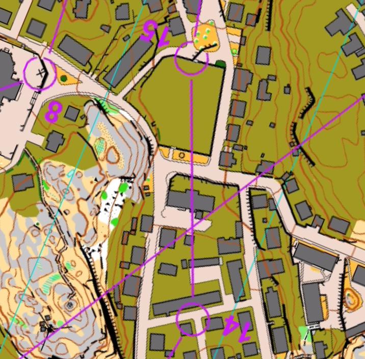
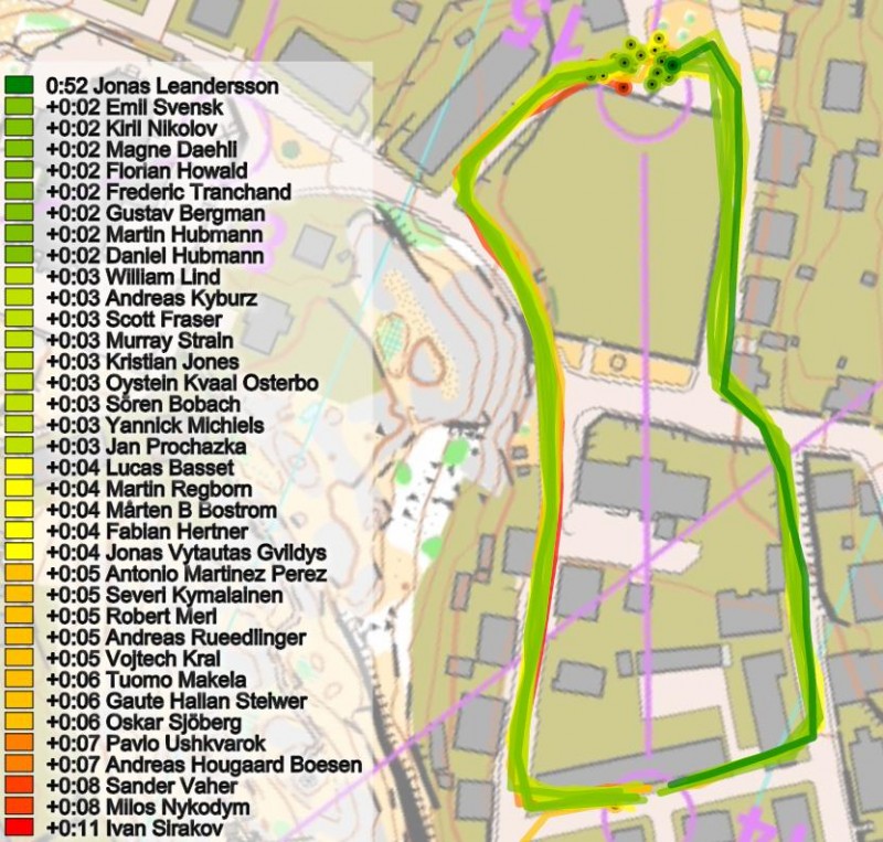
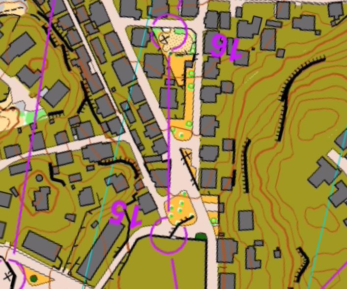
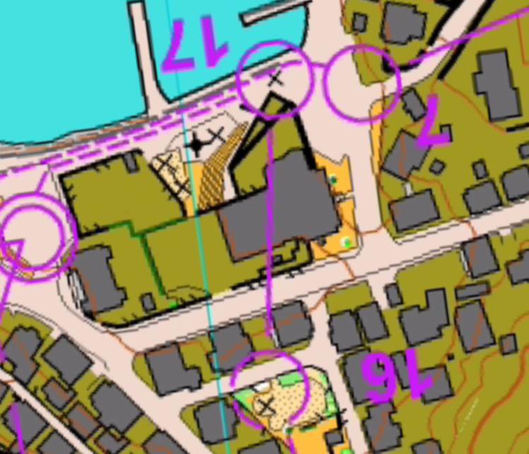
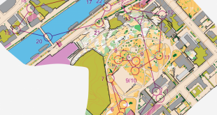
Below each leg is first provided first without any routes and then with the routes of the GPS-tracked runners along with split times from the timing system. From the colors (green = fast, red = slow) it is easy to see where there are significant differences for the different route choices – and which route was fastest. No text-based analysis is provided.
 World of O News



Great article format: really quick to use for learning.
Thanks! Further comments on various legs are of course always of interest. Especially here where I didn’t find time to do a full analysis myself.
And the women are coming shortly :)
The event wasn’t cancelled, it was voided. Cheers, A
Thanks for the correction of my English language. Voided is the correct wording, yes. I’ll remember until next time – but I hope I don’t need it again ….