 How do you orienteer and plan your routechoices in the terrain used for OO.cup in Slovenia? OO.cup 2008 – staged from July 23rd until July 27th 2008 in the western part of Slovenia – is one of the events featured in the article series “Top Multiday O-events 2008″ at World of O – giving you event presentations with a special twist! Read more about the “Top Multiday O-events 2008″ feature articles here – including information about how to submit your event. The content in this article is written mostly by the organizers, and World of O is not responsible for any inaccuracies – and the spelling errors.
The terrain – and how to master it!
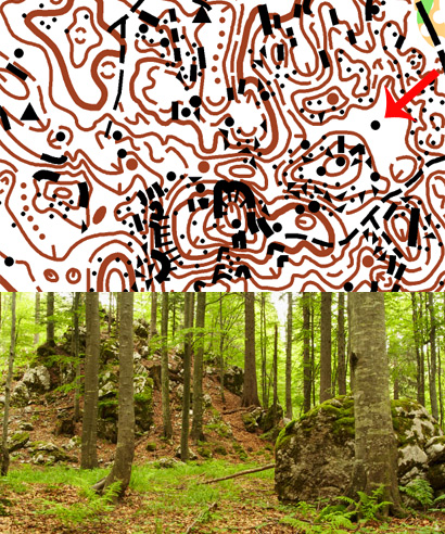
There will be 3 terrain types in OO.cup/08, but here we will describe the one which is probably the most interesting. The map extract below is from a typical karst terrain. The only way to master this type of terrain is to be really careful with your orienteering, and to work hard on simplification.

Typical routechoice challenges
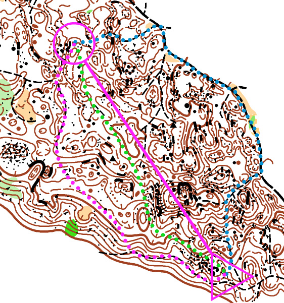
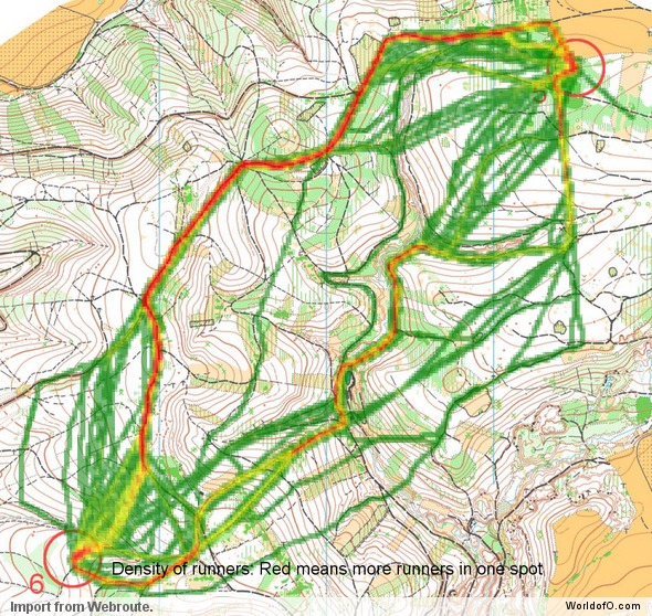
The first stage (also WRE) will be middle distance and this is the kind of leg which you can expect:

- PURPLE: This is a rather safe route, 580m long. The idea is to follow the small paths – simplifying the navigation and taking advantage of the faster speed you can develop comparing to the terrain running. Small paths can be tricky, though, and very easy to miss!
- GREEN: Probably the fastest route, 480m long. Not just that it’s fastest, it also gives you the most pleasure, as you have to navigate through intricate forms and try to simplify them. One should always try to avoid stony areas on this map, as when it’s drawn stony it’s really stony. Try to navigate on positive forms like hills and ridges, since, unlike depressions, you can spot those from farther distance.
- BLUE: Or the chicken route :). 680m long. This is fast running and a bit less thinking. Often it will be possible to approach controls by paths. But we will do our best that it will not be worth it!
Why choose OO.cup 2008?
… you can be sure we make no compromises regarding terrain and maps
As always since 2002, we will try to deliver a race in top terrain and on high quality maps. Races of OO.cup/08 will be staged around Ajdovščina, which is situated in the west of the country. Runners will have a chance to experience orienteering in karst forests at different speeds and with different navigational challenges. OO.cup is known as an event organized in a somewhat spartan manner but in friendly and relaxed atmosphere. Coming to OO.cup, you are not to expect luxorious Finish area, but you can be sure we make no compromises regarding terrain and maps.
OO.cup: A lot more than only orienteering!
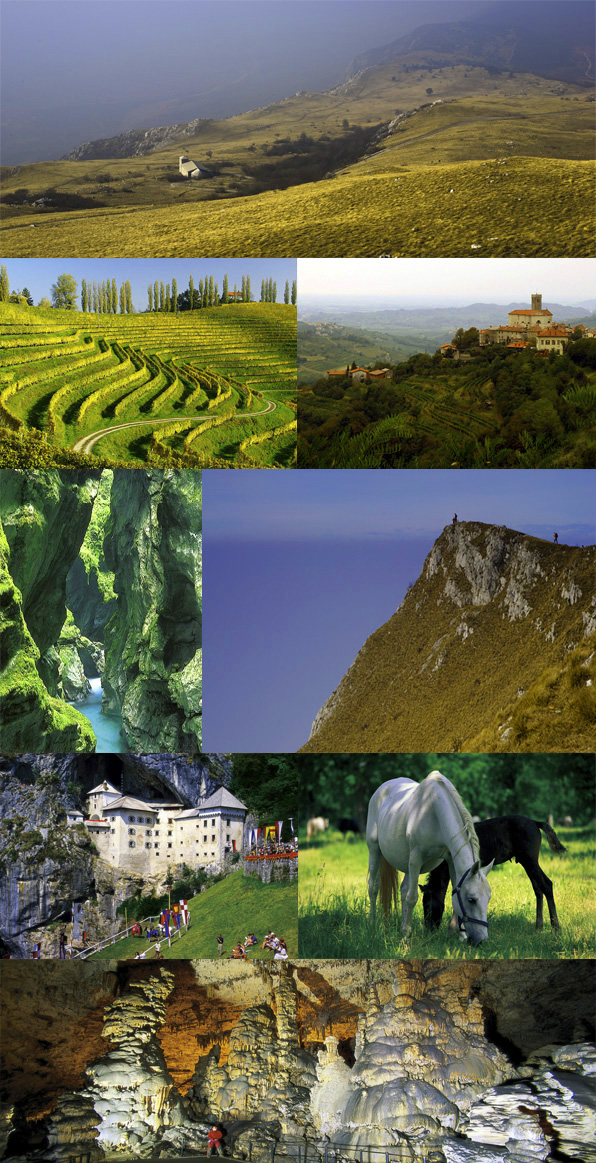
Hiking and cycling possibilities are rather good in the area. Just above Vipava valley there is a big plateau with highest point Nanos (cca. 1300m). This is a great place for hiking (pictures 1 & 5 below). Very close to Ajdovščina (direction Kras) there are also many small roads with sparse traffic, which are great for cycling. In the area there is also a so called Wine road, by which it is possible to travel and visit farms with home made wine (pictures 2, 3).
Then in the circle of 30-50 km from Ajdovščina you can reach the following: Triglav national park and Soča River (both just 30km from stages 1, 2), Postojna cave (just 10 km from stages 4 & 5, pictures 6, 8), Škocjan caves (UNESCO), Lipica (famous for Lipizzaner horses, picture 7), Adriatic coast (Slovenian or Italian …) and many other points of interest (even Venice is no more than 165km by highway).

 World of O News
