 World of O News
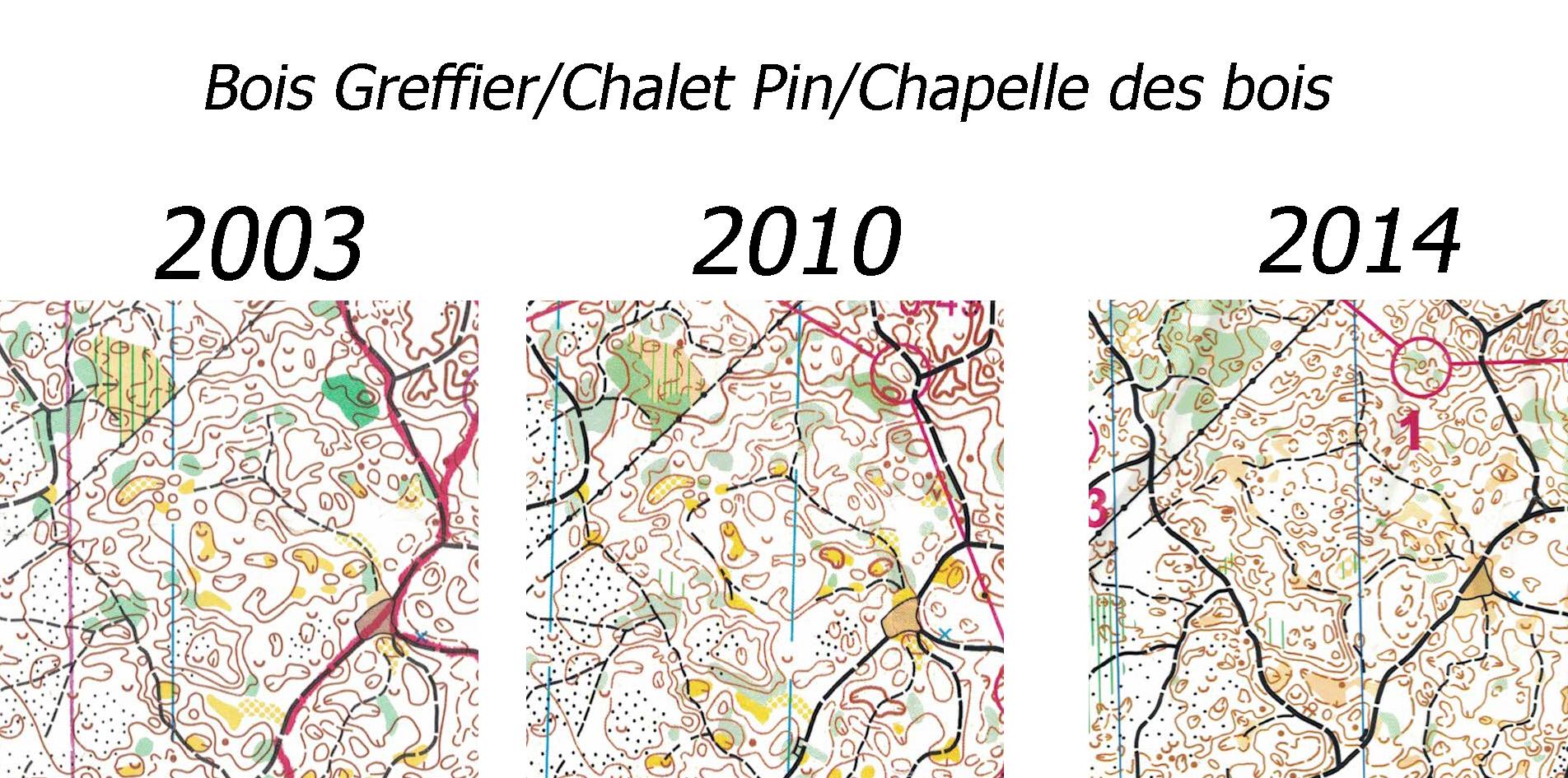
Orienteering maps have changed a lot the last 10-15 years – especially in very detailed areas with more detailed base maps and LIDAR data available. Remo Ruch has posted a very interesting example to the Facebook-group “Orienteering Mappers Int.”.
On “Orienteering Mappers International” Ruch showcases the development of the Chapelle de Bois map from 2003 via 2010 and up to 2014. The changes from 2003 to 2010 are minor; mostly the addition of more vegetation details. In 2014 a lot of extra contour details have been added, making the map very tricky to read in parts.
What do you think about the development of orienteering maps? Which map would you have liked to run on? See the complete map (newest version) below.
Relais de Pentecôte - Mass Start

» See map in omaps.worldofo.com


I prefer to run on the new map. I do not see any problems with more details on the maps (and even like it), until (1) it is readable, that is, it satisfies ISOM requirements on the size of symbols and gaps between them, and (2) it is not confusing, that is I see in reality what I expect to see after looking at the map.