World of O News
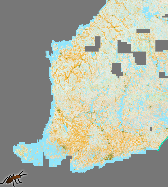
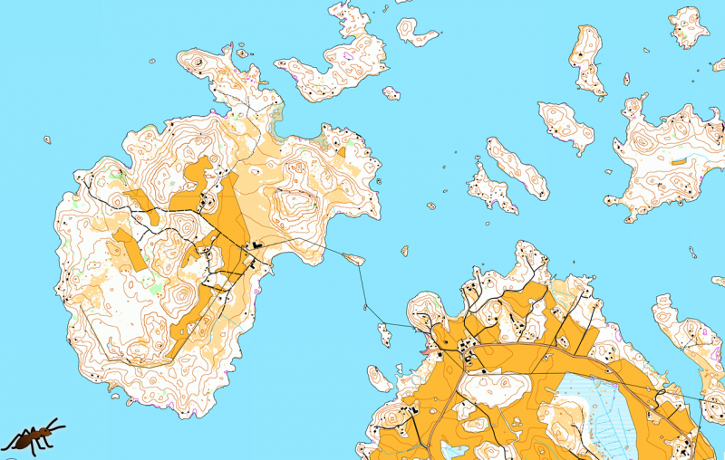
Jarkko Ryyppö, Joakim Svensk and Mats Troeng have made an orienteering map of nearly all of Finland based on publicly available laser scanning data and topographic maps from the National Land Survey of Finland using Karttapullatin. What an effort!
In comparison, a human mapper spending 30 hours per square kilometer would map the entire Finland in about 3500 years, if working 8 hours per day
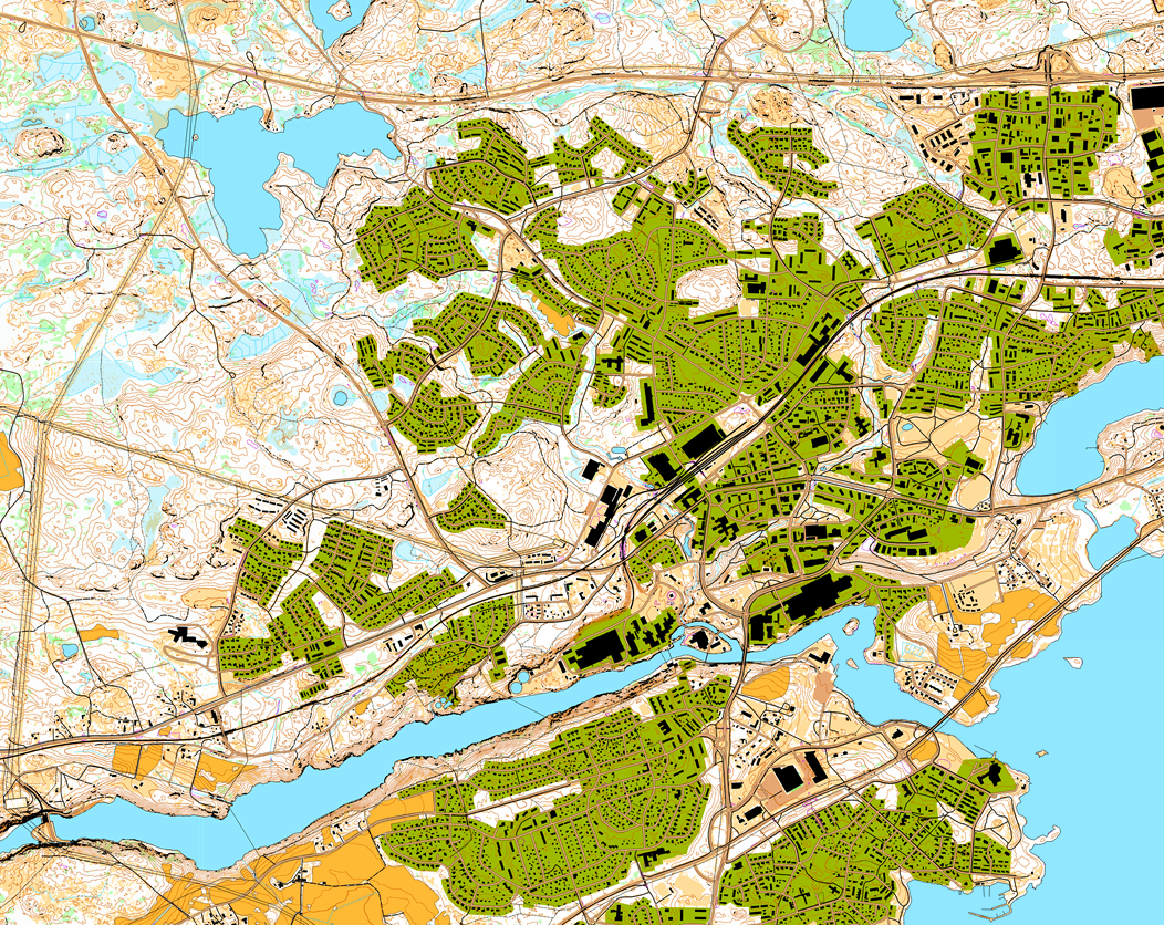
According to the MapAnt website, this is the most detailed and information-rich map available that is covering the whole country of Finland. – Its name is inspired by the way it was compiled: the about one-hundred computers involved were acting as ants in an anthill, working together in a structured chaos to construct something bigger than they were able to achieve on their own.
MapAnt writes the following about the generation of the map:
The map contains almost all types of features present in human-made orienteering maps. Contour lines (2.5 m interval), open land and dense vegetation is extracted from laser scanning data acquired between 2008 and 2016. The vegetation for early scanned areas might have changed quite a bit over the years. Some areas have been scanned during summer, which affects the vegetation mapping and contour quality due to leaves on the trees.
To summarize, the quality of a human-made map is still a few levels higher
Private land, fields, buildings, roads, paths, railways, lakes, streams, marshes, cliffs, and so on have been extracted from topographic maps in scale 1:10 000. There are a few orienteering map features that are not present in MapAnt: boulders, fences, pits, small depressions, small marshes, and other small features. Negative contours, i.e. depressions, are shown in purple. To summarize, the quality of a human-made map is still a few levels higher.

As Finland covers almost 340 000 square kilometers, one needs to wait roughly eight years to get it all done on a single computer
Constructing an auto-generated map with the detail level of MapAnt is a computing-intensive process. In average, it takes the Karttapullautin software about one hour to generate a ten square kilometer map when running on a decent computer. As Finland covers almost 340 000 square kilometers, one needs to wait roughly eight years to get it all done on a single computer. But we were more impatient than that. The solution: parallel computing. With 100 multi-processor computers – acting as the ants of the anthill – we were able to cut down the time to three weeks. In comparison, a human mapper spending 30 hours per square kilometer would map the entire Finland in about 3500 years, if working 8 hours per day…
Trying to put this number into context, printing 10 TB of data as text on paper would require about half a million trees
The steps involved included downloading laser scanning data and topographic map data, dividing the labor on the Karttapullautin processing computers, and creating about four millions of 256×256 pixel tiles at different zoom levels. The combined image size for the highest zoom level is 150 gigapixels, with a resolution of 0.7 pixels per real-world meter. In total, about 10 TB (terabytes) of data were processed. That’s pretty much. Trying to put this number into context, printing 10 TB of data as text on paper would require about half a million trees. The pile of A4 papers would be 150 kilometers high when printed on both sides. And the map of Finland would have been more yellow.