World of O News
3 Days from now the World Orienteering Championships 2016 (WOC 2016) starts with the individual Sprint in Strömstad, Sweden. We continue the countdown to the championships here at WorldofO.com continues with a look at old maps and terrain for the WOC 2016 races.
The central part of any orienteering competition – event the World Championships – is the terrains, the maps and the courses. This short preview article takes a brief look at the terrain the athletes will meet at WOC 2016 – and the available orienteering maps of the competition areas.
In addition to providing old maps of the competition areas, the organizers have this year provided automatically generated maps covering the embargoed areas. Using a LiDAR-based elevation model and the Swedish Land Survey’s Fastighetskartan product, a computer is used to automatically generate orienteering maps. Above is part of the map from the WOC 2016 Middle distance area.
See also: WOC 2016 Bulletins with all information about the races.
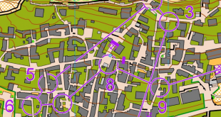
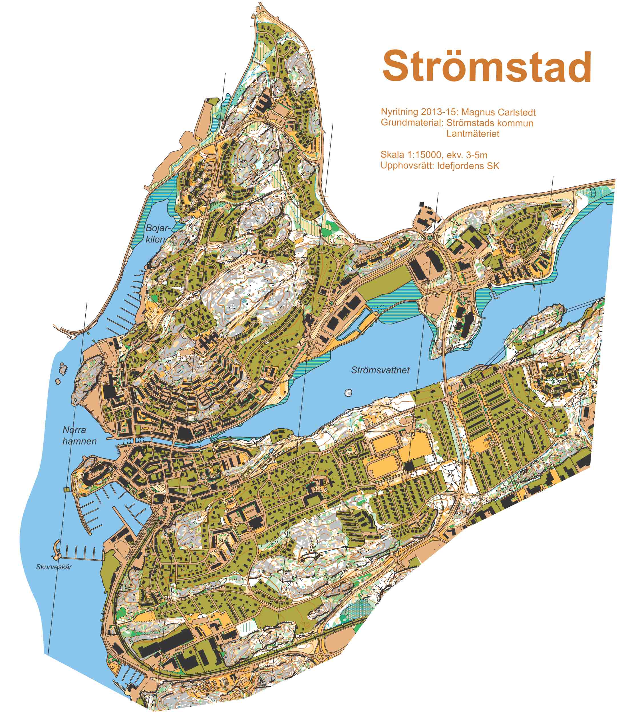
Sprint and Sprint Relay
The sprint races (Sprint qualification and final on Saturday, Sprint Relay on Sunday in the Strömstad area) are held in urban area with some narrow streets, small forested areas and some areas of grass and lawns. Th area also includes hilly parts. Approximately 80% of the course lengths will be on hard surfaces. Altitude is 0-40 m above sea level. Below are some of the old maps of the area – included one automatically generated map.
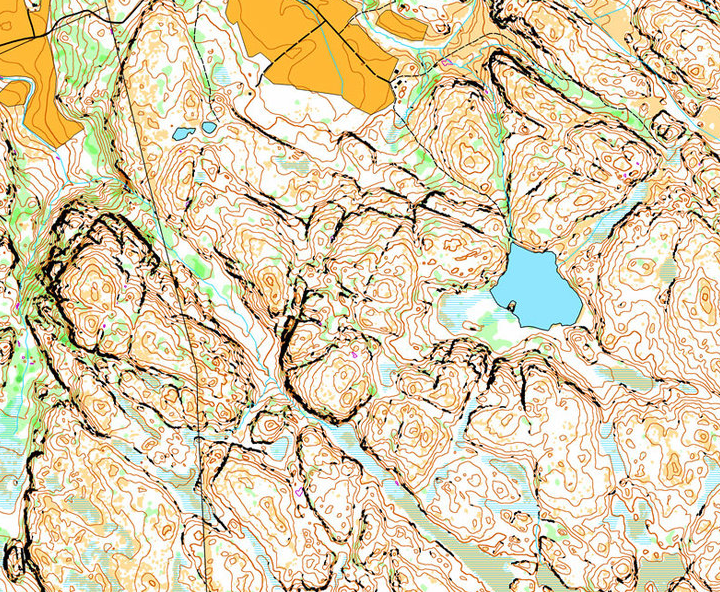
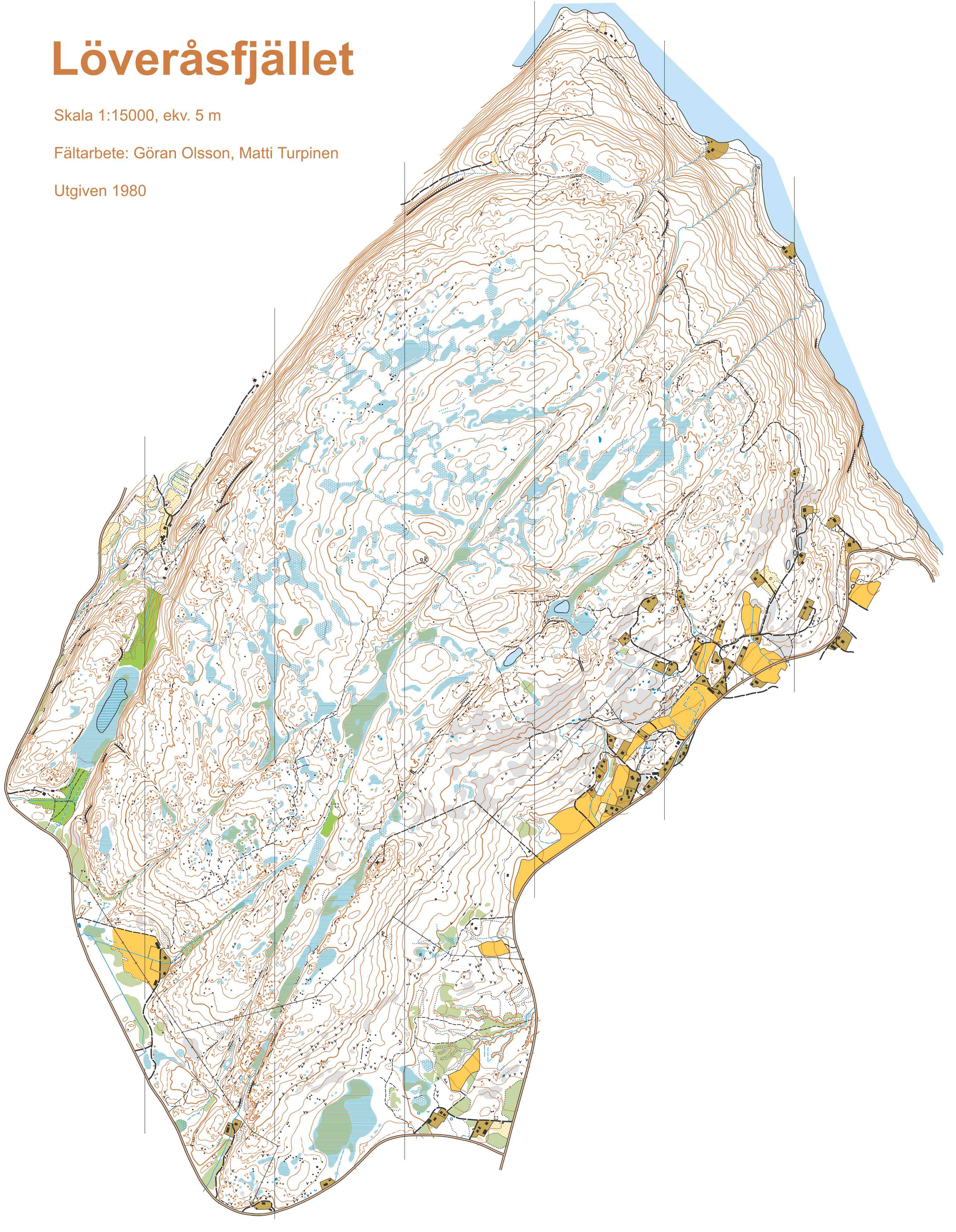
Middle distance
The middle distance (organized on Tuesday in Tanum) will be held in undulating terrain with a lot of areas of bare open rock. The map contains detailed contours with both larger and smaller cliffs and reentrants and marshes of varying size. The vegetation consists of coniferous forest, mainly pine on the hills with stands of spruce and oak in the valleys. There is mostly very good visibility and runability. Some areas of thicker vegetation and younger spruce forest may reduce running speed. There are only a few paths and smaller roads in the competition area. Altitude 40-150 m above sea level.
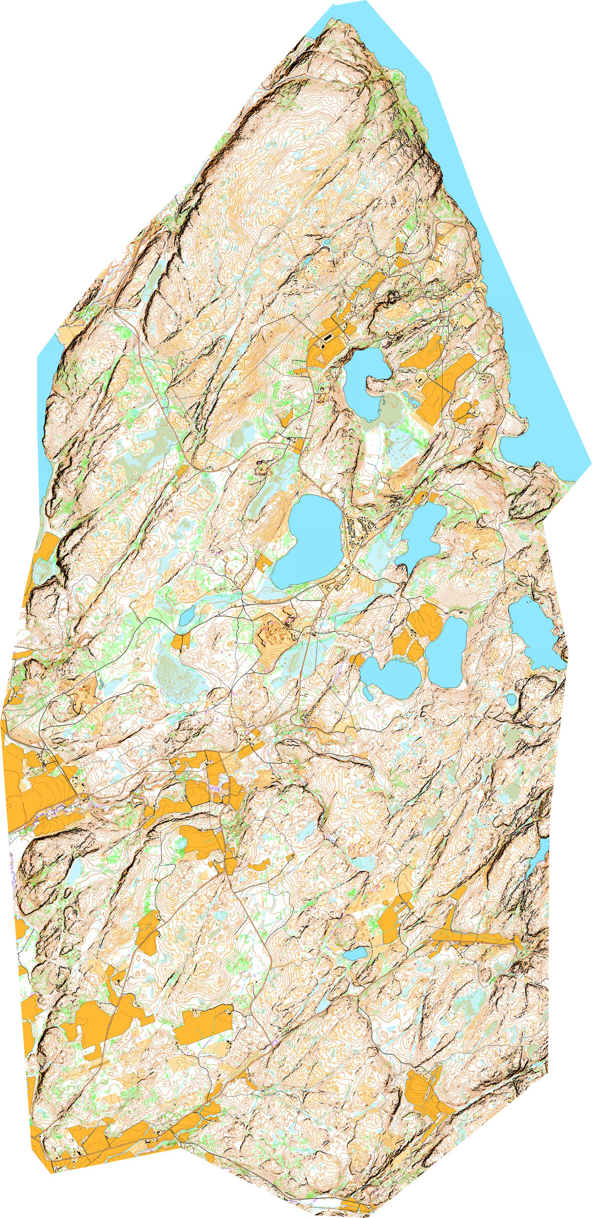
One of the most interesting features of this terrain is the cliffs – which may make some interesting route choice dilemmas for the athletes. This has been seen in several of the selection races for WOC 2016. Below is an automatically generated map of the middle distance area.

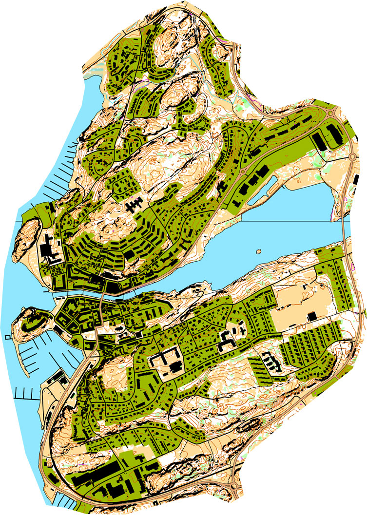
Long distance and Relay
The Long distance (organized Thursday east of Strömstad) and the relay (organized Saturday east of Strömstad) will be going in undulating terrain with a lot of areas of bare open rock. As for the middle distance, there will be detailed contours with both larger and smaller cliffs and reentrants and marshes of varying size. The vegetation consists of coniferous forest, mainly pine on the hills and spruce in the valleys. Generally older forest with very good visibility and runability. The area also includes a lot of heather and some logged areas and younger spruce forest which may reduce running speed. Some larger and smaller roads cross the competition area and a network of larger and smaller paths. Altitude 40-200 m above sea level.
Below is an old map of part of the competition area and an automatically generated map.
Typical route choice challenges (forest races)
Some of the typical orienteering challenges which the athletes will meet can be seen in the GPS animations from some of the WOC selction races in nearby areas below. See also a suggested WOC 2016 Middle distance course on the automatically generated map here – and here is another one.